Posts Tagged ‘access’

Biking and SafeTrack – Highlighting the Need for Bike Infrastructure

September 28th, 2016 Comments off

Transit and bikes go hand in hand. Not only can riders bike to and from stations for that first and last mile, but biking is a great way to get around when Metrorail is under maintenance.  It’s important that our policy makers understand the importance of having good bike infrastructure.

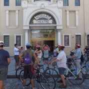
jim-at-howard-theater

Biking to historic Howard Theater (photo courtesy of APA’s Sam Schipani)

On Sunday, September 18th, I rode around DC with a bunch of planners from across the country in town for the American Planning Association’s (APA) annual Policy and Advocacy Conference.  This annual conference gears planners up to advocate for federal, state and local policies that advance good planning principles through the legislative process.   There are two days of training workshops and speaker sessions and an entire day of meetings on Capitol Hill, where planners meet with their representatives to discuss planning issues and their importance to creating strong communities.

One of the training sessions sponsored by the APA Virginia Young Planners Group (YPG) was a mobile workshop on bicycle infrastructure planning and the role of the bicycle as a viable transportation option.  I was there as a speaker to provide some background about bicycling as an alternative for riders trying to get around during our SafeTrack rebuilding program.  Two other speakers very familiar with the biking world here in DC were on the tour as well – Jim Sebastian, who manages DDOT’s Active Transportation Branch and is their chief bike planner responsible for most of the DC bicycling infrastructure that has come on-line in the last decade and helped make DC #4 in the country for bike commuting, and Doug Smith, WABA’s Everyday Bicycling Coordinator. Read more…

Bike and Pedestrian Infrastructure – Quantifying the Return on Investment

September 26th, 2016 Comments off

Sometimes small investments yield large returns. Building sidewalks and bike lanes to Metrorail stations increases safety and pays off two to one.

To close the loop on the last post that described our station area bike/ped project selection and evaluation process, we’ve posted the summary report online for your reading pleasure.   To skip right to the bottom line, though, we’ve been able to tie dollar amounts to certain project benefits and have calculated a total return on investment that’s nothing to sneeze at.   In short, we’ve estimated that a $13 M investment in some of the 394 top pedestrian projects leads to a $24M discounted revenue impact for Metro and its funders of the course of these projects’ useful life, a net positive benefit of $11M.  BAM!

MSIS Report Cover

In addition to the monetary returns, there are a number of other benefits that tend are challenging to quantify financially but have great value to customers and society at large.   For example:

  • New pathways shortens someone’s travel time, making Metro a more attractive option for the trip they are making;
  • New sidewalks may open up the station to an ADA customer who had to rely paratransit before to get to where s/he was going; and
  • New bike lanes provides a separation between both moving and parked cars, and the bicyclist, making her safer.

These projects are valuable indeed and the task before us (the royal ‘us’) is to ensure that they are built, thereby contributing to a more efficient use of the Metro system by maximizing the accessibility of stations.  So, let’s get cracking!

Since we collected projects from planning documents going back a few years, we anticipated that some of them might already have been built or might no longer work in the current context.  Therefore, we asked staff from our local transportation departments and planning agencies to help us “ground-truth” or update project status.  Out of the 394 top projects, we removed 194 that were already completed, no longer under consideration or that have already been funded, leaving 200 to focus on.

Not bad for a day’s work!

The summary report includes maps showing where the most-needed projects are located, as well as a “scorecard” detailing each project’s potential benefits as calculated in the prioritization process.  These include the safety measure defined by frequency of crashes proximate to the project, the potential ridership generated for certain projects, community facilities served, whether or not the project is located in a low income area (and, if so, how much of it falls in that area), the Walkscore, estimated cost, and a number of other useful indicators.

Read more…

Would a Cordon Charge Help Stabilize Metro’s Finances? (Part 4)

July 5th, 2016 2 comments

Adding a London-style cordon charge (or fee) to enter much of the region’s central employment area would increase transit ridership across all modes and also reduce (or eliminate) the subsidy that local governments pay every year to support Metro, meaning lower tax bills for regional residents.*

(This post is part of a multi-part series about ConnectGreaterWashington (CGW) a study that WMATA completed in 2015 and its application of land use and pricing as a transportation strategy.)

Approach for Building Scenario B to make Transit More Cost-Effective

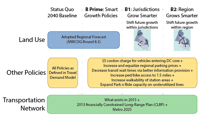
Scenario “B” looked at land use shifts and increasing the price of driving, and how those changes would impact Metro.

Metro asked, “What if the region’s future growth was used to fulfill the expectations of regional plans such as Region Forward and Place + Opportunity? What if transit-supportive policies were implemented across the region? Would WMATA benefit? Would the region?”

Answer: YES!!

*Note that Metro is not proposing that the region adopt a cordon charge, but it was tested as part of an analysis of how smarter land use and more transit-supportive policies could impact transit ridership, our operating subsidy, and other measures that support the region’s growth.

Read more…

Acting Regionally Pays Big Dividends (Part 3)

March 10th, 2016 Comments off

Adding jobs and households in transit-served areas not only increases Metro ridership, but also reduces and may even eliminate the subsidy that local governments pay to support Metro, meaning lower tax bills for regional residents.

(This post is part of a multi-part series* about ConnectGreaterWashington a study that WMATA completed in 2015 and its application of land use as a transportation strategy. The below post and links provide additional detail.)

In December of 2015, public and private leaders issued a call to action for the many jurisdictions in this region to start acting as one.  We’ve actually been thinking about this for some time, and their announcement timed well with our desire to share perspectives on the following questions.

Questions:

  • What if the region’s future actually approached the goals of collaborative regional plans such as Region Forward and Place + Opportunity?
  • Would WMATA and the region benefit?
  • Are there financial, social, quality of life and environmental benefits?

Answers: YES, YES, and YES!

Approach: Metro planners hypothesized that changing local jurisdictions’ and/or the region’s approach to future land use decisions, such as where to guide future jobs and population and expanding transit-supportive policies, could enable the region to better use the transportation system we already have rather than require us to spend tens of billions on new transportation projects.

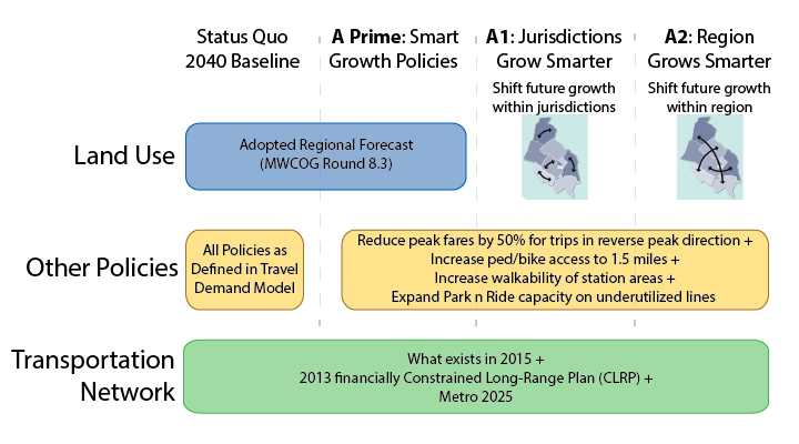
Planners developed three different scenarios (A, B, and C) that used the transportation system we already have, but modified future growth policies that determine travel patterns. The below post talks only about Scenario A, which had a specific goal to increase ridership on all segments of the Metrorail system, while minimizing the potential for overcrowding on any segment in the system. The image below shows how we built Scenario A and its three iterations (A Prime, A1, A2).


Approach for Building Scenario A to make transit more efficient

Read more…

Improving Bicycle Access to Vienna Metrorail Station – Come one, Come all!

February 29th, 2016 Comments off

Next Wednesday, March 2,  join Fairfax County’s bike program for a kick-off meeting about its Vienna Metrorail Bicycle Access Study.  This is your opportunity to make it even easier to get to the station on a bike.

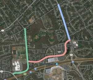
On March 2nd, from 6:00-8:00 pm, in the Oakton High School cafeteria, Fairfax bike planners will will introduce the public to this planning project and gather feedback on existing conditions, concerns, and ideas to improve bicycling in the area.  The study will look at ways to improve bicycle access to the Vienna Metrorail Station on Nutley Street, Virginia Center Boulevard, Country Creek Road, and Sutton Road.  The meeting includes a presentation and a breakout session to gather feedback on areas of concern, ideas for improvements, and overall goals for bicycling in this area.  We hope you can attend and help make our station more bike-friendly.  viennametrostudymap-thumb2

The project is funded through the Metropolitan Washington Council of Governments’ (MWCOG) 2016 Transportation and Land Use Connection (TLC) Grant Program.  Hopefully, we will see more projects coming through the TLC program since it is through studies like these that the region can advance the projects identified in Metro’s Station Area Strategic Investment plan and make progress toward achieving Metro’s strategic goal to connect communities and move us closer to the bicycle access goals our Board established in 2011.

Categories: Engage Tags: , , ,

Estimating the Impact of the US Citizenship and Immigration Facility on Metrorail

February 24th, 2016 Comments off

The Federal Government is the region’s single largest employer, and where it chooses to locate its jobs has huge implications for ridership, revenue, and the local operating subsidy.

We recently detailed why the Federal government’s location decisions matter so much to Metro – and you, the taxpayers who help support WMATA through your local taxes.  We’re always keeping an eye on moves within the region and certainly hopeful that any major moves (whether they are in the public sector or private sector) locate near Metrorail.  That’s because locating near Metrorail increases ridership, increases farebox revenue, and lowers the (your) taxpayer burden to support Metro.

Naturally, the news about GSA’s upcoming decision on the location of the US Citizenship and Immigration Services complex (USCIS) caught our eye and wonkiness.  We wanted to know about how much ridership and revenue the different options might generate.

US-Citizenship-and-Immigration-790x320

Read more…

Regional Transit Opportunities Explored

February 11th, 2016 2 comments

You name it, we tested it as possible opportunities to carry future demand and here’s what we found out.

Metro is completely focused on safety, reliability, and financial stability.  It’s also our job to ensure that the regional transit system improves mobility and connects communities.  So we’ve had many posts on ConnectGreaterWashington over the last few years describing the importance of a regional approach to transit planning. Posts include FAQs, how different modes compare, the paramount importance of transit-supportive land use, an approach to assessing Metrorail, BRT, and LRT expansion projects, and the overall proposed plan for Metrorail and surface transit to name a few.

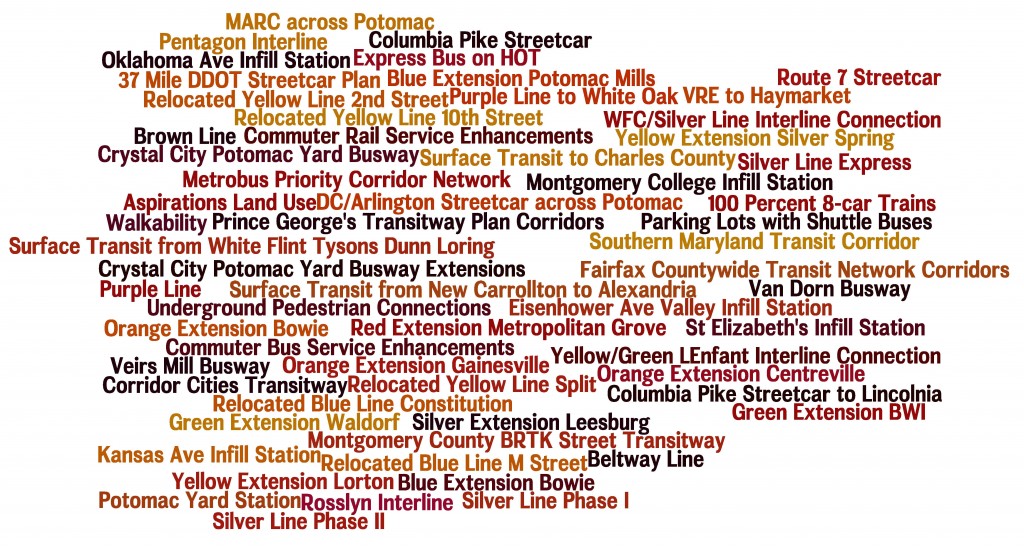
List of Transit Corridors, Projects, and Plans Analyzed as Part of CGW

List of Transit Corridors, Projects, and Plans Analyzed as Part of CGW

Finally, we have completed a set of one- to two-page summaries for all the strategies, plans and projects we tested in our evaluation of future needs and opportunities. Note, these summaries are inclusive of everything that we analyzed over the course of ConnectGreaterWashington, but only some are recommended to advance. Some strategies were recommended (e.g. eight-car trains), others were not recommended (e.g. Kansas Ave. infill station), while many were partially recommended (e.g. the I-66 corridor beyond Vienna shows promise as bus rapid transit, light rail, or enhanced bus, but not Metrorail unless and until additional housing and/or jobs are guided to the station areas and new Metrorail lines are added in the core).

Due to the size of the pdfs, the summaries are divided into three documents. First, are the new Metrorail lines in the core, eight-car trains, and interline connections (pdf updated February 24, 2016). Second, are Metrorail pedestrian tunnels, extensions, and infill stations (pdf updated February 24, 2016). Third, are all of the other modes’ strategies, plans, and projects (pdf updated February 24, 2016). All documents include bookmarks to help you find the various summaries by topic area.

Each strategy, project, or plan includes:

  • A summary of the strategy;
  • The goals that were addressed;
  • The regional activity centers connected;
  • A map that shows the project or plan;
  • Key findings for each such as ridership (including new transit riders vs riders gained from other existing modes), transfers, crowding, connectivity, and surrounding density; and
  • Recommendations for this strategy.

As we and the region continue to grapple with today’s safety, operations and maintenance needs, while also planning for future growth, we will continue to refer to the CGW work undertaken to date. Let us know how you can imagine this body of work being used in the future.

How Do Marylanders Use Metro?

February 2nd, 2016 2 comments

We analyzed Metrorail, Metrobus, and MetroAccess ridership for all Maryland residents in response to the Maryland Legislature’s data and analysis request. Newsflash – we have customers from across the state!

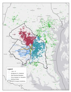
Origins of Maryland Rail Riders

Origins of Maryland Rail Riders

In the 2015 legislative session, the Maryland General Assembly passed the WMATA Utilization Study (HB300),which required the Maryland Department of Transportation (MDOT) and WMATA to analyze the utilization of Metrorail, Metrobus, and MetroAccess every five years. This year’s analysis is based on the most recent Metrorail passenger survey (2012), Metrobus passenger survey (2014), and actual ridership for MetroAccess for an average day in April 2015. Below are some findings that I found most interesting. But more importantly, here is the complete 2015 Maryland HB300 WMATA Utilization Study (native pdf), which includes all the links to the underlying survey data, interactive charts, and analysis.

  • 82 percent of Metrorail trips by Montgomery County residents are destined for Washington DC in the morning on a typical weekday;
  • 71 percent of Metrobus trips in the AM peak period made by Prince George’s County residents are for work purposes on a typical weekday;
  • 3.3 percent of all trips across all Metro services on a typical weekday are taken by Maryland residents from Frederick, Charles, Calvert, Howard, Anne Arundel, and Baltimore Counties and Baltimore City;
  • 35 percent of other Maryland residents on Metrorail access via commuter rail (MARC) and Amtrak; and
  • 17,600 residents of the District and Virginia reverse-commute into Maryland on Metrorail and bus each morning on a typical weekday (about 5 percent of total system ridership)

Any other nuggets that you found from analyzing the data? Ideas for other ways to graphically represent the findings?

Prioritizing Bike and Pedestrian Station Access Projects Near Metrorail, Part 2

November 24th, 2015 Comments off

Other than ridership potential, what are some of the other ways we can rank access projects relative to each other?

In our last post, we discussed how bike and pedestrian access projects relate back to ridership and how that relationship could be used to prioritize projects. In this post, we talk about some of the other criteria we are using to prioritize projects.

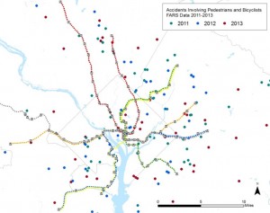
Bike and Ped. Fatalities, Sample Data Set

Bike and Pedestrian Fatalities, Sample Data Set

The first is safety. We are pulling together data about bike and pedestrian crashes near our stations that result in injuries or fatalities. We will then link these data in GIS back to the location the project, with the idea being that a new crosswalk or dedicated bike path in an area with a lot of recent crashes should score higher and deserves more attention. A safer path of travel helps not only our customers but all walkers and cyclists in these areas.

We also want to explore some other prioritization criteria. Here is what we have come up with: Read more…

Prioritizing Bike and Pedestrian Station Access Projects Near Metrorail

November 1st, 2015 Comments off

We all know improving station access is good.  But, how do we rank access projects relative to each other?   Step 1: Ridership

In our recent post, we gave you an overview of our Station Access Investment Strategy project.  We’ve identified 1,000s of recommendations for new pedestrian and bicycle infrastructure near our Metrorail stations and need a way to prioritize them.  After some thought, we’ve come up with a number of potential criteria.  In this post, we’ll discuss those that deal with ridership.

July 2014 Post on Ridership Potential from New Ped./ Bike Projects

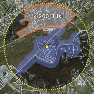
Map of the Southern Ave walk shed from July 2014 Post on Ridership Potential from New Ped./ Bike Projects

Once again, one of key concepts we’ve been telling you about in recent months is that by improving access to stations we can grow ridership.  For stations with relatively small walk sheds, we’ll conduct a detailed analysis of what happens to the walk shed when the proposed projects are built.  For example, add a sidewalk at Cheverly and the walk shed will grow by X%.  We will then look at the amount of households and jobs in the newly connected area and, using some methods we’ve shown you in other posts, calculate the potential ridership gained by the new project.  The higher the potential ridership gain, the better the project scores.

But, we also want to understand the value of a new project to a part of the station that is already connected to the network and how this could relate back to ridership.  To do this, we’ve come up some other metrics.  They include: Read more…