DDOT’s 16th Street transit plan will benefit Metrobus riders, drivers and taxpayers alike and could “break even” in just a year and a half.
We know the problems with buses on 16th Street NW: overcrowding, slow speeds, lengthy boarding times, and bunched buses. While both the District Department of Transportation (DDOT) and Metro have made several small but important improvements in the past two years to improve traffic flow and increase bus capacity on 16th Street, both agencies realize that more needs to be done. Now, after a year of detailed study in partnership with Metro, DDOT has developed a set of recommendations (PDF) that will save time and improve the customer experience in the coming years. As an added bonus, it comes with a relatively cheap price tag, yielding great value for taxpayers.
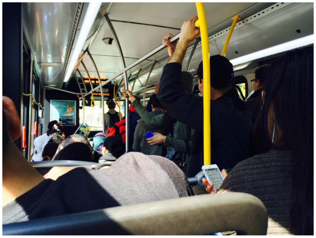
Riders aboard a crowded S-Line bus (click for study information)
Read more…
February 23rd, 2016
Wendy
At the 2016 TRB Annual Meeting last month, Metro, together with DDOT and AECOM, presented the H and I Streets Bus Lanes as a case study of a bus lane in a downtown environment. TCRP Report 118 concluded that arterial bus lanes, ranging from low-cost restriping of existing lanes to new bus lanes, could offer 12-57% reliability improvements.
The presentation, built upon the 2013 study - H and I Streets Bus Improvements, highlighted the need for actions for all users and provided a range of improvement options for the H and I Streets corridor through downtown DC. We discussed details of the bus lane alternatives and benefits back in November 2013, and in the study’s final report (PDF). Here is a snapshot of the alternatives considered in the study:
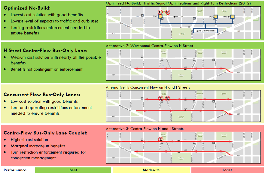
Summary of Alternatives, click for a larger version.
The TRB session participants were interested in the status of the study recommendations, and raised a big question on how to solve bus delays in a large downtown area including river crossings. The good news is that DDOT is including the bus lane alternatives in a new study — more details soon — that aims to improve the urban design and enhance the streetscape along Pennsylvania Avenue between 17th St. NW and Washington Circle. The DDOT study intends to assess the operational feasibility of the contra-flow bus lane on H Street - the best performing bus lane alternative in the 2013 study. This study will be initiated in 2016.
Stay tuned.
Update, 2/25/2016: The paper has been accepted for publication in the Transportation Research Record, Journal of the Transportation Research Board.
Construction of the K Street Transitway and Union Station to Georgetown Streetcar might result in some growing pains, but Metro & DDOT already have a remedy.
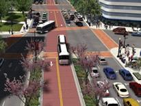
Rendering of K Street Transitway, from http://ddot.dc.gov/page/k-street-reconstruction-and-revitalization
The H/I/K Streets NW Corridor is a heavily congested corridor with traffic frequently backed up and traffic jammed at rush hour. Fortunately, DDOT has approved the K Street Transitway, an exclusive two-way, two-lane median east-west transitway between 20th and 9th Streets NW, to improve the transit and traffic conditions in this corridor. The transitway would also be utilized by a future Union Station to Georgetown streetcar.
Construction of the transitway will likely take a lane or two away from an already congested corridor and Metro would need to reroute our buses to ensure safety and performance.
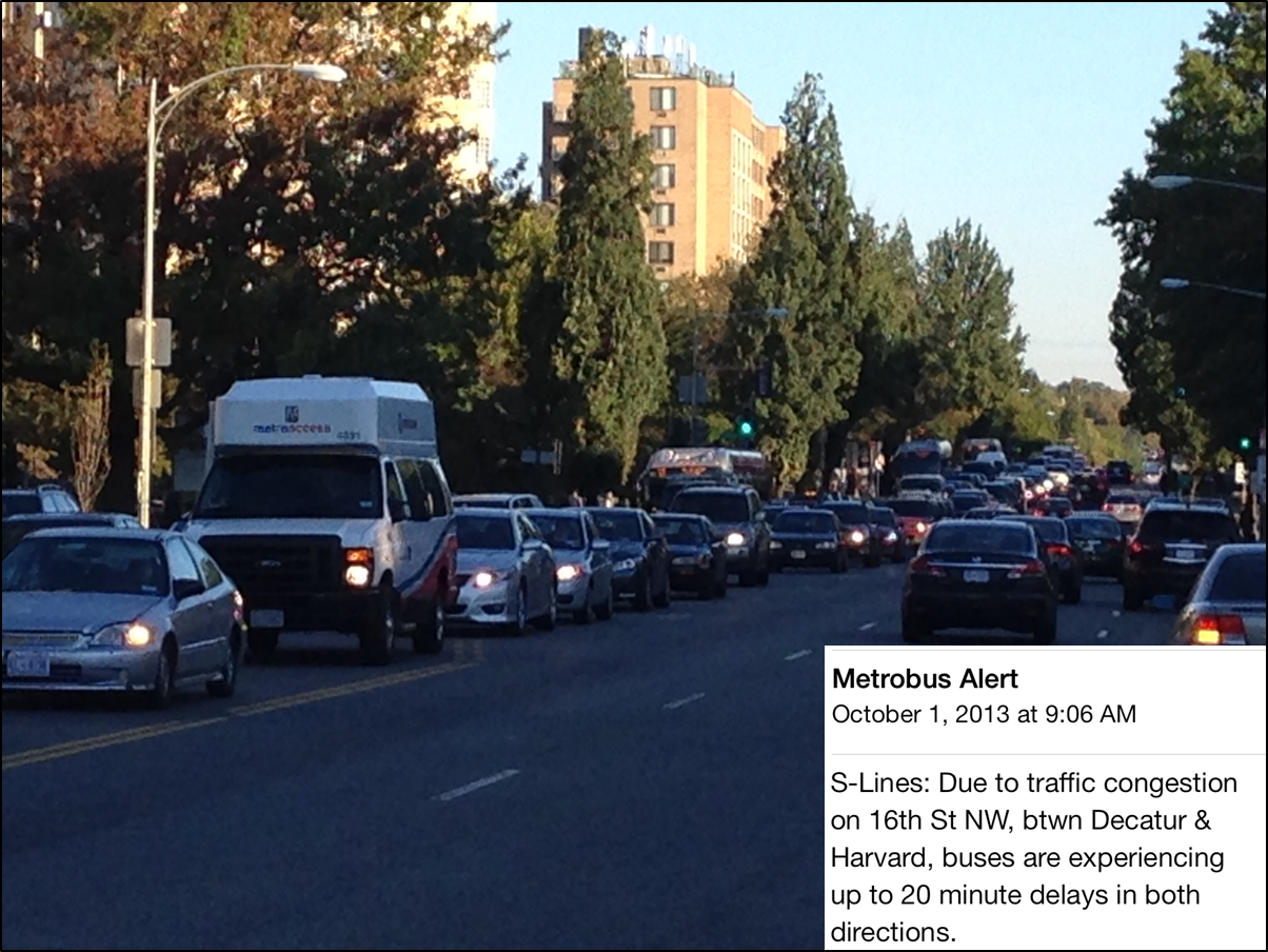
Current K Street bus service would likely need to detour via H and I Streets NW, but H and I Streets are at capacity!
At rush hour, cars, bikes and pedestrians all fight for limited street space along H and I streets NW. It is common to see bottlenecks, strings of red brake lights, packed crosswalks and cars moving at a sluggish 10.8 MPH through the corridor during the PM Peak. These delays impact our bus service along the corridor. How much service do we have there? A lot. Read more…
Metrobus is a critical part of the region’s transit system. It can be better, stronger, faster, and more efficient than it is today. Here’s how.
As described in previous posts, Metrobus is due for a regional service update to better reflect its many and sometimes conflicting regional roles. Certainly, updates to its business model, operational scale and performance standards could go a long way towards helping the region make business- and customer-savvy decisions about the best way to deploy this service. However, alone these changes would not significantly enhance cost efficiency, nor make the buses run faster, nor get more people to use the service, nor better connect this region which is hungry for more mobility as it prospers and expands.
Multiple Metrobus vehicles stuck in traffic on 16th Street in DC, a regular occurance.
Unfortunately, today’s bus operating environment is unsustainable, both operationally and financially. Growing traffic congestion and longer boarding times due to growth in demand have prolonged the scheduled bus travel times, resulting in less reliable service, longer passenger wait times, the use of more fleet just to keep the same headway, and ultimately higher operations costs. As a region we can choose to just accept the service we have, or we can do the heavy lifting to create the service we need (and deserve).
Here is the beginning of a blueprint of near-term actions that can speed up buses, improve on-time performance, and better serve our customers. Read more…
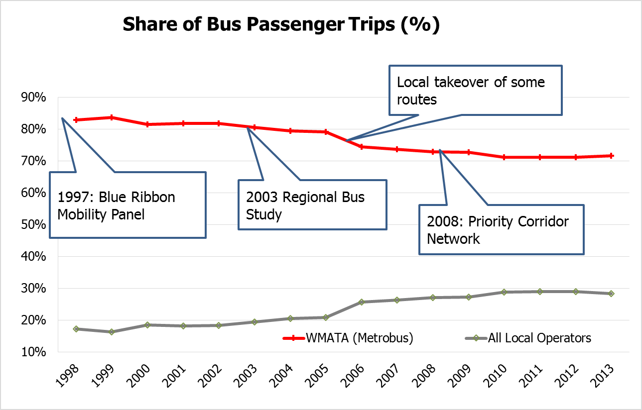
In the past 17 years, Metrobus has faced dual challenges: increased competition and increased roadway congestion.

A past post discussed the role of the 1997 Blue Ribbon Mobility Panel in resetting the regional role and funding structure for Metrobus. In the decade-plus since then, several trends have emerged: Local operators are rolling out more and more bus service, and buses are getting slower.
Read more…
Metro is re-imagining the region’s bus network to improve travel times, enhance connectivity, and deliver service cost-effectively.
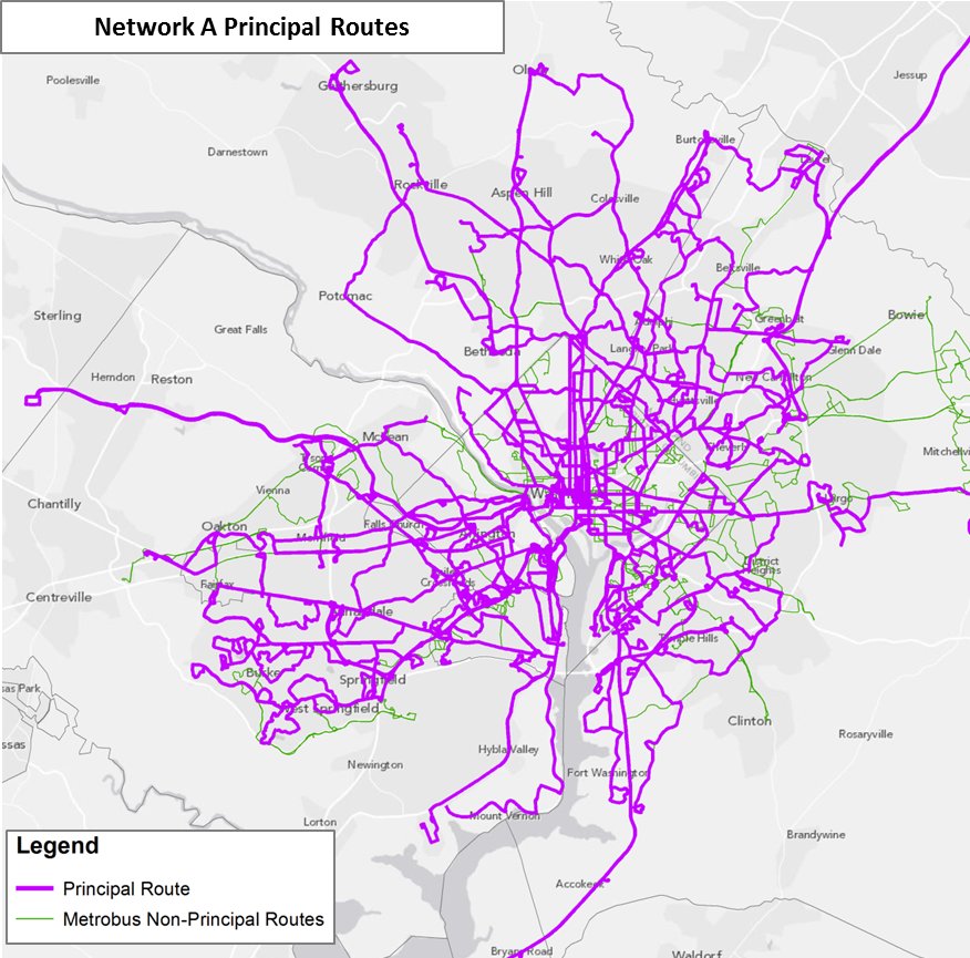
Over the past year, as part of the Metrobus Network Effectiveness Study, Metro began exploring potential future Metrobus restructuring scenarios based on the region’s growth trajectory over the next two decades. The scenarios also reflect the market segments where Metrobus can be more effective — places like the urban core, activity centers, and major arterial streets. Planners took the Metrobus network in the region’s Constrained Long-Range Plan (CLRP) for 2030 as the basis of comparison and formulated several network restructuring alternatives. This post will introduce the alternative networks, while future posts will present the performance of the networks, as well as a completely new proposed network built from the ground up. The flow chart below illustrates the network alternatives, followed by a brief explanation about each alternative.
Read more…
Despite having two million fewer people, our region used to have 60 miles of bus lanes. It’s time to revive them.
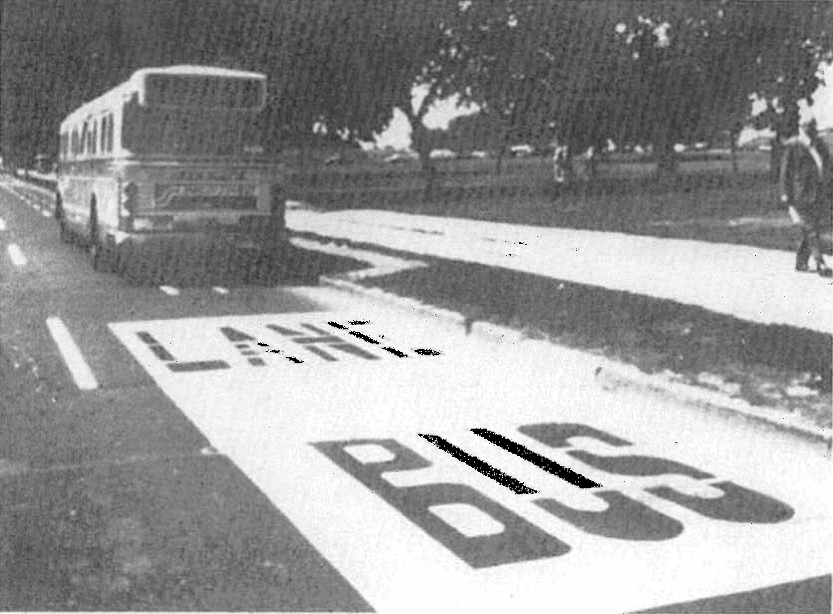
Bus Lane on 14th Street next to the National Mall in the early 1970s
Did We Really Have That Many Bus Lanes?
Yes. In the 1960s and 70s before Metrorail was built, Washington and its surrounding inner suburbs relied heavily on its bus system to get around, with very frequent service on a number of major streets. According to our records (linked at the bottom of this post), the first bus-only lane was installed in 1962 on 16th Street NW in DC, generally between H Street NW and Florida Avenue NW [DDOT Fact Sheet, p. 6]. This was followed by dozens of miles of rush-hour and full-time installations, as shown in the map and table below. Streets in red indicate bus lanes that were implemented as of 1976, while streets in black and blue represent bus lanes that were planned but, to our knowledge, never put in place.
Read more…
In parallel with the proposed 2040 Metrorail network, we have identified 25 regionally significant corridors that merit high-capacity surface transit by 2040. Depending on the corridor, high-capacity surface transit can be provided more efficiently and effectively by modes other than Metrorail.
The best transit systems in the world are comprised of large networks served by multiple modes. In the National Capital Region, due to the growth and dispersal of activity centers, the high demand placed on Metrorail, and the realities of transit funding, expanding the transit network needs to occur by expanding transit on the region’s roads and highways not just by Metrorail. Metrorail is not and cannot be the best mode for every corridor because the vast majority of corridors do not have the land use, density and ridership to support it.
But don’t despair! There are plenty of other high-capacity modes such as bus rapid transit (BRT), light rail (LRT), streetcar, and enhanced bus that can provide:
- high-frequency;
- all day service;
- large, comfortable vehicles; and
- lower capital and operating costs than Metrorail.
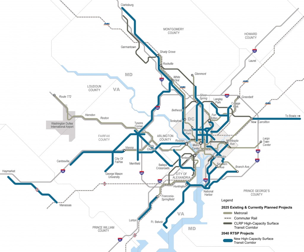
Regionally Significant High-Capacity Surface Transit Corridors as part of 2040 Regional Transit System Plan
Read more…
Categories: Strategies Tags: BRT, bus, capacity, Light Rail, Metrorail, planning, plans, priority, rail, ridership, RTSP, Streetcar, studies, travel patterns
Priority treatments speed up buses, which saves everyone time and money, uses street space most efficiently, and attracts development.
Bus priority projects, such as those begun through the regional TIGER grant and included in the Metrobus Priority Corridor Network Plan, will improve travel times, increase service reliability, and attract thousand of new riders once fully implemented.
But let’s step back for a moment. Why are these improvements needed?
")
Average AM Rush Hour Bus Speeds (Nov. 2009)
Read more…

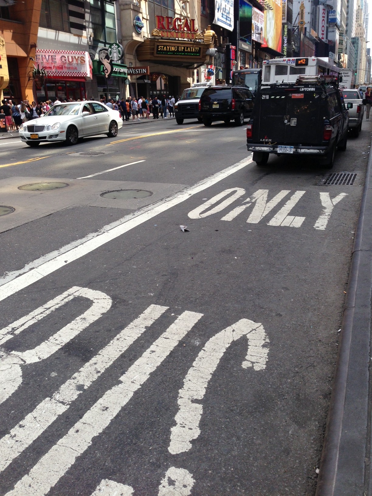
Photo of New York City bus lane violation.
This picture of a bus lane in New York City shows how easily bus priority treatments can be violated without enforcement mechanisms in place. Traffic control officers, bus-mounted cameras or self-enforcing contra-flow lanes can help ensure that street space dedicated to buses is available for them to use. Bus priority is a hot topic here at PlanItMetro.


Recent Comments