Posts Tagged ‘stations’

Bike to Work (or Metro) Day 2016

May 18th, 2016 Comments off

Metro will host three Bike to Work Day pit-stops on May 20th; sign up now!

Friday May 20th is Bike to Work Day 2016, and Metro is gearing up to be part of the fun (Yes, biking to Metro counts!). While it may be appropriate that National Bike Month has opened with rainy Dutch weather, we’re optimistic that the sun will break through in time.

Sign up now and plan to stop by one of the 83 pit-stops across the region. Each pit-stop will be chock-full of food, drinks, giveaways, city cycling safety tips and more. We may be biased, but we think the best pit-stops are at Fort Totten, East Falls Church, and College Park stations.

Hope to see you there!

Categories: In The News Tags: , ,

Metro Confidential – Expert Tips to Hack Your Trip

January 7th, 2016 2 comments

In 2016, resolve to travel like a transit pro with these five Metro master tips and tricks.

Even the most seasoned Washingtonian learns a thing or two each day about a tip, tweak, hack, or just plain common sense adjustment to their transit trip that makes their journey quicker, hassle-free, and more fun!  Here are some of our favorites that we hope you’ll try in 2016 – happy transiting!

We've all been there. These tips will help you master train crowding and more. Image: WMATA

We’ve all been there. These tips will help you master train crowding and more. Image: WMATA

  1. Set up Auto Reload – You’ve got more important things to do than fuddle with a 1970s era fare machine or to get stuck at the end of your trip without enough stored value to exit the system.  Set it and forget it to skip this step forever!  Auto Reload allows you to set up stored value and pass products so they can be automatically reloaded to your SmarTrip® or CharmCard® when your stored value runs low or your pass is about to expire.
  2. When it comes to train cars, there’s usually more room up front or in back.  WMATA runs trains in two different “consists” – those with eight cars, and those with six.  For whatever reason, customers tend to gather on the platforms near the middle cars and pack them way too tightly.  Meanwhile, even when the middle cars are overloaded, there is often room in the first or last car in the train (Cars 1 and 6/8).  We don’t know exactly why human behavior fosters “bunching” (we do know that lack of traffic priority fosters bus bunching) but now that you know, try the first or last cars when you want to spread out and/or have a seat.
  3. You’ve heard of Next Bus – try Next Station.  What’s that?  A new app?  New service?  Nope – it’s a handy tip for making your journey simpler.  The next time you’re approaching your destination, try peeking up from your phone and get into the aisle (not vestibule, and please don’t block priority seating if our most sensitive customers are standing!) one stop ahead.  That way you are pre-positioned to exit the train without pushing/shoving through on boarding passengers (or getting elbowed yourself as you slow everyone else down!)
  4. Plan an exit strategy.  I’m a Red Line rider and my office at WMATA is convenient to Judiciary Square.  I try and make sure to board the train at Car 3, door 1.  That way I’m exactly where the escalator meets the platform when I disembark.  Try figuring out your exit strategy next time you travel, or use the Metro Master website.  Which car and door makes the most sense for your journey?  How does that work with/against the tips above?
  5. There’s an App for that.  WMATA works with the developer community to help them help you.  Choose from the multitude of apps out there that help you plan the perfect transit trip.  Is your line running smoothly or gummed up?  Hop on a bus or take the train?  Blue for you or Hello Yellow? Eliminate the guesswork and join the transit technology revolution – you’ll be surprised how much easier your trip is when you app before you tap.

What other tips help you ride Metro like a regular?


Feds, Metro, Locals take on Pedestrian and Bike Safety at Wiehle-Reston East

July 16th, 2015 Comments off

On May 12, 2015, the Federal Transit Administration (FTA) convened an event to bring together Federal, State, regional, and local transportation officials and local stakeholders for an on-the-ground bike-ped safety assessment at the Wiehle-Reston East Metrorail station.

BaseMap_2014_Wiehle Assessment

Wiehle-Reston East: one mile bikeshed and 1/2 mile walkshed

The assessment was one of 50+ that have been occurring around the nation as part of U.S. Department of Transportation Secretary Anthony Foxx’s “Safer People Safer Streets” campaign to improve bike-ped safety across the country.  These assessments have been led by many of the US DOT agencies and operating administrations, namely: Federal Highway Administration (FHWA), National Highway Traffic Safety Administration (NHTSA), Federal Transit Administration (FTA), Federal Motor Carriers Safety Administration (FMCSA), and the Federal Railroad Administration (FRA). Each of these agencies is participating in the effort to improve bicycling and pedestrian safety, and each has particular roles and responsibilities in this effort.

The primary goal of these assessments is to:

  • facilitate relationship-building between employees of different jurisdictions who share responsibility for creating safer streets;
  • engage practitioners who typically focus on pedestrian and bicycle safety, as well as those who do not; and
  • focus on locations that have non-motorized safety challenges.

The assessment kicked-off with remarks from Deputy Secretary, Victor Mendez, who stressed the importance of agency coordination in ensuring bicycle and pedestrian safety on America’s streets, later blogging about the event on US DOT’s FastLane blog. Metro’s Director of Planning, Shyam Kannan, also gave remarks that highlighted the importance of station connectivity for increasing Metrorail ridership.  Other VIPs from Fairfax County, Virginia Department of Transportation (VDOT) and local community/advocacy groups spoke to the participants as well about the importance of the day’s events to keeping our residents safe as they travel. Read more…

Cherry Blossoms 2015: The Secret to Beating the Crowds

March 30th, 2015 4 comments

Metro’s planners provide tips on avoiding crowds this Cherry Blossom season.

After this long and trying Washington winter, locals and visitors alike are marking their calendars for the 2015 Cherry Blossom Festival. While everyone knows that Metro is the best way to reach the blossoms, PlanItMetro has been digging into the data to help you minimize the crowd crush and maximize your enjoyment of this treasured DC celebration.

What happens to Metro ridership? As we showed last year, the Cherry Blossoms always bring a major bump to Metrorail ridership, especially on weekends and at Smithsonian station. Metro is ready for the increased demand: track work is cancelled, service levels are increased, and our customer ambassadors are out in the field to help with the needs of visitors. So how do savvy Washingtonians avoid the thickest crowds?

Tip #1: Avoid Smithsonian station

On weekends during Cherry Blossoms, the number of customers exiting Metro at Smithsonian dwarfs every other station during daylight hours

Read more…

Study Recommends New Mezzanine to Connect Red/Purple at Silver Spring

July 10th, 2014 3 comments

To handle future ridership demand, Silver Spring may need a new mezzanine to connect Metrorail to the planned Purple Line light rail station.

Last year, we began a study looking at potential station capacity issues at Silver Spring.  The assessment determined that the demand at the Silver Spring Metrorail station (entries and exits) is adequately served by the existing station infrastructure.   Since then, the study has assessed the future conditions that will be impacted both by ridership growth due to growth of jobs and households in the station area, but also the arrival of the Purple Line light rail to Silver Spring.

Purple Line station and potential Metrorail connection at Silver Spring.  Source, purplelinemd.com, PDF.

Purple Line station and potential Metrorail connection at Silver Spring. Source, purplelinemd.com, PDF.

The Purple Line station at Silver Spring is planned as an elevated platform and mezzanine, with the mezzanine connecting to the top floor of Silver Spring Transit Center, Metropolitan Branch Trail, and  Ripley Street to the south.   The elevated light rail platform will be approximately 80 feet above the street, about the height of the current MARC pedestrian bridge.  The MTA design team envisioned a possible direct connection between Metrorail and the Purple Line, as illustrated in the red shape in the center of the above image.  Without such a connection, riders transferring between Metrorail and the Purple Line at Silver Spring would have to descend those 80 feet to the ground level, enter an existing Metrorail mezzanine, and then ascend again to the Red Line platform. Read more…

Tokyo Metro Signage – You Can Find Your Way Without Reading Japanese

January 6th, 2014 2 comments

Ten years ago I moved to Tokyo for work. Unfortunately, my Japanese language skills were non-existent, so I spent much of those early months perpetually lost on Tokyo’s streets. But underground it was a different story. If you’ve ever been, you know that many of the central Tokyo stations are massive – multiple exits, mezzanines, pedestrian tunnels, and tons and tons of people. However, Tokyo Metro, the JR East Lines and the private rail lines that together create the city’s rail network have a good wayfinding system provided in Japanese and English that make it fairly easy to get around underground.

Which car should I stand in?

Which car should you use?

Read more…

New Station Mezzanine Lights Show the Way

November 21st, 2013 9 comments

New Station Lighting at Judiciary Square

New Station Lighting at Judiciary Square.  Click image for larger version.

Pilot upgrades using energy-efficient lighting at three stations have been a success, so Metro is planning to ramp up the effort to 41 more stations by 2015.

Metro recently completed retrofitting the mezzanine-level lights at Judiciary Square, Gallery Place, Bethesda, Smithsonian and Metro Center. Through careful fixture selection, the new fixtures provide a higher quality of light with an improved Color Rendering Index (CRI) thereby improving both lighting levels and overall visibility. Significantly, the new lighting design offers better light levels without compromising the integrity of the original lighting design and station aesthetic. The retrofits also provide significant lifecycle cost savings for Metro through reduced energy consumption and maintenance requirements.

Following these successes, Metro General Manager/CEO Richard Sarles today that it plans to upgrade mezzanine lighting at the 41 remaining underground Metrorail stations by 2015.  In addition to the five already completed stations, one station, L’Enfant Plaza is currently under construction. Read more…

Pedestrian Paths and Bike Stairchannel Complete at Glenmont

November 15th, 2013 9 comments

As we continue to improve pedestrian and bicycle access to Metrorail,  Metro has recently completed several  improvements on the east side of Glenmont station.

Walking and bicycling are key access strategies for Metrorail, as Metro seeks to grow ridership in sustainable and cost-effective ways. As our studies have shown, accommodating new riders at our current access modal shares would be quite costly to the region.  At Glenmont station, around 12% of riders in the morning arrive on foot or by bike, but there may be growth potential. Nearly 80 customers per day live within 1 mile of the station but currently park.  Over 550 customers, or a third of all parking customers, live within 3 miles of the station but currently park.

To make Glenmont station more attractive and safe for pedestrians and bicycles, Metro’s Parking Office has constructed new paved pathways connecting the station to the intersection of Layhill Road and Glenallan Avenue, replacing a dirt path. Metro has completed this work as part of the Bicycle and Pedestrian Capital Improvement Program.

Glenmont NE Path 3Glenmont NE Path 2

Read more…

moveDC Public Workshop Announcement – Comment on DC’s long-range transporation plan!

October 18th, 2013 Comments off

moveDC
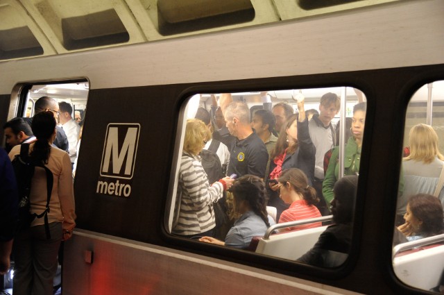
The District Department of Transportation (DDOT) is hosting its third and final round of public workshops in October to discuss moveDC, DDOT’s initiative to develop a strategic, multimodal long range transportation plan for the District.  The public is encouraged to attend a workshop to review the draft plan and help prioritize the transportation options. The October workshops will enable you to:

  • Share your ideas and observations on future plans for transportation;
  • Learn how three approaches to a future DC transportation system perform;
  • Review the results of our survey research;
  • Provide input into the draft transportation plan; and
  • Learn more about the moveDC local bus study.

Online Survey

Throughout October, you are also invited to participate in a survey to comment on and critique three approaches that have the potential to transform the way people travel in the District.

Public Meeting Dates and Locations

Monday, October 21

7:00 a.m. to 6:00 p.m.

Union Station

625 First St NE

Tuesday, October 22

6:30 p.m. – 8:30 p.m., with a formal presentation 7 p.m.

Dorothy I. Height/Benning Neighborhood Library

3935 Benning Road, NE

Saturday, October 26

1:00 p.m. – 4:00 p.m.

DCUSA Retail Center, 2nd Floor, between Target and Best Buy

3100 14th St. NW

Wednesday, October 30

6:30 p.m. – 8:30 p.m., with a formal presentation 7 p.m.

Petworth Neighborhood Library

4200 Kansas Ave., NW

Web Meetings

Visit www.wemoveDC.org for more details and to sign up.

October 24, noon – 1:00 p.m.

October 28, 7:00 p.m. – 8:00 p.m.


Silver Spring Capacity Analysis Study Under Way

September 6th, 2013 Comments off

Metro is addresses crowding, integration of Purple Line in new Silver Spring Capacity Analysis.

Metro staff have recently kicked off a capacity analysis of the Silver Spring station. The purpose of this study is to evaluate how well the station is functioning currently in terms of access and egress, vertical circulation, and faregate crowding. The study is also looking at how to accommodate growth in demand due to the opening of the Purple Line as well as increasing job and household density in Silver Spring and the region between now and 2030.

queuing heat map

The current conditions assessment is nearly complete, and shows that the station is performing well under normal conditions.  The graphic above is a cumulative mean density map, illustrating the average amount of “elbow room” each passenger has during the peak 15 minutes.  It shows that the current configuration of faregates at the two mezzanines (north is to the upper left corner) is adequate to service PM peak period demand, with only a little crowding (orange) near some faregates.

This post focuses on the PM peak period because Silver Spring has more station exits in the PM peak than the AM peak:  exiting passengers all disembark the train at the same time, which can cause queues to form at escalators and faregates.  Passengers entering the station, however, tend to trickle in and don’t put as much of a strain on station facilities.   These passengers can crowd the platform waiting areas, which will also be evaluated under this study.

Read more…