Posts Tagged ‘pedestrian’

Bike and Pedestrian Infrastructure – Quantifying the Return on Investment

September 26th, 2016 Comments off

Sometimes small investments yield large returns. Building sidewalks and bike lanes to Metrorail stations increases safety and pays off two to one.

To close the loop on the last post that described our station area bike/ped project selection and evaluation process, we’ve posted the summary report online for your reading pleasure.   To skip right to the bottom line, though, we’ve been able to tie dollar amounts to certain project benefits and have calculated a total return on investment that’s nothing to sneeze at.   In short, we’ve estimated that a $13 M investment in some of the 394 top pedestrian projects leads to a $24M discounted revenue impact for Metro and its funders of the course of these projects’ useful life, a net positive benefit of $11M.  BAM!

MSIS Report Cover

In addition to the monetary returns, there are a number of other benefits that tend are challenging to quantify financially but have great value to customers and society at large.   For example:

  • New pathways shortens someone’s travel time, making Metro a more attractive option for the trip they are making;
  • New sidewalks may open up the station to an ADA customer who had to rely paratransit before to get to where s/he was going; and
  • New bike lanes provides a separation between both moving and parked cars, and the bicyclist, making her safer.

These projects are valuable indeed and the task before us (the royal ‘us’) is to ensure that they are built, thereby contributing to a more efficient use of the Metro system by maximizing the accessibility of stations.  So, let’s get cracking!

Since we collected projects from planning documents going back a few years, we anticipated that some of them might already have been built or might no longer work in the current context.  Therefore, we asked staff from our local transportation departments and planning agencies to help us “ground-truth” or update project status.  Out of the 394 top projects, we removed 194 that were already completed, no longer under consideration or that have already been funded, leaving 200 to focus on.

Not bad for a day’s work!

The summary report includes maps showing where the most-needed projects are located, as well as a “scorecard” detailing each project’s potential benefits as calculated in the prioritization process.  These include the safety measure defined by frequency of crashes proximate to the project, the potential ridership generated for certain projects, community facilities served, whether or not the project is located in a low income area (and, if so, how much of it falls in that area), the Walkscore, estimated cost, and a number of other useful indicators.

Read more…

Pledge to Go “Car Free” on September 22!

September 19th, 2016 Comments off

Planning to Walk, Bike, Telework or Take Metro on September 22?  Then take the pledge to go Car Free.

Car Free Day is this Thursday, September 22.  Any of us who live or work in the Washington region can pledge to go Car Free or “Car Lite” (meaning some access to a car or van pool) to help raise awareness  about alternative modes of travel relative to driving alone.  In addition to showing your support for a good cause, you might even win a prize.

Interest in Car Free Day is widespread, from folks who don’t even own cars (see our post from a few years ago) to folks who typically drive alone to work and may need a little encouragement to try something else.  Last year, more than 3,500 people pledged to go car free in the region.  About 38% said they would bike, 22% would take rail, and 17% said they would use a bus as their primary mode of transportation.  As with Bike to Work Day, events like Car Free Day can have a lasting impact beyond the one-day event by leading people to make changes in the ways they choose to get around.  So help bring up this year’s number of pledges by signing up today.

Metro Reminds Customers to be Street Smart as Daylight Recedes

November 2nd, 2015 Comments off

As daylight hours shorten, the region’s Street Smart initiative takes to the streets to reduce collisions involving bicyclists and pedestrians.

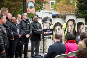
Alexandria Mayor Euille kicks off safety campaign

Alexandria Mayor Euille kicks off safety campaign

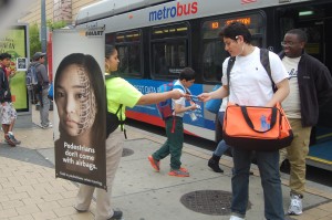
Daylight saving time ended on November 1 and evening commuters now have one less hour of daylight. In 2013, 72 percent of pedestrian fatalities in the U.S. occurred in the dark. To mark this transition and remind the region’s residents to be extra vigilant when travelling during these darker hours, the region recently kicked off the Fall 2015 Street Smart Pedestrian and Bicycle Safety campaign at Alexandria City Hall. Metro Board member and  Alexandria Mayor Euille opened the campaign with some personal remarks about ensuring his own safety.  He and other local officials were on hand to remind motorists, pedestrians and bicyclists to be extra vigilant as they travel throughout the region.  ‘Walking billboards’ also will be out and about near heavy pedestrian areas handing out safety information and highlighting safety messages for those who pass by. 

Street teams hand out safety materials to Metrobus riders

Street teams hand out safety materials to Metrobus riders

Metro riders use many modes to travel to and from our services, and each and every one is a pedestrian at some point along their trip, so we partner with the Street Smart campaign to spread these safety messages:

  • If you are a driver, slow down and watch for pedestrians and cyclists.  Stop for pedestrians in crosswalks and leave at least 3 feet when passing a cyclist.
  • If you are a pedestrian, use crosswalks and be sure to look left, right and left again before stepping off a curb.
  • Cyclists, obey traffic laws and ride with traffic.
  • And for all, pay attention to your surroundings as you travel, do not let your devices distract you.

To make it easy to keep these tips in mind, we also like Arlington’s transportation team’s  handy acronym that offers an easy reminder to keep us safe on the streets: be a PAL – that is, be Predictable, Alert, and Lawful.  It works for everyone.

We all have a role to play in keeping each other safe – let’s be sure we do our part.  Stay safe out there.


Prioritizing Bike and Pedestrian Station Access Projects Near Metrorail

November 1st, 2015 Comments off

We all know improving station access is good.  But, how do we rank access projects relative to each other?   Step 1: Ridership

In our recent post, we gave you an overview of our Station Access Investment Strategy project.  We’ve identified 1,000s of recommendations for new pedestrian and bicycle infrastructure near our Metrorail stations and need a way to prioritize them.  After some thought, we’ve come up with a number of potential criteria.  In this post, we’ll discuss those that deal with ridership.

July 2014 Post on Ridership Potential from New Ped./ Bike Projects

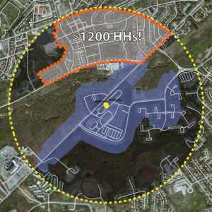
Map of the Southern Ave walk shed from July 2014 Post on Ridership Potential from New Ped./ Bike Projects

Once again, one of key concepts we’ve been telling you about in recent months is that by improving access to stations we can grow ridership.  For stations with relatively small walk sheds, we’ll conduct a detailed analysis of what happens to the walk shed when the proposed projects are built.  For example, add a sidewalk at Cheverly and the walk shed will grow by X%.  We will then look at the amount of households and jobs in the newly connected area and, using some methods we’ve shown you in other posts, calculate the potential ridership gained by the new project.  The higher the potential ridership gain, the better the project scores.

But, we also want to understand the value of a new project to a part of the station that is already connected to the network and how this could relate back to ridership.  To do this, we’ve come up some other metrics.  They include: Read more…

Transit Today, Tomorrow, and Beyond: There’s More to It Than Metrorail

July 6th, 2015 1 comment

In part one of this series, Metro Planners led a session at StreetsCamp  Saturday June 20, 2015 to talk with transit advocates about other possibilities beyond Metrorail to increase transit use, reach, and access.

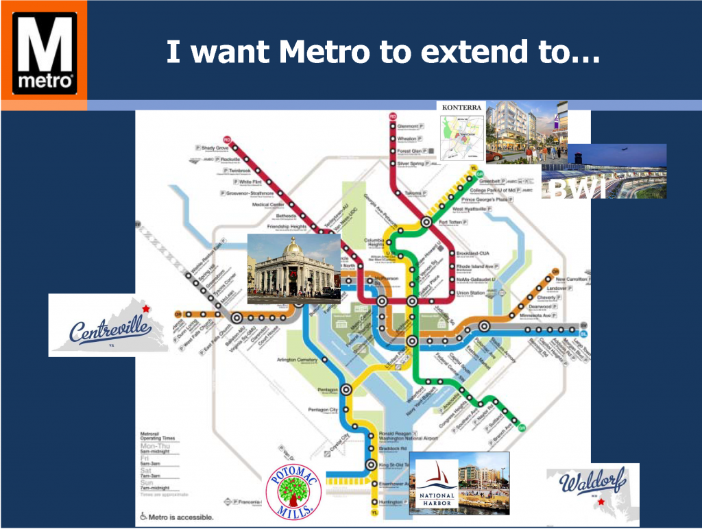
I want Metro to...

Politicians and citizens always ask for more Metrorail, but why should transit continue to chase land use decisions? Metro Planners Allison Davis and Kristin Haldeman talked to transit advocates and urbanists at StreetsCamp last Saturday to provide approaches that can help the transit we have today reach more people and be more cost-effective without requiring more Metrorail (pdf). The major take-aways for advocates and urbanists were to advocate for:

(1)    Local decision makers to monetize full life‐cycle cost of land use options;

(2)    Access projects that create comfortable (i.e. desirable) paths for pedestrians and bicyclists; and

(3)    Local jurisdictions to add transit signal priority, queue jumps, and bus lanes

Why these three specifically? Read more…

Cherry Blossoms 2015: The Secret to Beating the Crowds

March 30th, 2015 4 comments

Metro’s planners provide tips on avoiding crowds this Cherry Blossom season.

After this long and trying Washington winter, locals and visitors alike are marking their calendars for the 2015 Cherry Blossom Festival. While everyone knows that Metro is the best way to reach the blossoms, PlanItMetro has been digging into the data to help you minimize the crowd crush and maximize your enjoyment of this treasured DC celebration.

What happens to Metro ridership? As we showed last year, the Cherry Blossoms always bring a major bump to Metrorail ridership, especially on weekends and at Smithsonian station. Metro is ready for the increased demand: track work is cancelled, service levels are increased, and our customer ambassadors are out in the field to help with the needs of visitors. So how do savvy Washingtonians avoid the thickest crowds?

Tip #1: Avoid Smithsonian station

On weekends during Cherry Blossoms, the number of customers exiting Metro at Smithsonian dwarfs every other station during daylight hours

Read more…

Solving the Region’s Congestion Woes – One Step at a Time (Part 3 of 3)

March 31st, 2014 2 comments

Making every Metrorail station area walkable could reduce regional congestion without breaking the bank.

This is part three of a three-part series.

In the previous two posts we’ve laid out a case for making all transit stations walkable as quickly as possible.

  1. Increasing walkability and density at station areas has huge impacts on transit mode share and can take tens of thousands of cars of the road every single day.
  2. At a regional level, walkable station areas have an equivalent impact on congestion as a quarter trillion dollars in “last mile” infrastructure (see pages 37, 38, 43, 48).

Maximizing the capacity of the existing transit network while intelligently investing in station area connectivity would combat regional congestion just as effectively as trying to “build our way out of the problem”. And unlike many potential interventions, the market actually wants to do this for us.

Perhaps it is time to harness these market forces to make the areas around our transit network walkable and implement this low-cost congestion-busting paradigm. As for where to begin – well, we have a few suggestions…

Existing Walkability Near Metrorail Stations

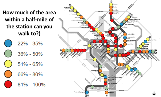
The map below shows the range of existing walkability conditions near the Metrorail network and helps answer the question of how much of a half-mile radius of each station a person can walk to. The higher the percentage, the better the pedestrian network coverage. As shown, many of the station areas are under performing relative to their potential walkability. If walkability = connectivity and connectivity = mode share, then just imagine the impact on the region’s roads if we could focus on taking station areas with low accessibility and invest in some relatively easy, short-term solutions like sidewalks, pedestrian bridges, crosswalks, and smart, transit-oriented development to take maximum advantage of the existing Metrorail system and take tens of thousands of cars off the road each day.

How walkable are our region's Metrorail stations?

How much of the area within a half-mile of our Metrorail stations can you walk to?

Read more…

Solving the Region’s Congestion Woes – One Step at a Time (Part 2 of 3)

March 24th, 2014 4 comments

Improving pedestrian connectivity takes cars off the road at a formidable clip – rivaling the power of all of the region’s planned roadway additions and “last mile” transit connections.  Cheaply and quickly. 

This post is part two of a three-part series.

The data is finally in, and we now know that walkable station areas result in fewer motorized trips, fewer miles driven, fewer cars owned, and fewer hours spent traveling. And when we improve the pedestrian and bicycle access and connectivity to Metrorail station areas, ridership goes up, putting a major dent in congestion by taking trips off the roadways. Earlier, we discussed what it means to build walkable station areas and research shows the tremendous benefits to the region of making this a priority.

First, our data confirms that when walking access to transit is improved, transit ridership goes up – way up. In the 2040 Regional Transit System Plan (RTSP), we stress tested TPB’s transportation model to improve walkability to the transit network and saw huge increases in transit linked trips.  These trips go up by about 10% region-wide and we get an increase in transit mode share for all regional trips by 0.5%.  That’s over and above the roughly one percent increase in mode share we anticipate occurring as a result of building the entirety of the CLRP, an impact about half that of constructing all of that transit.

Source: Regional Transit System Plan

Source: Regional Transit System Plan

Read more…

Solving the Region’s Congestion Woes – One Step at a Time

March 17th, 2014 1 comment

One solution to the region’s crippling congestion could be right under our feet – literally.

This post is part one of a three-part series.

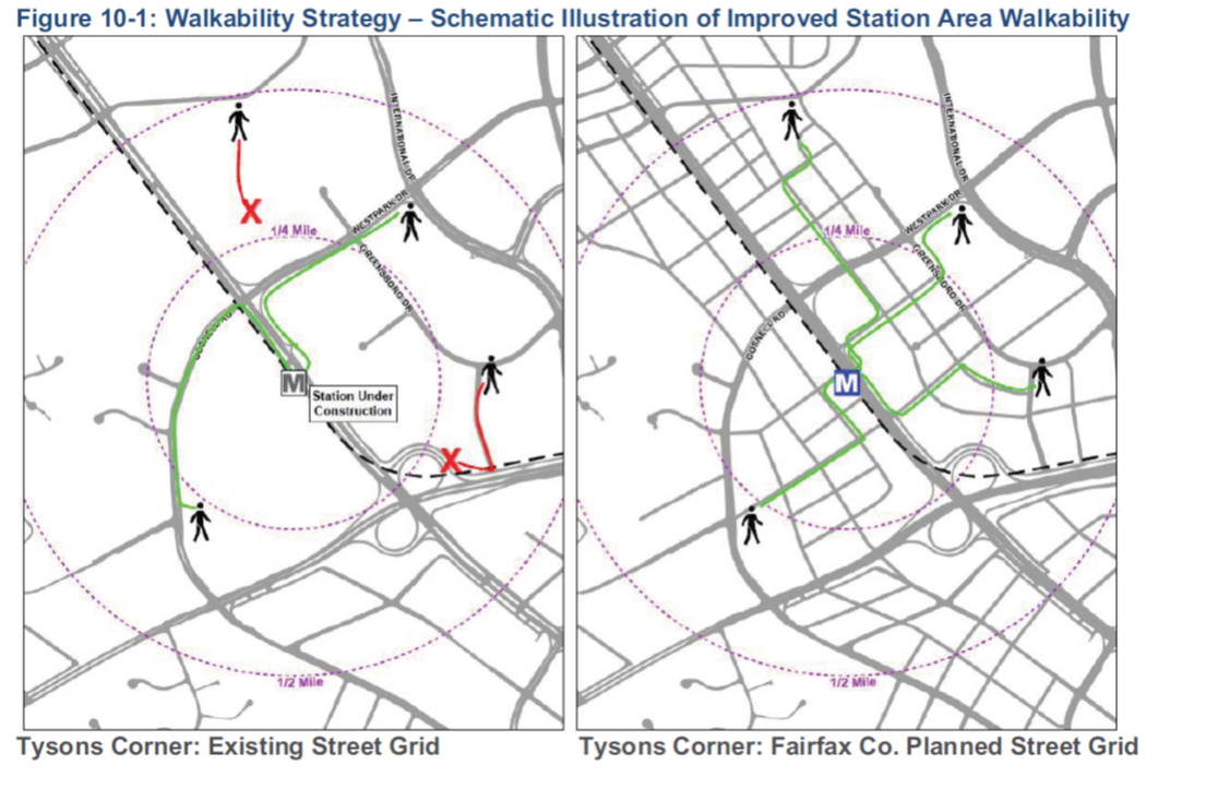
Illustration of possible walkability improvements that could occur in/around Tysons Corner. From Regional Transit System Plan


The region is abuzz with $220B of planned new transportation investments – the Purple Line, HOT Lanes, new streetcar lines, and additional roadways. Though there is not one dollar currently pledged to add capacity to Metro, these other investments may help the region chart a course away from leading the country in congestion (pdf).

However, for a quarter trillion dollars, one would expect that collectively these projects would have significant impacts on the region’s congestion. While there are some benefits – vehicle miles traveled (VMT) per capita are expected to decline and  transit mode share may increase by one percent – overall increases in VMT are expected to outpace road construction, leading to a 38% increase in the number of lane miles of congestion (pdf). But is there another way to get more bang for our buck?

Make station areas walkable. Every one of them. Now.

Read more…

Significant Property Tax Values Generated near Metro Stations

December 12th, 2013 Comments off

New buildings right near Metrorail stations are 23-30% more valuable than buildings farther away, showing that our funding partners can generate significant property tax revenues from Metro.

A recent study shows that Metrorail stations in Arlington’s Rosslyn-Ballston corridor are powerful anchors for economic development and value. The report, by the real estate firm Cushman & Wakefield, showcases the substantial value the region can realize with good transit-oriented development policies near stations. Among the report’s findings:

Offices in the Rosslyn-Ballston corridor right near Metro command higher rents.

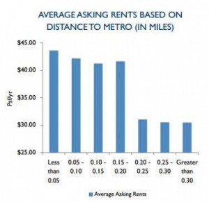
Offices in the Rosslyn-Ballston corridor right near Metro command higher rents. Source: Cushman & Wakefield via washingtonpost.com.  Click for original context.

  • Being able to walk to Metro is worth a lot. New office buildings within 500 feet of a station in Arlington’s Rosslyn-Ballston corridor are earning a 30% premium over buildings under construction just a quarter-mile away. For apartment buildings, the premium is 23%. No wonder walk access to Metrorail is on the rise, especially from those close by the station!
  • 92% of over 20 million square feet of office space under construction in the Rosslyn-Ballston corridor is within a quarter mile of a Metrorail station.
  • Conversely, new office buildings built farther than a quarter-mile from Metro are worth 18% less in rent.

These “rail premiums” of 23-30% are significantly higher than the 7-9% we found in our “Business Case for Transit” study, because of several significant differences in methodology. We looked at the assessed value, not the market/rental rate of property. Also, we looked at all properties in the region, rather than just those under construction in one corridor.

Although the presence of Metrorail creates this value premium near stations, Metro does not receive any of these revenues directly, even though continued rebuilding and improvements are needed to address state of good repair and relieve capacity issues in the corridor.

Nevertheless, this report certainly confirms that Metrorail increases property tax revenues, and shows just how big that value can be in certain markets.