Metro cares about transit walk sheds because more households accessible to transit by walking translates directly into more ridership.
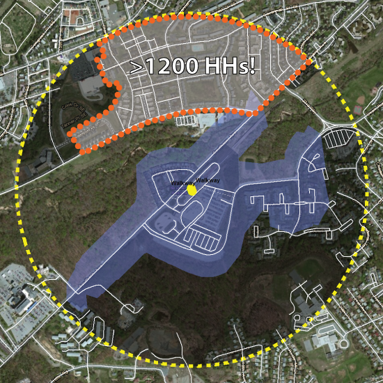
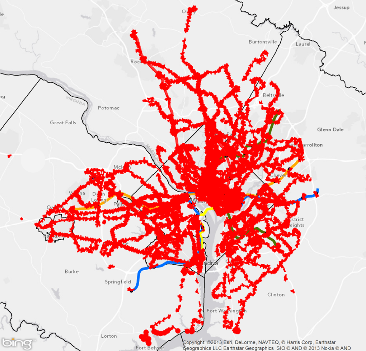
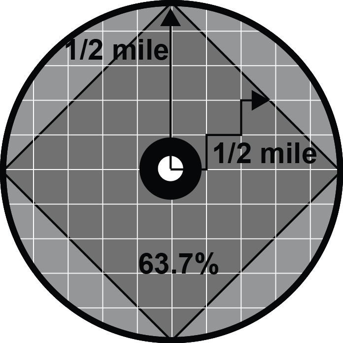
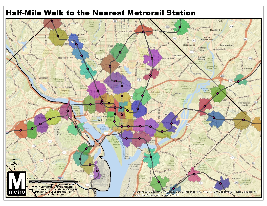
We’ve been focusing a lot on transit walk sheds lately. We’ve shown that the size of a transit walk shed depends heavily on the roadway network and pedestrian infrastructure, and that these sizes vary dramatically by Metrorail station. We’ve also demonstrated that expanding the walkable area can make hundreds of households walkable to transit.
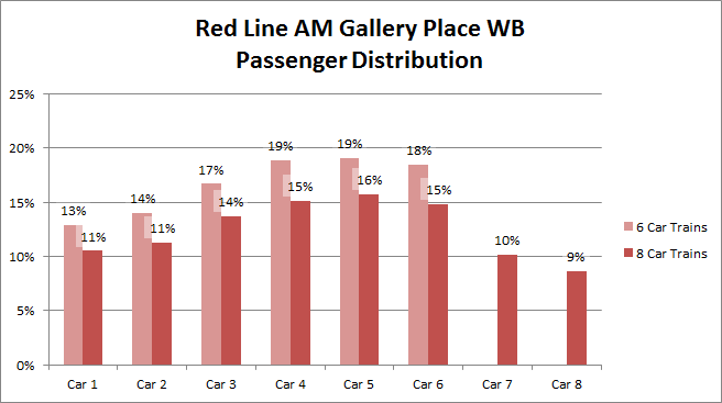
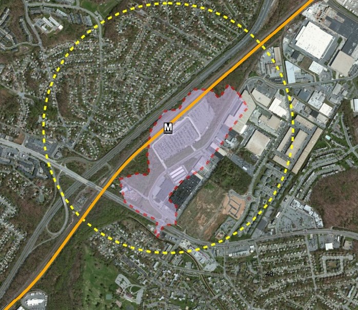
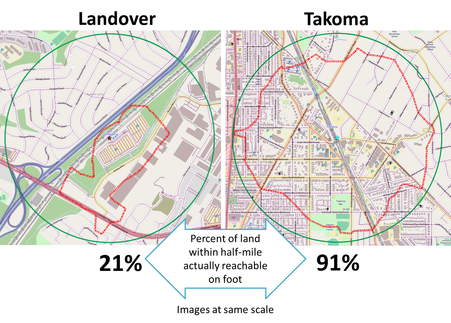
But why do we care so much about walk sheds? Because larger walk sheds mean more households in the walk shed, and that means ridership. For example, we’d be hard pressed to find many households in Landover’s small walk shed, so it’s no surprise that walk ridership at that station is low. On the other hand, thousands of households are within a reasonable walk to Takoma’s larger walk shed, and walk ridership there is much higher.
In other words, the more people can walk to transit, the more people do walk to transit – and data across Metrorail stations prove it:

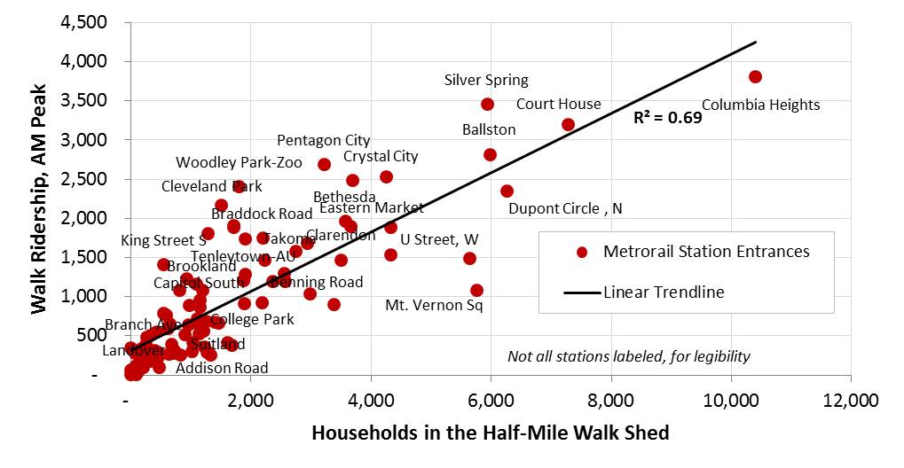
More households in the walkable area around a Metrorail station means higher ridership
Read more…
Pedestrian infrastructure can cost-effectively increase coverage of transit walk sheds.
The roadway networks of most station areas are mostly unchangeable. Existing structures on private property create unmovable barriers and usually prevent new roads from being added to the network. However, there is still opportunity to add pedestrian facilities that would increase a station’s walk shed in a relatively cost-effective way.
Take the example of Southern Ave Metrorail station. We previously noted how a large number of customers drive to the station from between one and three miles away. We discussed several reasons for this tendency to drive to Southern Ave, including the proximity to parks on both sides of the station. The map below shows the transit walk shed of Southern Ave station.

Current walkshed of Southern Ave station. The area with the orange dotted border contains over 1,200 households that could be within a half mile of Metrorail if a direct pedestrian connection were built.
But what if a pedestrian path could be built to connect the station to the neighborhood to the north?
If a well lit, safe pedestrian path were constructed between the station and the orange-dotted area on the map, it could expand the walkshed to include up to 1,200 additional households in DC. This new connection would likely increase ridership at Southern Ave. and might even generate enough additional fare revenue to fund the construction of the trail.
Metro’s Office of Planning is currently evaluating the walk sheds of our rail transit stations. What other opportunities do you see for cost-effectively increasing the walk sheds around Metrorail stations?
Metro will soon be measuring how much growth happens in places that are walkable to transit. Here’s an in-depth look at how we define “walkable” to Metrorail stations and Metrobus stops.

Areas reachable on foot from regional Metrobus stops and Metrorail stations
Metro’s new Connecting Communities metric will measure annual household growth in our region that occurs within the “transit shed” – the catchment area around transit service that generates walk ridership. And improving walkability can be an incredibly cost-effective way to reduce congestion and increase transit ridership. Let’s take a closer look at how we defined what’s “walkable to transit.”
How Far is Walkable? First, we defined walking distance as a half-mile from Metrorail, and a quarter-mile from Metrobus, for a number of reasons:
- Of all the passengers who walk to Metrorail each morning, the median walking distance is just under a half-mile (0.35 miles, actually). Riders walk farther to some stations than others, but the systemwide average is just shy of a half-mile. Since rail riders are on average willing to walk a little under a half-mile today, it is reasonable to use a half-mile as an upper limit for walking in the future. (We don’t have similar survey data on Metrobus – yet.)
- The land use within a quarter- and half-mile is where we see the strongest effects on ridership on Metro today. More on this below.
- Academic literature supports the half-mile radius from rail transit as no better than any other distance, particularly for the link between households and ridership.
- Practically, setting the distance any farther than 0.50 and 0.25 miles increases overlap with other nearby stations and bus stops, which increases computational complexity. Read more…
Station-area walkability is one of the most potent congestion-busting tools in the planner’s bag of tricks. Now we’ve mapped out in detail which stations are living up to their full potential – and where we need to redouble our efforts.
We’ve brought to you information about the power of station area walkability. Not only does better station access give mobility benefits to those who most need it, but it also boosts ridership and revenue and therefore lowers Metrorail’s operating subsidy. That means lower taxes for you and me.
Metro’s Office of Planning is wiring the science of walkability into WMATA’s Key Performance Indicators. We are committed to working with our partner jurisdictions to improving station area access and identifying the near-term and low-cost improvements that have big returns for ridership and revenue. And we have been working diligently to develop a comprehensive geodatabase of walk sheds and the land uses – existing, planned, and proposed – located within them.