
What’s a Transit “Walk Shed”?
Metro will soon be measuring how much growth happens in places that are walkable to transit. Here’s an in-depth look at how we define “walkable” to Metrorail stations and Metrobus stops.
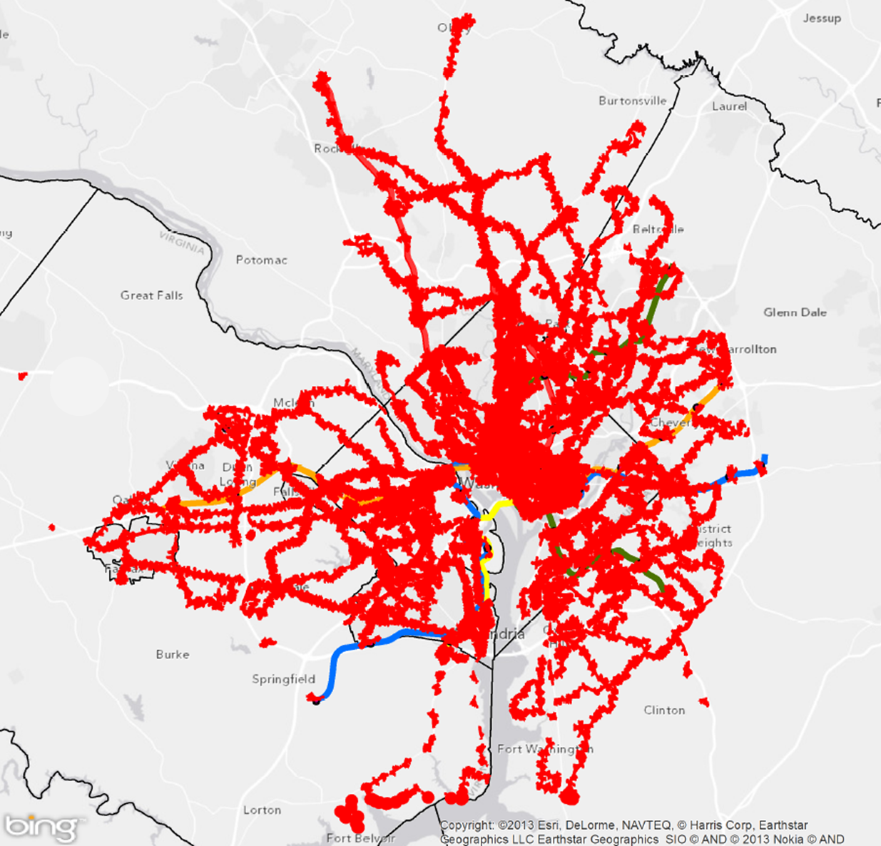
Areas reachable on foot from regional Metrobus stops and Metrorail stations
Metro’s new Connecting Communities metric will measure annual household growth in our region that occurs within the “transit shed” - the catchment area around transit service that generates walk ridership. And improving walkability can be an incredibly cost-effective way to reduce congestion and increase transit ridership. Let’s take a closer look at how we defined what’s “walkable to transit.”
How Far is Walkable? First, we defined walking distance as a half-mile from Metrorail, and a quarter-mile from Metrobus, for a number of reasons:
- Of all the passengers who walk to Metrorail each morning, the median walking distance is just under a half-mile (0.35 miles, actually). Riders walk farther to some stations than others, but the systemwide average is just shy of a half-mile. Since rail riders are on average willing to walk a little under a half-mile today, it is reasonable to use a half-mile as an upper limit for walking in the future. (We don’t have similar survey data on Metrobus - yet.)
- The land use within a quarter- and half-mile is where we see the strongest effects on ridership on Metro today. More on this below.
- Academic literature supports the half-mile radius from rail transit as no better than any other distance, particularly for the link between households and ridership.
- Practically, setting the distance any farther than 0.50 and 0.25 miles increases overlap with other nearby stations and bus stops, which increases computational complexity. Read more…

Recent Comments