Metro will soon be measuring how much growth happens in places that are walkable to transit. Here’s an in-depth look at how we define “walkable” to Metrorail stations and Metrobus stops.
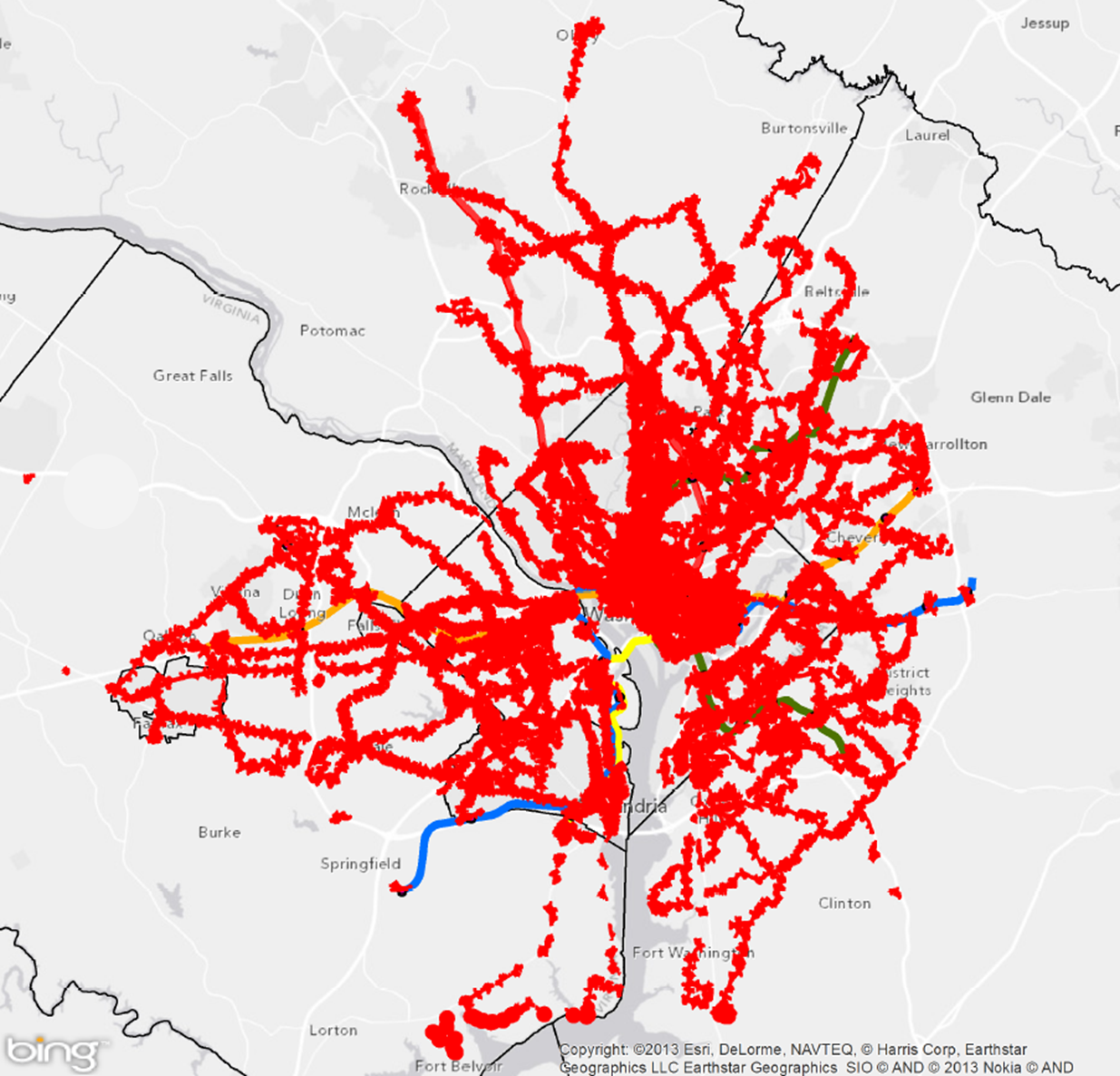
Areas reachable on foot from regional Metrobus stops and Metrorail stations
Metro’s new Connecting Communities metric will measure annual household growth in our region that occurs within the “transit shed” – the catchment area around transit service that generates walk ridership. And improving walkability can be an incredibly cost-effective way to reduce congestion and increase transit ridership. Let’s take a closer look at how we defined what’s “walkable to transit.”
How Far is Walkable? First, we defined walking distance as a half-mile from Metrorail, and a quarter-mile from Metrobus, for a number of reasons:
- Of all the passengers who walk to Metrorail each morning, the median walking distance is just under a half-mile (0.35 miles, actually). Riders walk farther to some stations than others, but the systemwide average is just shy of a half-mile. Since rail riders are on average willing to walk a little under a half-mile today, it is reasonable to use a half-mile as an upper limit for walking in the future. (We don’t have similar survey data on Metrobus – yet.)
- The land use within a quarter- and half-mile is where we see the strongest effects on ridership on Metro today. More on this below.
- Academic literature supports the half-mile radius from rail transit as no better than any other distance, particularly for the link between households and ridership.
- Practically, setting the distance any farther than 0.50 and 0.25 miles increases overlap with other nearby stations and bus stops, which increases computational complexity. Read more…
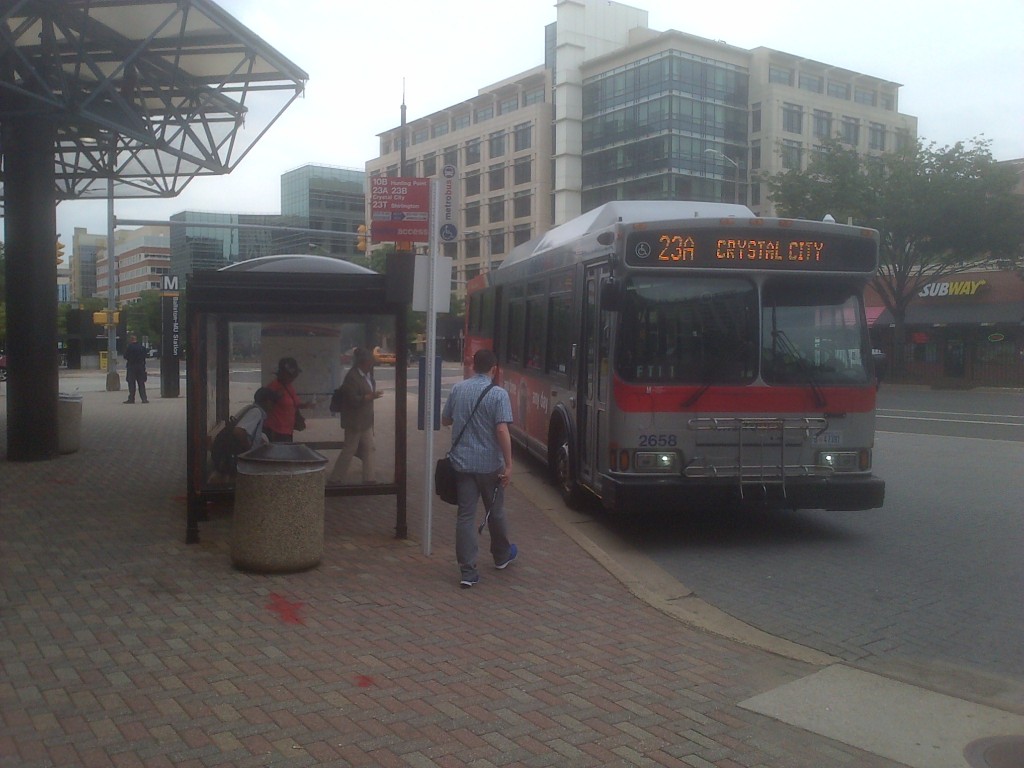
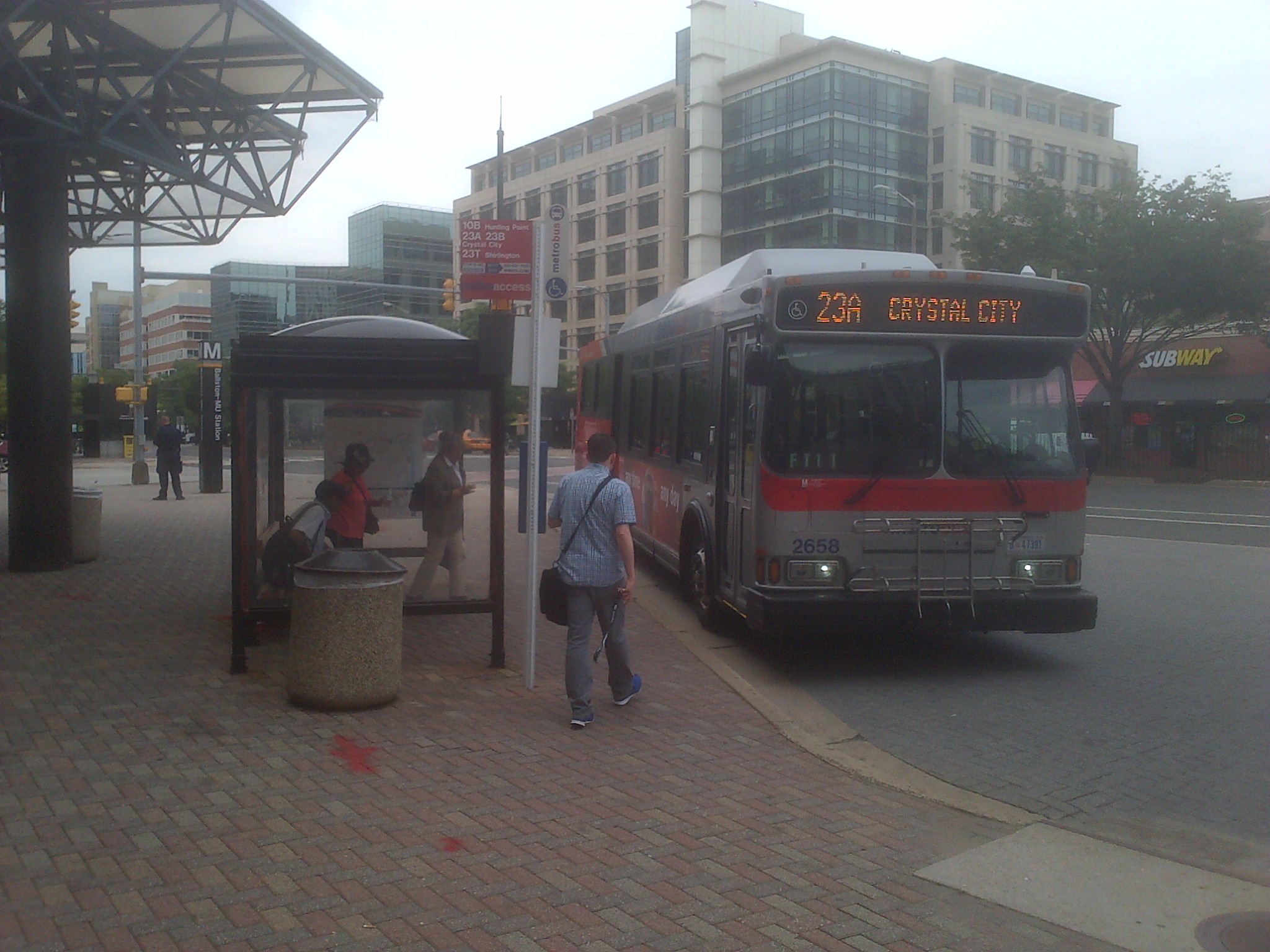
Customers boarding the 23A at Ballston
The distance between stops is of key concern to Metro and its customers. More closely spaced stops provide customers with more convenient access, as they are likely to experience a shorter walk to the nearest bus stop. However, closely-spaced stops are also likely to result in a longer ride for customers because of the number of times the bus stops — to decelerate, come to a complete stop and then accelerate and re-merge into traffic — is increased. This also can lead to increased fuel and maintenance costs.
Having fewer stops along a bus route benefits passengers not only by reducing the time it takes for them to make their trip, but by making the service more reliable and predictable.
Read more…
The region either already has or is planning for a variety of different modes. How do they compare? 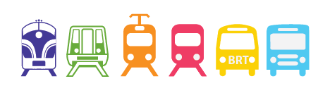 The Silver Line will soon open as a Metrorail line. Later this year, a streetcar will be operating on H Street, NE with others planned for Columbia Pike in Arlington and the District. Arlington and Alexandria are jointly building a bus rapid transit (BRT) line between Crystal City and Potomac Yard. Once funding is finalized, Maryland will build the Purple Line and light rail transit (LRT) will connect New Carrollton and Bethesda. This is all in addition to the region’s existing commuter rail, commuter bus, Metrorail, Metrobus, and MetroExtra services. The region is not only expanding transit services, but it also expanding the types of transit modes that will operate. At long last, instead of talking about Portland (streetcar), Jersey City (light rail), or Cleveland (bus rapid transit), we’ll be able to point directly to services and infrastructure in our backyard or take a trip and experience the pros and cons of these modes for ourselves.
So how do the different modes compare? What kind of purposes does each serve? There are many external factors and trade-offs that influence how agencies and jurisdictions select which mode to implement. As we see from the ongoing debates in jurisdictions across the region between LRT and BRT or streetcar and enhanced bus, there is not always one perfect choice. However, an array of transit and land use measures can provide context to the conversation. As part of ConnectGreaterWashington: The 2040 Regional Transit System Plan, we developed the below table to compare commuter rail, commuter bus, heavy rail, light rail, streetcar, bus rapid transit, and enhanced bus across land use intensity (households and employment), vehicle capacity, stop spacing, trip length, and capital and operating costs.
What do you think? Does this information better inform the rail vs bus debate? What other information would provide more clarity on what modes work where?
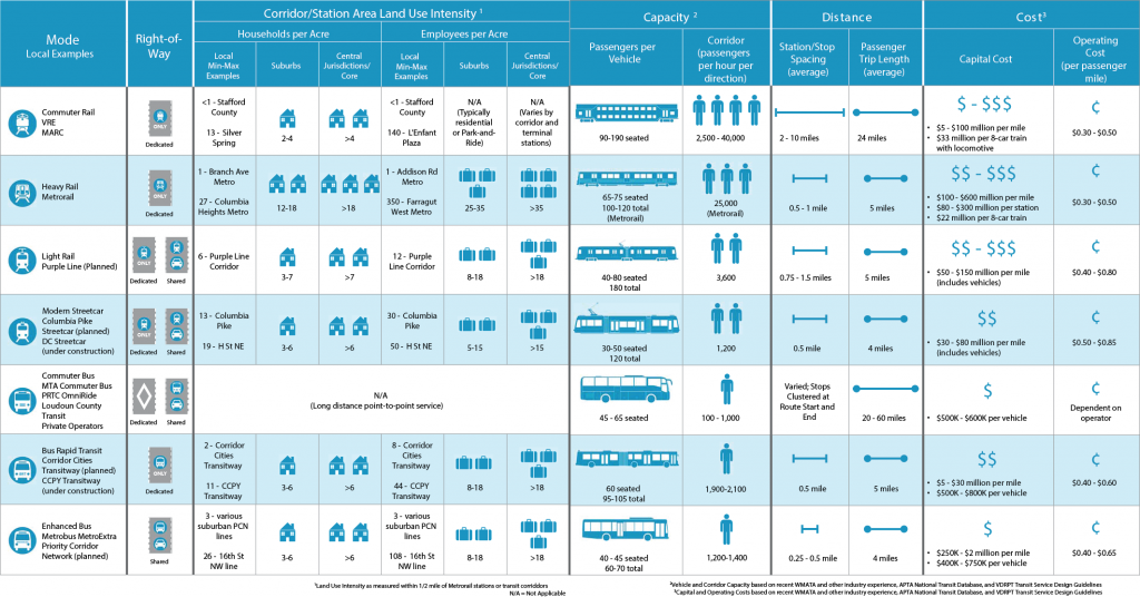
Comparison of High-Capacity Transit Modes
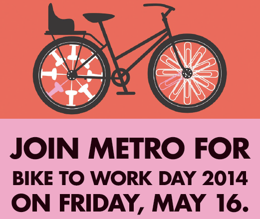
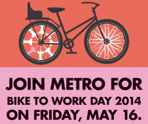 Bike to Work Day is Friday, May 16th, and this year Metro is hosting three pitstops at Metrorail stations. Bike to Metro and Metro to Work! Register now.
If biking all the way to work sounds a bit daunting this year, Bike to Metro and Metro to Work! Leave your bike at a Metrorail station or a bus stop.
Metro is hosting three pitstops at Metrorail stations, where we’ll be distributing t-shirts, maps, information about parking your bike, bikes on bus, locker rentals, and of course – free goodies. In addition, Metro Transit Police will be at all three pitstops distributing free U-locks to cyclists who register their bikes. We’ll even have a “bike rack demonstration” bus so you can try using the bike rack on buses.
Register now at www.biketoworkmetrodc.org, and enter your pitstop as one of the stations above!

Bus Wash Montgomery Division
Fresh water is a precious resource and Metro is doing its part to reduce strain on shared natural resources and infrastructure. The Authority uses water for a whole host of activities beyond drinking and flushing. Water is used to maintain our facilities, keep stations cool, to wash buses and trains, and to clean vehicle parts. To give Metro’s water use some sense of scale, in 2013 the Authority used 98 million gallons of water, or the equivalent of 148 Olympic-sized swimming pools.
Metro has already made significant investments to conserve water throughout the Authority. For example, all of Metro’s new and renovated bus garages feature bus wash systems that incorporate high efficiency water saving equipment. Wash water is no longer just fed from the utility and mixed with detergents. Instead, during the wash cycle the mix is drained off, transferred to large sumps and then pumped through reclaiming modules of gratings and filters that clean the water that is then reused in the following wash cycles. The bus wash system automatically calibrates not only water usage but detergent application amounts; saving on detergent use as well. The use of high efficient bus wash systems reduces the amount of potable water Metro uses and the amount of wastewater Metro generates.
Also, all new Metro facility construction and major retrofits are Leadership in Energy and Environmental Design (LEED) certified and feature low-flow water fixture upgrades. Low-flow fixtures use high pressure and aeration to produce an acceptable flow without using as much water.
Future facilities, including Metro’s Cinder Bed Road Bus Operations and Maintenance Facility – anticipated to be completed in 2016 – will be designed to LEED specifications and will feature many of the sustainable design features including the efficient bus wash system and low-flow fixtures.
To expand water conservation in the future the Authority has set a target to reduce our potable water use per vehicle mile by 20% by 2025.
This post forms part of a series featuring content from Metro’s Sustainability Agenda, part of Metro’s Sustainability Initiative.
New Metro study evaluates best practices for the coordination of bus service with new, street-running rail services.
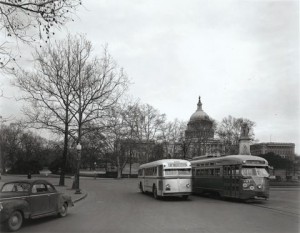
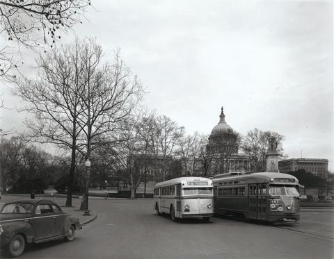
What’s old is new again! Capital Transit vehicles sharing the road in 1947.
In the Washington region, bus rapid transit (BRT), light rail transit (LRT) and streetcar (SC) systems are currently under study or construction on major transit corridors in every jurisdiction. Each is being planned by a different agency with different sets of goals and aspirations. Most of these corridors currently are already served by Metrobus and have heavy bus ridership. All of these projects can leave a bus planner wondering how all of these modes will work together and with the existing Metrobus system.
Some existing riders will be fully served by the new service; however, many others will require a combination of existing bus service and the new fixed route transit to reach their final destinations. As transit professionals, the ability for our customers to navigate seamlessly though the region via transit, regardless of the mode or operator, is our ultimate goal. Towards that end, we have been working on a set of guidelines for the operations planning of buses and new modes traveling in the same corridors. Read more…
Without Metro 2025, the region might give up more jobs than the current size of 80 of the nation’s 100 largest downtowns.
One way to alleviate congestion – limit transit funding and stymie job growth!
The Washington, D.C. region earned in 2012 the unfortunate honor of being named the #1 region in the nation – for congestion. For the workers in this region this comes as no surprise, as seemingly endless “volume delays” litter our evening traffic reports, commuters spend more than a full week and a half sitting in traffic each year, and even the public transit network – primarily Metrorail – is so crowded that commuters often have to wait for multiple trains just to squeeze onto the system. And unless proposed transportation investments keep up with projected household and job growth – MWCOG projects that the region will add 1.6 million jobs by 2040 – these commutes are only going to become more painful.
We all know that the high price of congestion is in the billions of dollars per year, a figure that would be even higher but not for transit’s impact has in reducing the region’s congestion by 10 to 15 percent, saving commuters time and money stuck in traffic, and preventing the need to build hundreds of thousands of new parking spaces and 1,000 additional lane miles of roads.
But that price pales in comparison to what may be if we don’t act now to make meaningful improvements to the regions congestion-reducing transportation infrastructure, especially in programs like Metro 2025. Turns out that we now know that when regions exceed 35 to 37 hours of delay per commuter per year – about four and a half minutes per one way free flow trip – regional job growth begins to slow. That means that expectations of continued economic growth in the region are a lot less rosy when we consider that we currently run about 72 hours of delay per commuter per year – and rising. And before you dismiss this as planning theory, remember that Hewlett Packard showed Atlanta and the nation in 1998 that congestion’s negative impact on employment growth can be economic fact. Read more…
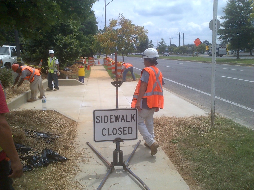
Metro is investing in a series of bus stop improvements across the region that will improve the rider experience and fully comply with the Americans with Disabilities Act (ADA).
Construction of the improvements for the stop on Branch Avenue and Silver Hill Road
Metro is investing in bus stop improvements to make bus riding easier for everyone, but especially for persons with disabilities. Improvements have been completed along two routes; the J4 route (College Park- Bethesda MetroExtra) and the P12 (Eastover-Addison Road Station). Addtional work was also done in the City of Greenbelt. These stops were selected as a part of the regional TIGER grant bus priority initiative designed to improve bus speeds and customer facilities along high demand corridors throughout the region.
To meet ADA requirements, bus stops must have four attributes:
• The pedestrian (landing) pad must have a firm, stable surface that is at least 5’ by 8’ (located at front door stopping location).
• The pedestrian pad must connect to the curb.
• The sidewalk must connect to the pad.
• The sidewalk must have a pair of curb ramps (leading to the bus stop).
At some locations, Metro was able to provide additional improvements, such as shelters, and in-street concrete pads, which are better able to withstand the heat and weight of a bus than regular asphalt. The specific improvements are described
Read more…
I was recently in Singapore for vacation and while I was there I used their delightfully clean and efficient rail system (more on that later). While walking through the stations, I spotted several movie posters, which actually happened to be posters for YouTube-based public information message ‘movies’. The movies are put out by the Land Transport Authority, which is a part of the government that does the planning for their transit systems.

‘May I Have a Seat Please?’

‘Can You Move in Please?’
Can you move in please? leaves viewers with two messages: 1. move to the back of the bus so that everyone can get on, and 2. take off your backpack or move any bags you may have out of the way. Some of the movie is lost in translation I think culturally speaking but still, you get the point.
Excuse me, May I have a seat please? is about exactly what the title suggests. This movie especially rings true in this day and age as a lot of commuters have their noses buried in their books and cell phones (even more prevalent in Singapore – a lot of people walking in stations and outside while watching movies!!).
The courtesy issues that Singapore is tackling rings true here in DC too, as well as any city that has transit.
[Editor’s note: this will be our last post of 2013. We look forward to seeing you again in early January.]
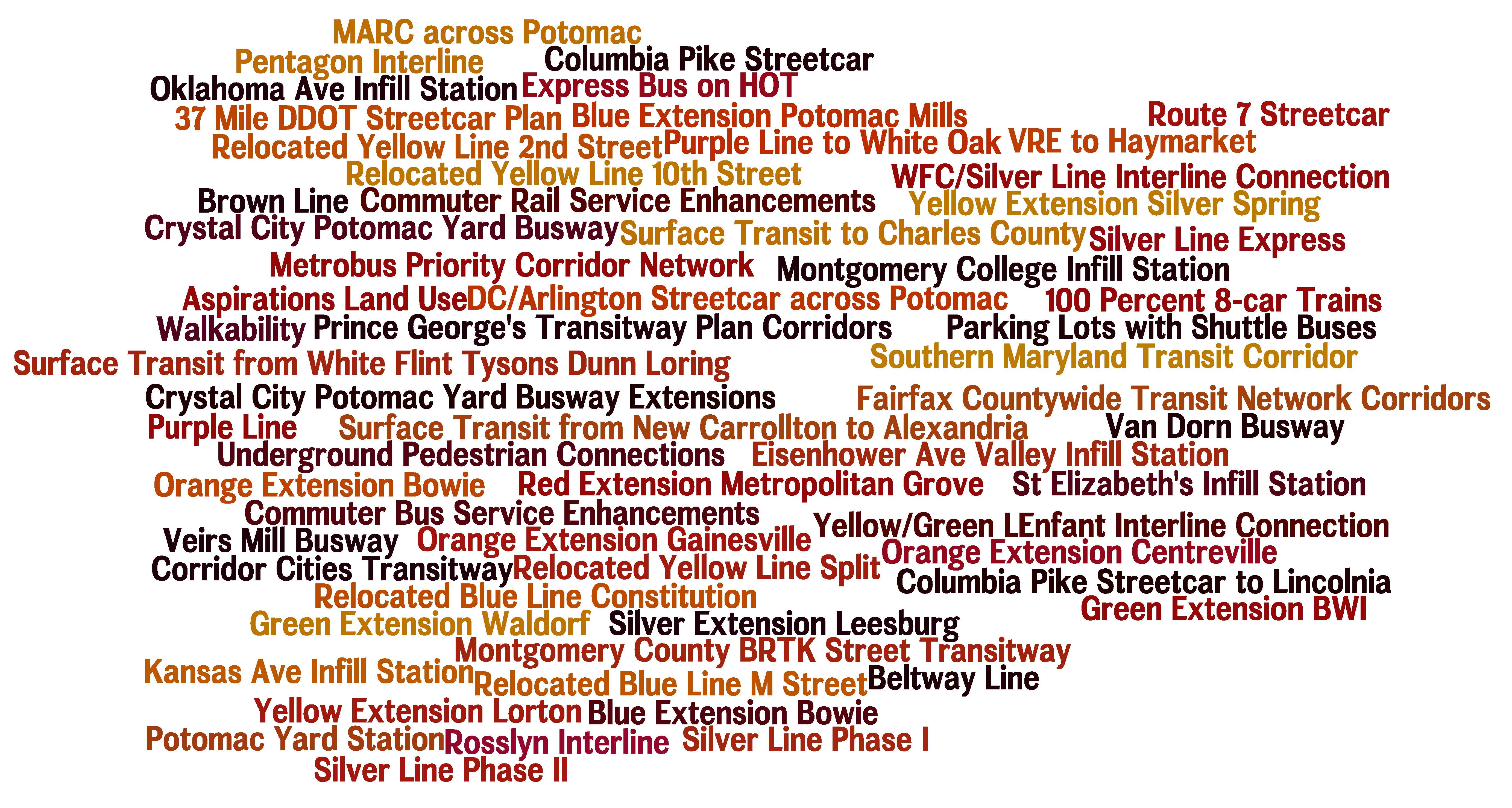
You name it and we tested it as part of our analysis and development of the Regional Transit System Plan (RTSP). Here’s the comprehensive list of what was analyzed.
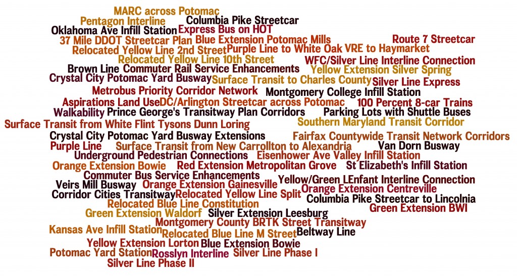
List of Transit Corridors, Projects, and Plans Analyzed as Part of RTSP
We have received tons of great comments on the proposed 2040 network of Metrorail and high capacity surface transit corridors. Many of you have said that we missed <insert corridor here> or have asked why we don’t have a line to <insert address here>. As part of this plan, we have analyzed almost every corridor or mode that you have identified. However, we recognize that most of it was behind the scenes and is buried deep in our posted presentations to the Technical Advisory Group (TAG).
Above is a list of what was analyzed before we unveiled the proposed 2040 Metrorail Network and regionally significant high capacity corridors. Better yet, here is a document that shows the Metrorail lines and other surface transit plans, projects, and strategies that were tested over the course of the project. Everything is listed and where possible, maps and graphics are provided to illustrate what was tested. All tested items were measured against a comprehensive set of measures of effectiveness (MOE). The MOEs assessed ridership, impact on core capacity, transfers, reduction in vehicle miles traveled (VMT), mode share, etc.
To wet your whistle, below, check out the Beltway Line that was tested. Only the segments that crossed the American Legion Bridge (between White Flint and Dunn Loring) and the Woodrow Wilson Bridge (between Branch Avenue and Eisenhower Avenue) had some promise and therefore, they continued on in the analysis, though as surface transit not Metrorail. The other segments did not provide good ridership, primarily due to the low densities within a walkable distance from the Beltway, and had little impact on Metrorail core capacity.
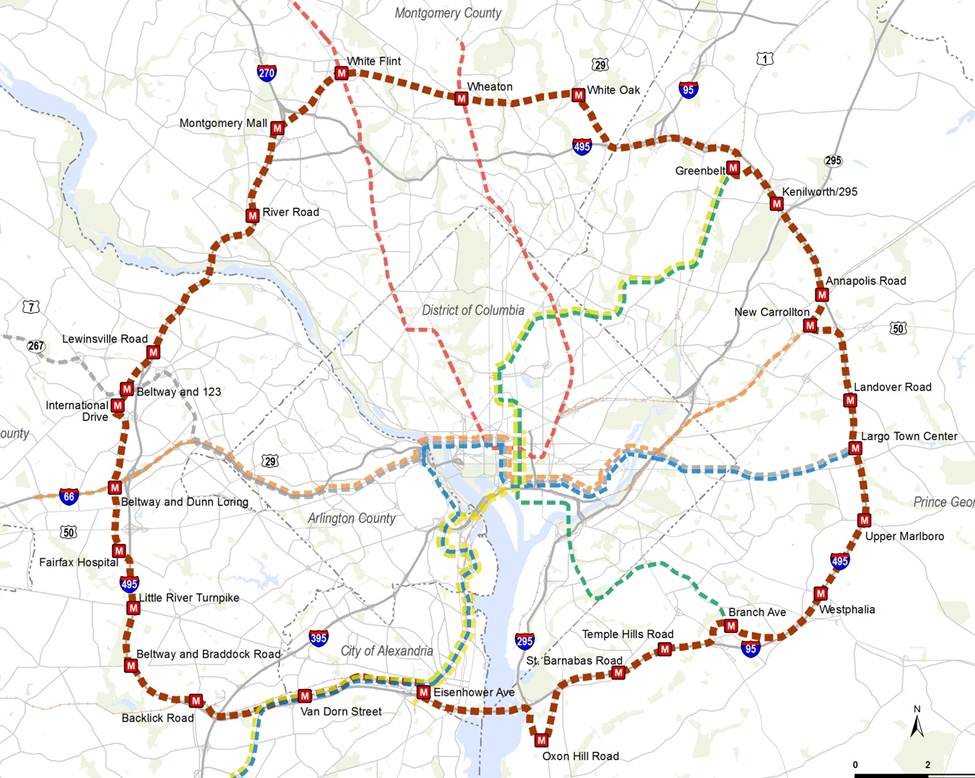
Alignment of a Beltway Line that was tested in the RTSP
Let us know what you think!


Recent Comments