Posts Tagged ‘tod’

Mass Transit Needs Mass

October 15th, 2014 7 comments

Transit expansion is in demand but Metrorail, light rail, and other high capacity transit projects can be expensive to build, operate and maintain.  With limited resources to invest, our region must ensure that these projects serve the most robust transit markets and are supported by strong transit friendly policies.

Informed by our peers and local performance measures, Metro is developing guidelines that the region can use to inform development of high capacity transit projects. As we’ve explored previously, there’s much more to transit expansion than Metrorail. In fact, due to the cost associated with Metrorail expansion along with existing land uses and built environment in much of the region, most of our future high capacity transit projects will be made up of other transit modes. But what is the best way to decide what mode best fits each corridor? The goal of the expansion guidelines is to inform those decisions.

Development in Arlington’s Rosslyn-Ballston Corridor has validated initial and ongoing investments in Metrorail. (source: Arlington County)

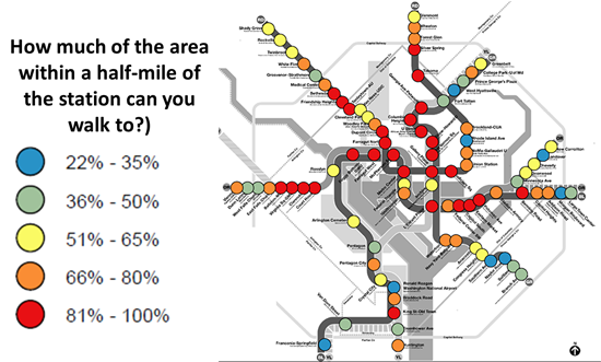
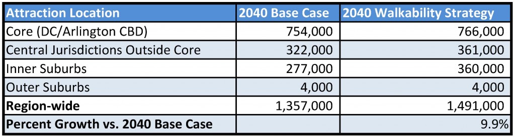
A literature and peer review included policy documents from BART (PDF), the Bay Area Metropolitan Transportation Commission, Florida DOT, Virginia DRPT, Federal Transit Administration (PDF), and research from the University of California Transportation Center (UCTC). The review found that ridership, density, the presence of walkable streets and sidewalks, local plans and policies, and cost effectiveness are the most relevant criteria to evaluate transit projects and that rigorous performance targets are needed to support each transit mode. Read more…

Solving the Region’s Congestion Woes – One Step at a Time (Part 3 of 3)

March 31st, 2014 2 comments

Making every Metrorail station area walkable could reduce regional congestion without breaking the bank.

This is part three of a three-part series.

In the previous two posts we’ve laid out a case for making all transit stations walkable as quickly as possible.

  1. Increasing walkability and density at station areas has huge impacts on transit mode share and can take tens of thousands of cars of the road every single day.
  2. At a regional level, walkable station areas have an equivalent impact on congestion as a quarter trillion dollars in “last mile” infrastructure (see pages 37, 38, 43, 48).

Maximizing the capacity of the existing transit network while intelligently investing in station area connectivity would combat regional congestion just as effectively as trying to “build our way out of the problem”. And unlike many potential interventions, the market actually wants to do this for us.

Perhaps it is time to harness these market forces to make the areas around our transit network walkable and implement this low-cost congestion-busting paradigm. As for where to begin – well, we have a few suggestions…

Existing Walkability Near Metrorail Stations

The map below shows the range of existing walkability conditions near the Metrorail network and helps answer the question of how much of a half-mile radius of each station a person can walk to. The higher the percentage, the better the pedestrian network coverage. As shown, many of the station areas are under performing relative to their potential walkability. If walkability = connectivity and connectivity = mode share, then just imagine the impact on the region’s roads if we could focus on taking station areas with low accessibility and invest in some relatively easy, short-term solutions like sidewalks, pedestrian bridges, crosswalks, and smart, transit-oriented development to take maximum advantage of the existing Metrorail system and take tens of thousands of cars off the road each day.

How walkable are our region's Metrorail stations?

How much of the area within a half-mile of our Metrorail stations can you walk to?

Read more…

Solving the Region’s Congestion Woes – One Step at a Time (Part 2 of 3)

March 24th, 2014 4 comments

Improving pedestrian connectivity takes cars off the road at a formidable clip – rivaling the power of all of the region’s planned roadway additions and “last mile” transit connections.  Cheaply and quickly. 

This post is part two of a three-part series.

The data is finally in, and we now know that walkable station areas result in fewer motorized trips, fewer miles driven, fewer cars owned, and fewer hours spent traveling. And when we improve the pedestrian and bicycle access and connectivity to Metrorail station areas, ridership goes up, putting a major dent in congestion by taking trips off the roadways. Earlier, we discussed what it means to build walkable station areas and research shows the tremendous benefits to the region of making this a priority.

First, our data confirms that when walking access to transit is improved, transit ridership goes up – way up. In the 2040 Regional Transit System Plan (RTSP), we stress tested TPB’s transportation model to improve walkability to the transit network and saw huge increases in transit linked trips.  These trips go up by about 10% region-wide and we get an increase in transit mode share for all regional trips by 0.5%.  That’s over and above the roughly one percent increase in mode share we anticipate occurring as a result of building the entirety of the CLRP, an impact about half that of constructing all of that transit.

Source: Regional Transit System Plan

Source: Regional Transit System Plan

Read more…

NPR Story on Arlington County’s Successes and Importance of Metro

October 25th, 2013 2 comments

NPR’s Morning Edition yesterday highlighted Arlington County‘s success in tackling commuting challenges, particularly as a result of the decision to bring Metrorail and transit-oriented development to the Rosslyn-Ballston corridor.  

When the Metrorail system was initially designed in the early 1960s, the plan proposed running the Orange Line in the median of what would ultimately become Interstate 66. Arlington County officials lobbied hard and put forward county funds to bring the Orange Line to its existing home, under Wilson Boulevard. They foresaw the benefits of high capacity transit IN the neighborhoods, as opposed to adjacent to the neighborhoods. They also set forth zoning, planning, and other policies to ensure that the county would maximize the benefits from that decision. The NPR story talks about the results of those decisions, the shift from a post-World War II auto-dependent suburb to a vibrant, mixed-use community that has become the gold standard for many cities across the world.

Orange Line - Proposed and Actual Alignments

Orange Line – Proposed and Actual Alignments

For more background on the history, growth, and experience with transit-oriented development in the corridor, check out this powerpoint from the Arlington County Department of Community Planning, Housing and Development. Not only does it provide additional information, it has some terrific before and after photos of the different Arlington neighborhoods and how they have changed. Parkington, anyone?

If you’d like to contribute to the NPR series, you can share your commuting experience with Morning Edition – #NPRcommute.

Yesterday’s NPR story was the first in a multi-part series on how communities are tackling commuting challenges.

moveDC Public Workshop Announcement – Comment on DC’s long-range transporation plan!

October 18th, 2013 Comments off

moveDCThe District Department of Transportation (DDOT) is hosting its third and final round of public workshops in October to discuss moveDC, DDOT’s initiative to develop a strategic, multimodal long range transportation plan for the District.  The public is encouraged to attend a workshop to review the draft plan and help prioritize the transportation options. The October workshops will enable you to:

  • Share your ideas and observations on future plans for transportation;
  • Learn how three approaches to a future DC transportation system perform;
  • Review the results of our survey research;
  • Provide input into the draft transportation plan; and
  • Learn more about the moveDC local bus study.

Online Survey

Throughout October, you are also invited to participate in a survey to comment on and critique three approaches that have the potential to transform the way people travel in the District.

Public Meeting Dates and Locations

Monday, October 21

7:00 a.m. to 6:00 p.m.

Union Station

625 First St NE

Tuesday, October 22

6:30 p.m. – 8:30 p.m., with a formal presentation 7 p.m.

Dorothy I. Height/Benning Neighborhood Library

3935 Benning Road, NE

Saturday, October 26

1:00 p.m. – 4:00 p.m.

DCUSA Retail Center, 2nd Floor, between Target and Best Buy

3100 14th St. NW

Wednesday, October 30

6:30 p.m. – 8:30 p.m., with a formal presentation 7 p.m.

Petworth Neighborhood Library

4200 Kansas Ave., NW

Web Meetings

Visit www.wemoveDC.org for more details and to sign up.

October 24, noon – 1:00 p.m.

October 28, 7:00 p.m. – 8:00 p.m.


Metro Anchors the Region’s Growth

February 14th, 2013 Comments off

Regional Activity Centers in the core jurisdictions served by high-quality Metro service. Click the image for a full regional map.

Of the 120 COG regional activity centers in the Metro Compact Jurisdictions, 81 are now or will soon be served by high quality Metro transit, either Metrorail or the Metrobus Priority Corridor Network (PCN). That means that two-thirds of these activity centers are primed to support transit-oriented developments. The map above illustrates the activity centers in the core jurisdictions and their level of transit service. Click the image  for a full regional map.

Some jurisdictions have placed a greater emphasis on high-quality transit service when deciding upon areas to designate as regional activity centers.  The chart below shows the total number of activity centers per jurisdiction and the percentage served by Metrorail and/or the PCN.  The core jurisdictions (the District, Arlington and Alexandria) each have over 80% of their activity centers served by high-quality Metro transit.  The beltway jurisdictions (Montgomery, Prince George’s and Fairfax counties) have between 48% and 70% of their activity centers served.   Loudoun County, soon to be added to the compact with two activity centers receiving Metrorail service when the Metrorail to Dulles Phase II comes online, has the lowest percentage of activity centers served by Metro.

The relationship between regional activity and high-quality transit is no accident.  Economic activity gravitates towards areas of greater accessibility, including Metrorail station areas and commercial corridors — once streetcar routes — currently served by Metrobus. However, transit service can also be extended to areas of economic activity which developed due to good highway accessibility, such as Tysons Corner.

As the local jurisdictions continue to focus population and employment growth into these areas, Metro and other regional transit operators are working to connect them to the regional core and to one another through high-quality transit.  It is clear from the current levels of highway congestion that Metropolitan Washington needs more high-quality Metro service (bus and rail) in order to support the growth anticipated over the next 25 years.

One goal of Momentum, Metro’s strategic planning process, is increasing regional mobility and connecting communities.

About the COG Activity Centers

The activity centers list, recently updated by the Metropolitan Washington Council of Governments (COG), describes where the local jurisdictions plan to focus household and job growth in order to support regional goals of transit-friendly development patterns and sustainability. This updated list includes 120 activity centers within the Metro Compact Jurisdictions (including Loudoun County) and additional 19 within the COG planning area not served by Metro, including Charles, Frederick and Prince William Counties, and the cities of Manassas and Manassas Park.

Categories: Impact Tags: , , , , ,

Developer to Add Real-Time Transit Info

October 17th, 2012 3 comments

A real-time transit information screen at Java Shack in Arlington, developed by Eric Fidler:Image courtesy of GreaterGreaterWashington.org

This is just a quick note to acknowledge what would hopefully be a trend in future transit-oriented development in the region.  According to the Washington City Paper article, Douglas Development wants an exception from a zoning code-required parking minimum for a new apartment building being planned for Tenleytown.  The generous community benefits package includes, among other things, ” installing a digital display with real-time bus and train schedules and information about nearby bike- and car-share stations.”

This is a great innovation that hopefully will be repeated in restaurants, cafes, bars, as well as new office and residential developments around the region.  The Washington area is rich with transportation options, and it’s exciting to see that third parties are engaged in helping promote alternatives to single-occupant vehicle travel.

The real-time transit information screen in the image above was developed by Eric Fidler, who blogs about transportation issues at Left for LeDroit.

Categories: In The News Tags: , ,

Metro’s Office of Planning Welcomes Shyam Kannan

September 28th, 2012 1 comment

Metro is excited to welcome Shyam Kannan to the position of Managing Director of the Office of Planning.  He offers the following statement to the online planning community.

Shyam Kannan speaking at the Capitol Riverfront BID's Annual Meeting. Photo credit: Tony DeFilippo Photography

After a decade consulting for real estate developers and public agencies alike, I learned the following:transportation drives development – always has, always will. The economic competitiveness of the Washington, D.C. region – especially in a rapidly-evolving global marketplace for talent and investment – is inextricably linked to the quality and appeal of its transit system. Furthermore, there is a window of opportunity right now as Metro continues to restore its aging system to a state of good repair to ensure that the right plans and visions are in place to guide the system – and the region – towards continued prosperity, vibrancy, inclusivity, and health for decades to come.

I look forward to working with Metro, the rider community, and our public leaders to bring forward-thinking and strategic solutions to the many challenges that the system faces and will face over the coming years. Admittedly, I’m a data hound, planning geek, transit aficionado – but I’m also a real estate economist, steward of public process, collaborator, and problem solver. Working to connect the dots and ensure that we have sound ideas that are not only beneficial to the region and sit on firm financial foundations, but also have measurable returns on investment is critically important to this office’s agenda, and we are wiring it into the DNA of everything we do.

Categories: In The News Tags:

Balancing Transit Mode of Access with Urban Design in Suburban Settings: A Comparative Assessment of Four European Transit Systems

May 27th, 2011 1 comment

Metro’s early experience with promoting TOD took place at below-ground rail stations in established urban settings that did not require the provision of transit access facilities beyond connections from sidewalks to the stations below. More recently, WMATA’s opportunities to develop its land to support TOD have been predominantly in suburban rail stations that include extensive parking lots, bus bays, and facilities for taxis, bicycles, customer pick-up and drop-off, and ADA patrons.

The default agency policy in recent years has been to replace existing facilities with a like amount and kind of facilities on a reduced footprint, and to emphasize transit operational functionality over urban design issues.  For example, this approach has tended to favor placing parking structures and bus bays adjacent to the station in lieu of pedestrian facilities, public spaces and mixed-use development.  However, public feedback has prompted WMATA to reassess the appropriateness of this default approach, and there is a need for new thinking about how future patrons should arrive at suburban stations; how transit operations should function in TOD contexts; and how to better meet local development policy objectives.

Development plan for Twinbrook Metrorail station.

Development plan for Twinbrook Metrorail station. Click the image for more information.

Over the past five years, WMATA has made a number of significant policy and program changes to recognize the changing development environment at suburban rail stations. For example, in 2008 WMATA adopted a new set of real estate development guidelines (1.91 MB PDF), and the first real estate projects implementing those guidelines were initiated in the summer and fall of 2010. While the evolution of WMATA’s planning and land development practice is underway, it is far from complete. WMATA’s most recently-launched TOD projects confront the agency with the immediate challenge of replacing first-generation, auto-oriented transit access facilities with a new generation of facilities that supports transit access, transit operations, and TOD.

Read more…