NPR Story on Arlington County’s Successes and Importance of Metro
NPR’s Morning Edition yesterday highlighted Arlington County‘s success in tackling commuting challenges, particularly as a result of the decision to bring Metrorail and transit-oriented development to the Rosslyn-Ballston corridor.
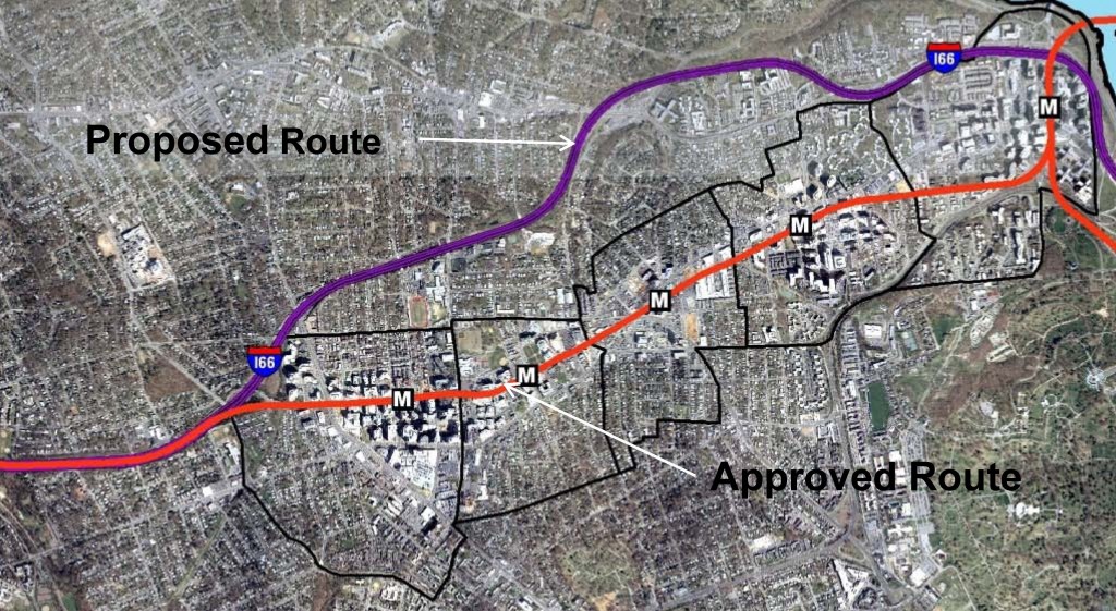
When the Metrorail system was initially designed in the early 1960s, the plan proposed running the Orange Line in the median of what would ultimately become Interstate 66. Arlington County officials lobbied hard and put forward county funds to bring the Orange Line to its existing home, under Wilson Boulevard. They foresaw the benefits of high capacity transit IN the neighborhoods, as opposed to adjacent to the neighborhoods. They also set forth zoning, planning, and other policies to ensure that the county would maximize the benefits from that decision. The NPR story talks about the results of those decisions, the shift from a post-World War II auto-dependent suburb to a vibrant, mixed-use community that has become the gold standard for many cities across the world.
For more background on the history, growth, and experience with transit-oriented development in the corridor, check out this powerpoint from the Arlington County Department of Community Planning, Housing and Development. Not only does it provide additional information, it has some terrific before and after photos of the different Arlington neighborhoods and how they have changed. Parkington, anyone?
If you’d like to contribute to the NPR series, you can share your commuting experience with Morning Edition – #NPRcommute.
Yesterday’s NPR story was the first in a multi-part series on how communities are tackling commuting challenges.


R-B corridor is a great example of how transit can transform a sleepy suburb from floundering to flourishing in just a few decades. In the 90s I lived in Clarendon/Courhouse and Ballston and never owned a car because I road Metro. Clarendon was still desolate back then, but I’m thrilled to see the level of development that’s taken place since I moved to California in 2000. I only wish we could take the same approach to the Geary corridor in SF that seems locked in the 1950s. This stretch has the highest transit ridership (bus), but the focus remains on the car instead of improving transit and encouraging higher density development in what is essentially a 5-mile long stripmall. Talks of expanding BART under Geary have been in the works for decades, but nothing has been done or proposed since the original BART system was drafted in the 1960s. Sad, really.
Mark, thanks for your comment. You might be interested to know (or might already know) that Muni is planning a bus rapid transit line down Geary Boulevard and BART is also working on a new “Metro Vision” study, which is investigating long term transit expansion in San Francisco and Oakland, including the Geary “BART to the Beach” corridor.