The American Automobile Association (AAA) highlights that, even with a proposed fare increase, Metro is still a cheaper than driving for many trips in the region.
AAA’s analysis compares the costs of driving and parking between Maryland and Virginia to Metro-accessible locations in and near downtown Washington. Below is a selection of these trips:

Comparing The Commuting Costs – Driving vs. Riding Metro (Source: AAA Mid-Atlantic)
Obviously, these are just examples and there are other trips where transit isn’t an option or driving may be more cost effective than Metro. Parking costs, levels of congestion, transit accessibility, travel times and other variables are quite different depending on where a trip begins and ends. Still, taking the train or bus is often much cheaper than driving, especially utilizing SmartBenefits or transit passes, which further reduce the cost of choosing Metro
New Station Lighting at Judiciary Square. Click image for larger version.
Pilot upgrades using energy-efficient lighting at three stations have been a success, so Metro is planning to ramp up the effort to 41 more stations by 2015.
Metro recently completed retrofitting the mezzanine-level lights at Judiciary Square, Gallery Place, Bethesda, Smithsonian and Metro Center. Through careful fixture selection, the new fixtures provide a higher quality of light with an improved Color Rendering Index (CRI) thereby improving both lighting levels and overall visibility. Significantly, the new lighting design offers better light levels without compromising the integrity of the original lighting design and station aesthetic. The retrofits also provide significant lifecycle cost savings for Metro through reduced energy consumption and maintenance requirements.
Following these successes, Metro General Manager/CEO Richard Sarles today that it plans to upgrade mezzanine lighting at the 41 remaining underground Metrorail stations by 2015. In addition to the five already completed stations, one station, L’Enfant Plaza is currently under construction. Read more…
The Silver Line will relieve traffic congestion on the Dulles Toll Road and I-66 when it opens in 2014.
This post is a continuation of our series that answers questions about the new Silver Line.
It’s no secret that the Washington region has some of the worst traffic in the country. Listeners to “drive time” radio are bombarded with rapid-fire traffic reports noting congestion on major regional highways, often caused by “nothing but volume”. This expression means there is no traffic accident, weather incident or excessive sunshine slowing cars down. Instead, too many cars are trying to squeeze into too few lanes at critical interchanges, resulting in traffic queues that can extend for miles and miles.
Not surprisingly, the highways along the Silver Line corridor are some of the region’s most congested. The merging of I-66 and the Dulles Toll Road was ranked fourth worst congested location (PDF) in the MWCOG Spring 2011 Traffic Survey. The survey showed the toll road has three major congestion spots in the AM Peak: the toll plaza, the interchange with the Capital Beltway and the merger with I-66. In all three cases, the recurring congestion was caused by vehicles weaving and merging.
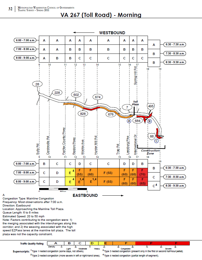
Surveyed morning traffic conditions on the Dulles Toll Road, from the MWCOG 2011 Traffic Survey. Image links to PDF report.
According to the MWCOG report, the speed in the traffic queue is between 20 and 50 MPH. This would result in between 2 and 12 minutes of delay per vehicle joining the back of the queue heading to the toll plaza. Assuming a duration of 2 hours for the queue, average vehicle occupancy of 1.1 and 1,900 vehicles per lane per mile, this results in between 560 and 3,300 person-hours of delay per day, up to 840,000 person hours per year. Read more…
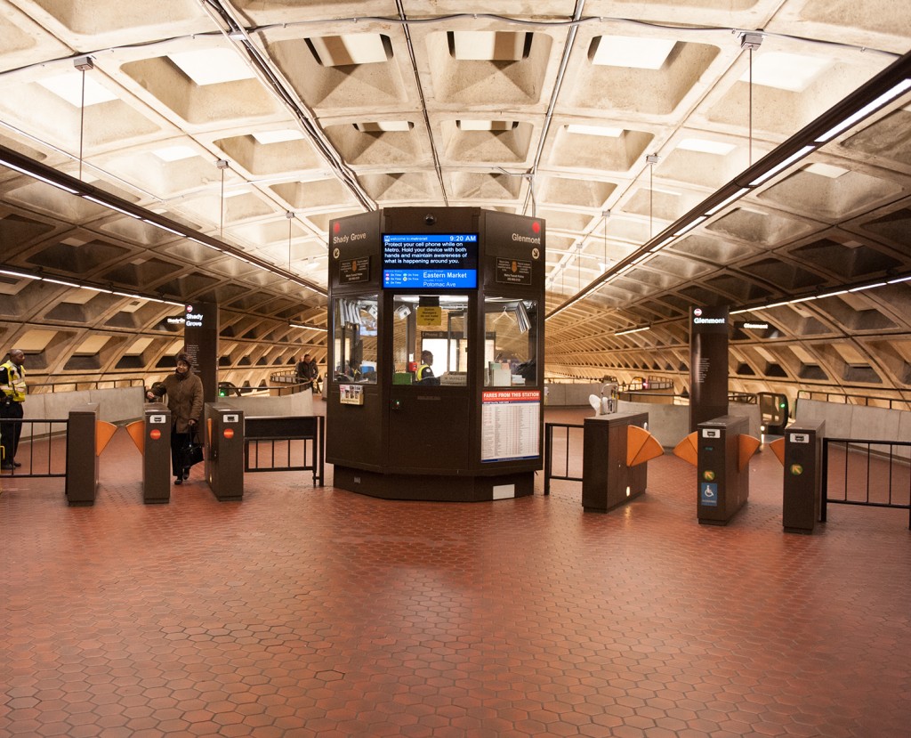
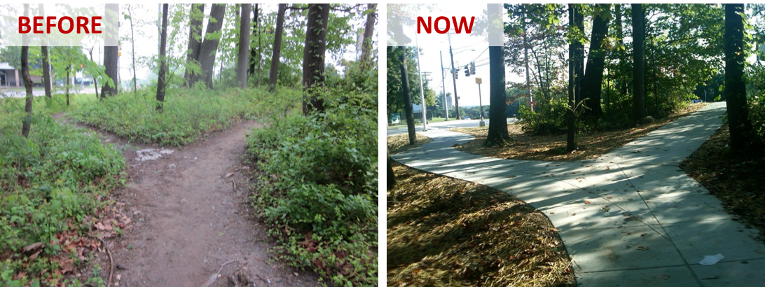
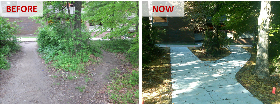
As we continue to improve pedestrian and bicycle access to Metrorail, Metro has recently completed several improvements on the east side of Glenmont station.
Walking and bicycling are key access strategies for Metrorail, as Metro seeks to grow ridership in sustainable and cost-effective ways. As our studies have shown, accommodating new riders at our current access modal shares would be quite costly to the region. At Glenmont station, around 12% of riders in the morning arrive on foot or by bike, but there may be growth potential. Nearly 80 customers per day live within 1 mile of the station but currently park. Over 550 customers, or a third of all parking customers, live within 3 miles of the station but currently park.
To make Glenmont station more attractive and safe for pedestrians and bicycles, Metro’s Parking Office has constructed new paved pathways connecting the station to the intersection of Layhill Road and Glenallan Avenue, replacing a dirt path. Metro has completed this work as part of the Bicycle and Pedestrian Capital Improvement Program.
Read more…
NPR’s Morning Edition yesterday highlighted Arlington County‘s success in tackling commuting challenges, particularly as a result of the decision to bring Metrorail and transit-oriented development to the Rosslyn-Ballston corridor.
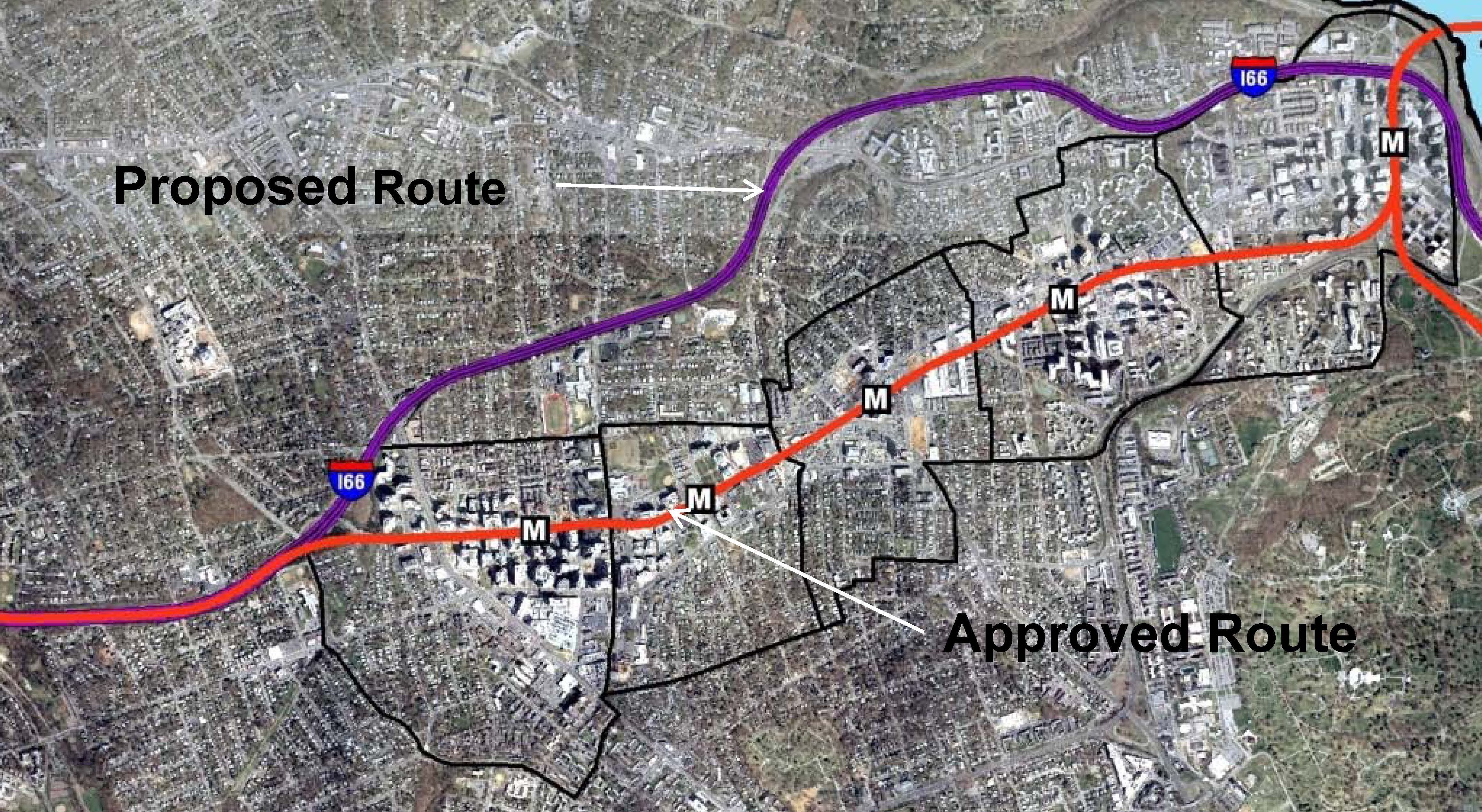
When the Metrorail system was initially designed in the early 1960s, the plan proposed running the Orange Line in the median of what would ultimately become Interstate 66. Arlington County officials lobbied hard and put forward county funds to bring the Orange Line to its existing home, under Wilson Boulevard. They foresaw the benefits of high capacity transit IN the neighborhoods, as opposed to adjacent to the neighborhoods. They also set forth zoning, planning, and other policies to ensure that the county would maximize the benefits from that decision. The NPR story talks about the results of those decisions, the shift from a post-World War II auto-dependent suburb to a vibrant, mixed-use community that has become the gold standard for many cities across the world.
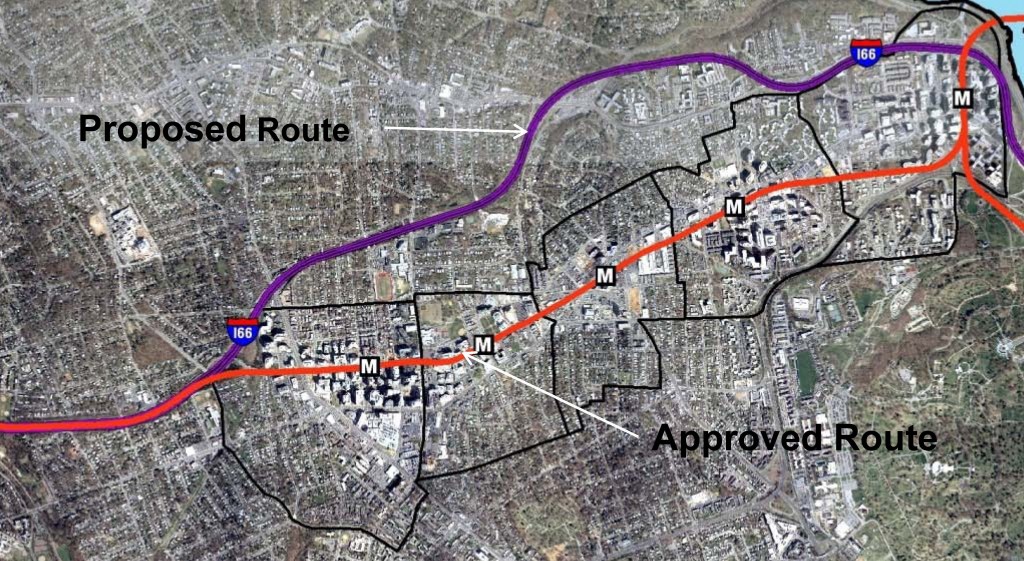
Orange Line – Proposed and Actual Alignments
For more background on the history, growth, and experience with transit-oriented development in the corridor, check out this powerpoint from the Arlington County Department of Community Planning, Housing and Development. Not only does it provide additional information, it has some terrific before and after photos of the different Arlington neighborhoods and how they have changed. Parkington, anyone?
If you’d like to contribute to the NPR series, you can share your commuting experience with Morning Edition – #NPRcommute.
Yesterday’s NPR story was the first in a multi-part series on how communities are tackling commuting challenges.
Our new “Line-Load Application” is expected to provide more accurate reports of system crowding by segment.
We recently finished testing a new version of the Line Load Application, a custom-developed application that distributes the load of passengers across the Metrorail system based on their points of entry and exit. This application allows us to estimate the passenger loads on rail system per segment (rail between stations). It is very important for Metro to be able to track the passengers per car across the rail system, both for peak hours on average weekdays and before and after special events. Because the new system is based on rail schedules, each passenger is assigned to an individual car for the assessment of passengers per car (PPC).
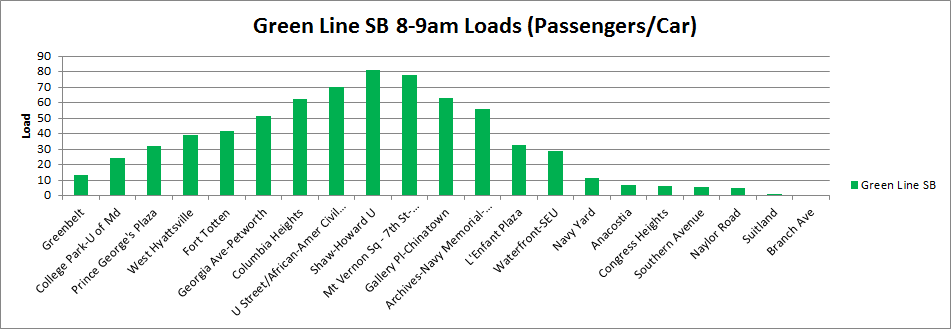
Example of southbound Green Line passenger loads, May 1, 2013, 8am-9am
Our current method of assessing passenger crowding is by stationing rail passenger counting personnel at key stations during peak periods, approximately twice per month per station. Because the inputs to the new application are faregate entry and exit data, this application is providing data like Metro has never seen before, including load factors and passengers per car for all stations at all times of the day.
Upon review, the output data from this tool appears to match expectations of passenger loads at major checkpoints in the system during peak periods with no disruptions. Output from this tool covering non-core checkpoints and non-peak periods will be validated soon.
In the next phase of improvements for this application, we will work to incorporate actual train arrival and departure times as an alternative to using schedules. This will allow us to understand the actual conditions our customers experience during service disruptions or after special events.
The completion of the development of the Line Load application comes at a point in time when Metro is striving to increase safety and relieve the crowding on the rail system, both of which are major topics of our new strategic plan, Momentum.
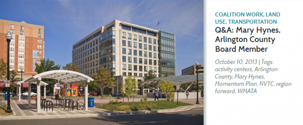
Mary Hynes, a Metro Board Member, sat down with the Region Forward team to answer a few questions about the region’s biggest challenges, how Metro can help the region meet the goals in Region Forward, and how citizens can get involved. In addition to her role at Metro, Ms. Hynes is an Arlington County Board Member and the Chair of the Council of Governments’ Region Forward Coalition, the public-private group leading the effort to implement COG’s vision for the region’s future.
Q: What do you think are the region’s biggest challenges?
Mary Hynes: “The economy is a big challenge. We are still figuring out ‘the new normal’ with the federal government. The issues of housing and how people move efficiently around the region are also critical. It’s critical that we understand how housing and multimodal transportation options fit into the bigger picture of achieving a thriving region built of individual vibrant communities – one that is also attuned and committed to meeting the social equity requirements of our diverse, sustainable region.”
Q: How does Metro help us meet our Region Forward goals?
Mary Hynes: “The Metro Board made a decision when considering how to frame its new strategic plan to key off of Region Forward. We – my colleagues on the Metro Board and Metro’s professional staff – looked at what regional leaders had done with Region Forward—the goals they had set—and said “Metro can be the catalyst that enhances regional mobility and convenes stakeholders to ensure a successful, integrated regional multi-modal system”. We worked with the Transportation Planning Board at COG to make sure Momentum and the TPB’s Priorities Plan are aligned. It wasn’t hard because, in fact, there is regional consensus on the next set of transportation moves the region needs to make.
It’s an exciting time to be participating with COG and Metro. It’s a remarkable moment because people share the same vision. Leaders across the region have learned the same lessons. So the time is right! Just as regional leaders did 50 years ago when planning Metro, we all must lock our arms, commit to a funding plan, and move forward together.”
Read the full interview!
 The District Department of Transportation (DDOT) is hosting its third and final round of public workshops in October to discuss moveDC, DDOT’s initiative to develop a strategic, multimodal long range transportation plan for the District. The public is encouraged to attend a workshop to review the draft plan and help prioritize the transportation options. The October workshops will enable you to:
- Share your ideas and observations on future plans for transportation;
- Learn how three approaches to a future DC transportation system perform;
- Review the results of our survey research;
- Provide input into the draft transportation plan; and
- Learn more about the moveDC local bus study.
Online Survey
Throughout October, you are also invited to participate in a survey to comment on and critique three approaches that have the potential to transform the way people travel in the District.
Public Meeting Dates and Locations
Monday, October 21
7:00 a.m. to 6:00 p.m.
Union Station
625 First St NE
Tuesday, October 22
6:30 p.m. – 8:30 p.m., with a formal presentation 7 p.m.
Dorothy I. Height/Benning Neighborhood Library
3935 Benning Road, NE
Saturday, October 26
1:00 p.m. – 4:00 p.m.
DCUSA Retail Center, 2nd Floor, between Target and Best Buy
3100 14th St. NW
Wednesday, October 30
6:30 p.m. – 8:30 p.m., with a formal presentation 7 p.m.
Petworth Neighborhood Library
4200 Kansas Ave., NW
Web Meetings
Visit www.wemoveDC.org for more details and to sign up.
October 24, noon – 1:00 p.m.
October 28, 7:00 p.m. – 8:00 p.m.
Categories: In The News Tags: access, bike, bike parking, BRT, bus, meetings, Metrorail, pedestrian, planning, plans, presentations, public comment, rail, stations, tod
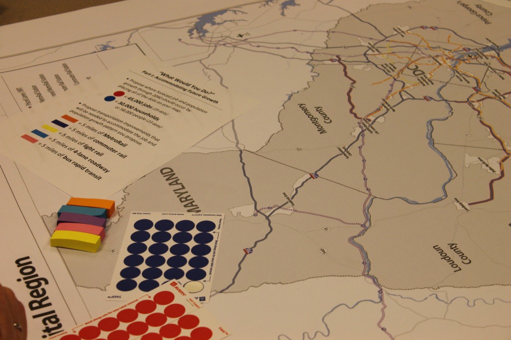
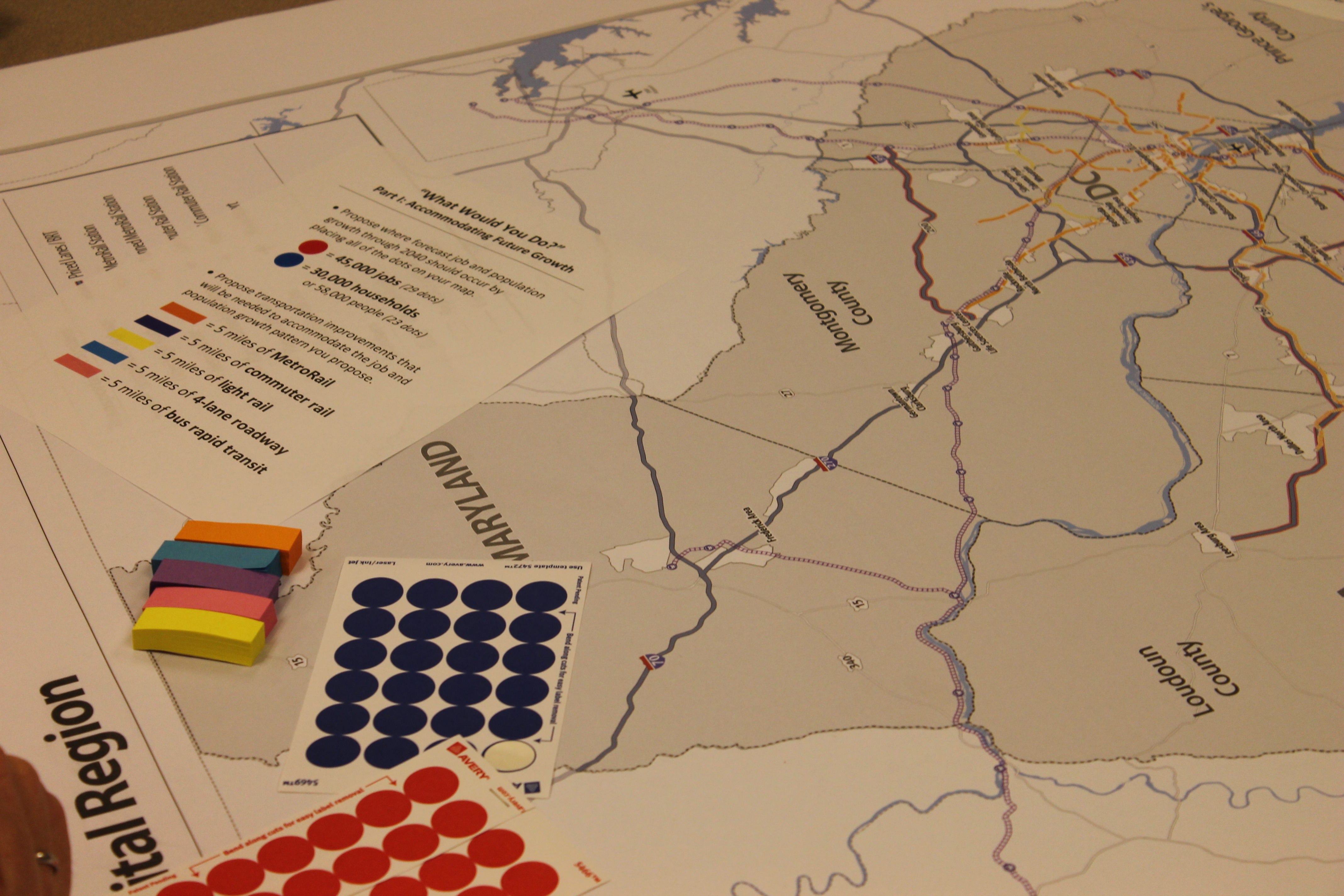
Accommodating future household and employment growth exercise
This past spring Metro planners participated in the latest session of the Transportation Planning Board‘s (TPB) Community Leadership Institute (CLI).
The CLI is an educational program put on by the TPB that brings together community leaders and educates them on the regional issues as well as how the transportation decision making process works for this region. The program takes place over the course of three workshops.
The CLI is an excellent way to meet new people in the region who are interested in transportation issues, as well as a way to learn about the challenges that the region currently faces. The latter was especially brought out in the two presentations on ‘What if the Washington Region Grew Differently? – Regional Challenges & Exploring Options’. The group exercise for this portion of the Institute included having to work with other members of your assigned team to decide where household and employment growth was going to occur throughout the region, and where the transportation improvements should be located to accommodate this growth. That was easy enough. However, right after that, all the groups were told that they would have to pay for the transportation improvements they had asked for earlier and that’s when people realized how expensive transportation improvements are and how difficult it can be to work with people who have different transportation priorities. Read more…
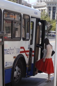 The distance between stops is of key concern to Metro and its customers. More closely spaced stops provide customers with more convenient access, as they are likely to experience a shorter walk to the nearest bus stop. However, closely-spaced stops are also likely to result in a longer ride for customers because of the number of times the bus stops — to decelerate, come to a complete stop and then accelerate and re-merge into traffic — is increased.
Having fewer stops along a bus route benefits passengers not only by reducing the time it takes for them to make their trip, but by making the service more reliable and predictable. Customer benefit is maximized when the only stops considered for removal have low average weekday ridership for boarding and alighting. We have chosen the 96/97 line, known as the East Capitol Street-Cardozo line, which runs between Capitol Heights Station, Stadium-Armory Station, Union Station, U Street Station, Woodley Park Station, and Tenleytown Station. Some of the bus stops in the Woodley Park area are also served by the X3 route.
Read more…


Recent Comments