Recent and upcoming Metrorail service changes to accommodate the Silver Line have been in the works for over a decade, and are better for Blue Line riders than originally planned.
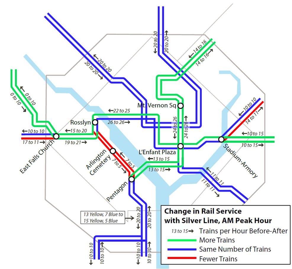
Metrorail Service Changes with the Silver Line Opening on July 26, 2014
Read more…
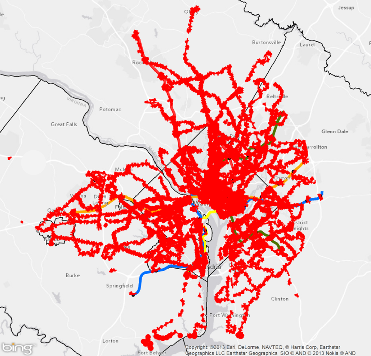
Metro provides the transit network around which a compact, low-carbon region can be framed. Without Metro available, the region would release an additional 400,000 metric tons of CO2e per year – equivalent to the carbon consumed annually by a land area approximately the same size as Fairfax County. By advocating for transit-oriented development as the region grows, Metro can continue to increase the net greenhouse gas (GHG) benefit or GHG displacement it provides to the region in three ways.
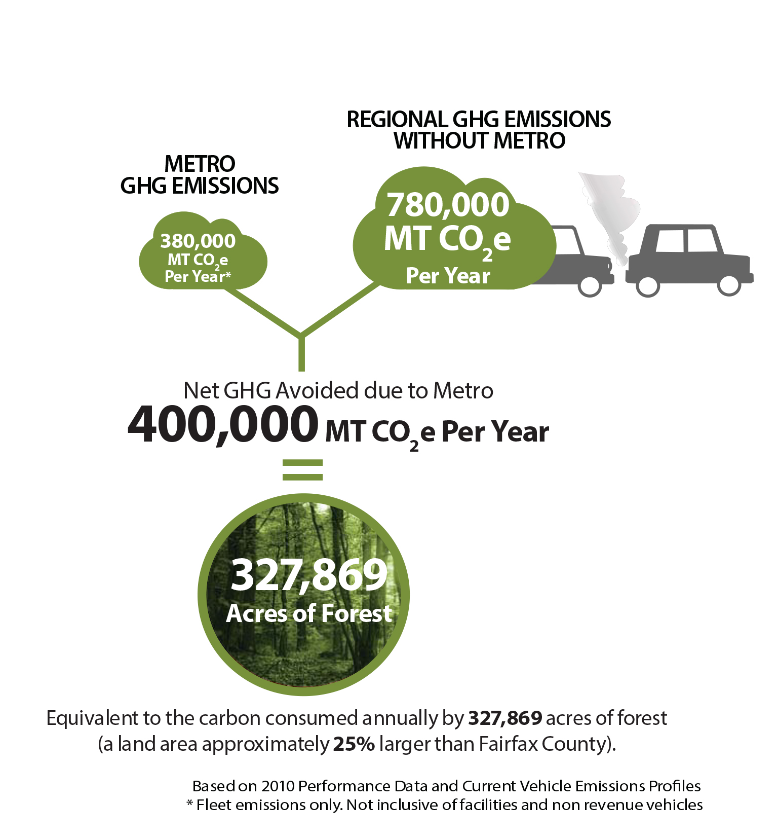
GHG Benefits of Metro
Read more…
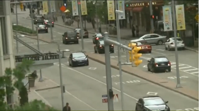
“If I’m a Blue Line rider in Virginia, what are my bus options once the Silver Line opens?”
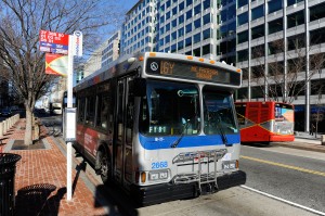
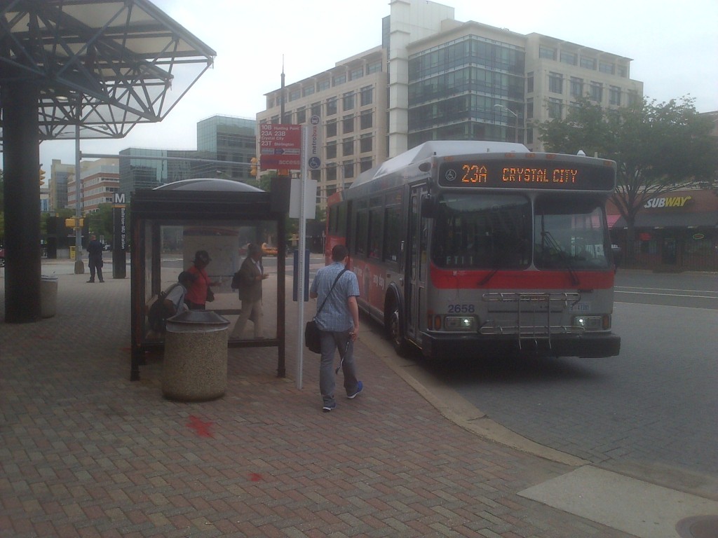
The 16Y to McPherson Sq.
We get asked this question quite a bit, and even more so now that the opening of the Silver Line is rapidly approaching. As we have written about extensively on PlanItMetro, the start of service on the Silver Line will mean a reduction in the frequency of rush hour Blue Line trains. Average headways will increase from 8.5 minutes to 12 minutes. For most riders, once they arrive at a Blue Line platform their quickest ride will still be via train (even with an additional few minute wait), but there are numerous options for riders looking to switch from rail to bus or new riders looking to commute via bus.
Here are some of your best bus options if you are a Blue Line rider going to, or coming from:
Downtown DC
- 7Y: Southern Towers to downtown DC. Beginning August 24, the 7Y will be rerouted to pass within walking distance of these Blue Line stations:
- Pentagon
- Arlington Cemetery
- Pentagon City (2 blocks)
- Crystal City (2 blocks)
- Farragut West
- McPherson Square Read more…
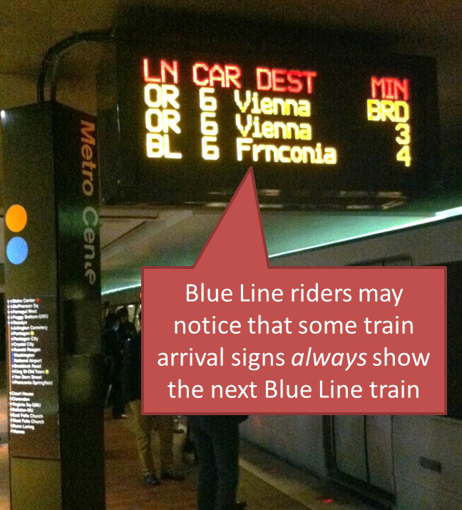
 Some train arrival signs now always show the next Blue Line train, and it’s helping Blue Line riders determine their best route.
At rush times, Blue Line riders know they can sometimes see two or three Yellow or Orange Line trains go by before a Blue Line train arrives. For some riders, knowing just how far away the next Blue Line train is can help them decide: is it worth waiting, or should I get on the next train and transfer at L’Enfant Plaza?
To help Blue Line riders, Metro changed the arrival signs to always show the time until the next Blue Line train arrives, even if it’s more than three trains away. That means that riders can always tell how far away a Blue Line train is, and decide whether to wait for it, or use the Yellow Line instead. Read more…
Though many of the stations that Metro 2025 seeks to improve are in the District of Columbia, the capacity expansion would help riders from all jurisdictions.
Metro needs to improve the capacity at over a dozen stations: some of these stations are at capacity today, and our 100% eight-car train program will bring even more customers to already crowded stations. We know we need to build new escalators, expand mezzanines, and build pedestrian passageways to meet this future demand.
The fact is that Metro 2025 is designed to benefit the Washington metropolitan area, residents of the District, Maryland and Virginia, as well as visitors from around the country and the world.
If you’re a commuter in Maryland or Virginia, it may look like the benefit of these improvements are focused on D.C. residents. After all, 10 out of the 15 stations are located in the District of Columbia. But the diagram below shows most of the riders who use these stations – those who create the need today, and who would benefit from fixing it – live in Maryland or Virginia. In fact, 77% of the users of the Metro 2025 stations live in the suburbs.
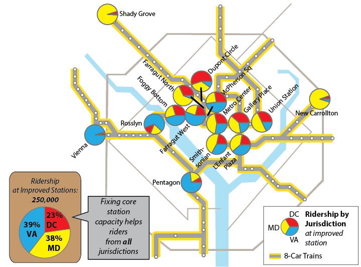
Fixing core stations in Metro 2025 helps riders from all jurisdictions
Help us make the Metro 2025 projects in Momentum a reality! Learn more about Momentum, call on your elected representatives, and endorse the plan.
Metro will soon be measuring how much growth happens in places that are walkable to transit. Here’s an in-depth look at how we define “walkable” to Metrorail stations and Metrobus stops.
Areas reachable on foot from regional Metrobus stops and Metrorail stations
Metro’s new Connecting Communities metric will measure annual household growth in our region that occurs within the “transit shed” – the catchment area around transit service that generates walk ridership. And improving walkability can be an incredibly cost-effective way to reduce congestion and increase transit ridership. Let’s take a closer look at how we defined what’s “walkable to transit.”
How Far is Walkable? First, we defined walking distance as a half-mile from Metrorail, and a quarter-mile from Metrobus, for a number of reasons:
- Of all the passengers who walk to Metrorail each morning, the median walking distance is just under a half-mile (0.35 miles, actually). Riders walk farther to some stations than others, but the systemwide average is just shy of a half-mile. Since rail riders are on average willing to walk a little under a half-mile today, it is reasonable to use a half-mile as an upper limit for walking in the future. (We don’t have similar survey data on Metrobus – yet.)
- The land use within a quarter- and half-mile is where we see the strongest effects on ridership on Metro today. More on this below.
- Academic literature supports the half-mile radius from rail transit as no better than any other distance, particularly for the link between households and ridership.
- Practically, setting the distance any farther than 0.50 and 0.25 miles increases overlap with other nearby stations and bus stops, which increases computational complexity. Read more…
Video still showing Cleveland’s center-running BRT, from the filming of Captain America, Winter Soldier. Click image for original video.
I recently watched “Captain America: The Winter Soldier” with some friends recently at the theater near Gallery Pl-Chinatown. I had heard rumors that the film was set in DC, which was a selling point since it’s always fun hearing names of local streets or venues and picking out inconsistencies between Hollywood’s portrayal and the real thing. Our friends over at Greater Greater Washington already noted that this film replaces parts of Rosslyn and Roosevelt Island with a massive S.H.I.E.L.D. headquarters complex.
But little did I know that the film would take me to Cleveland. Read more…
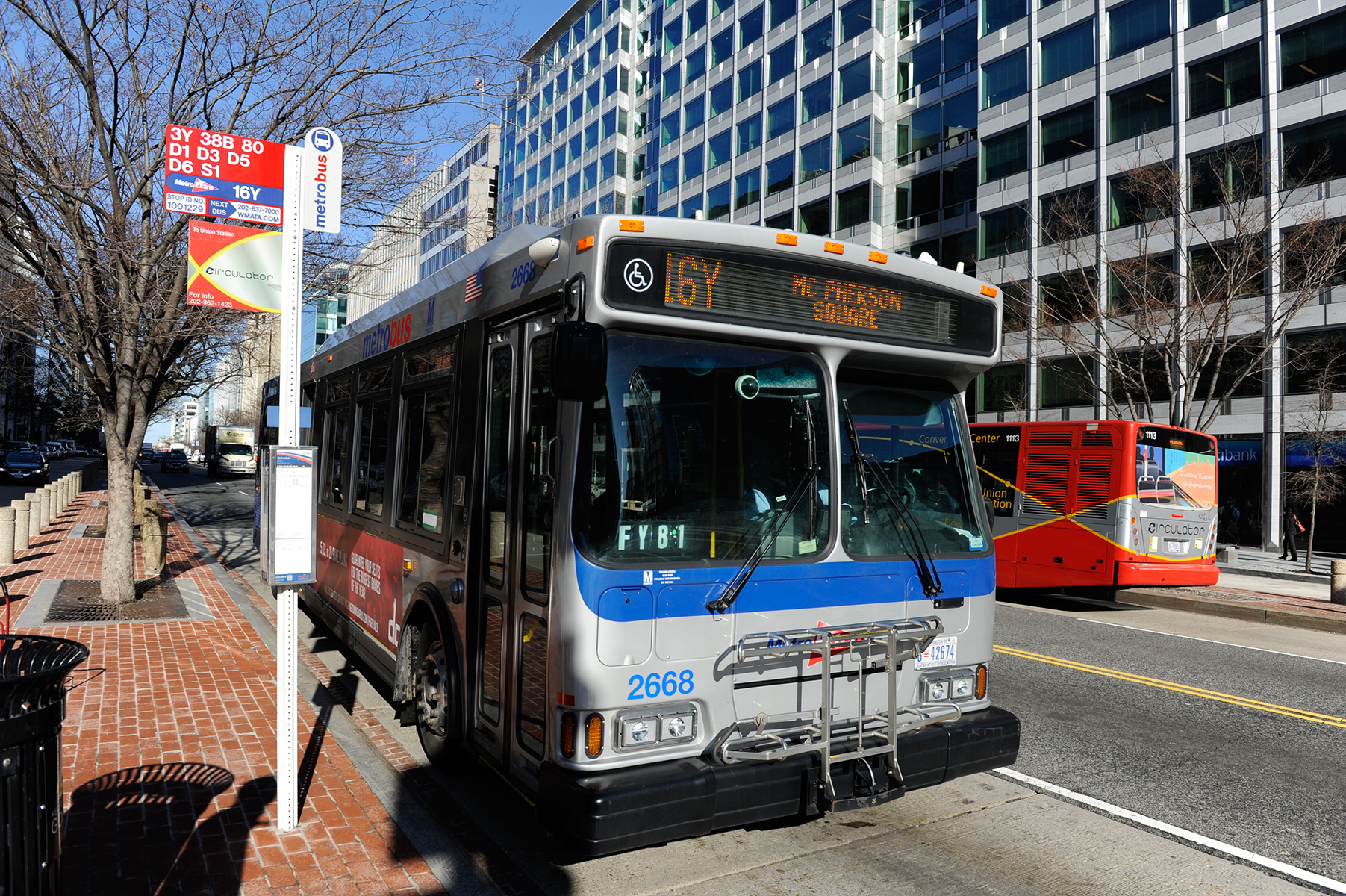
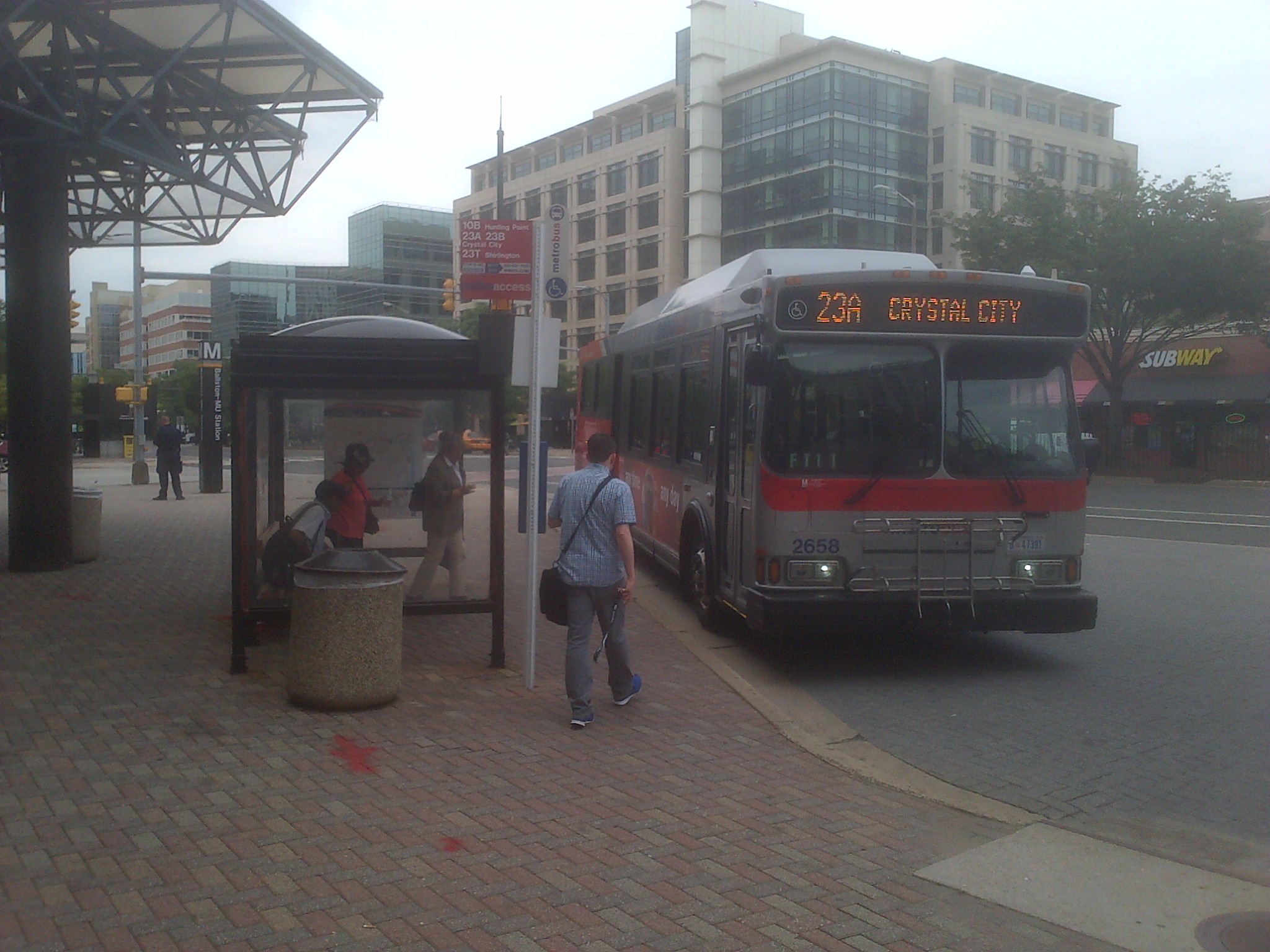
Customers boarding the 23A at Ballston
The distance between stops is of key concern to Metro and its customers. More closely spaced stops provide customers with more convenient access, as they are likely to experience a shorter walk to the nearest bus stop. However, closely-spaced stops are also likely to result in a longer ride for customers because of the number of times the bus stops — to decelerate, come to a complete stop and then accelerate and re-merge into traffic — is increased. This also can lead to increased fuel and maintenance costs.
Having fewer stops along a bus route benefits passengers not only by reducing the time it takes for them to make their trip, but by making the service more reliable and predictable.
Read more…

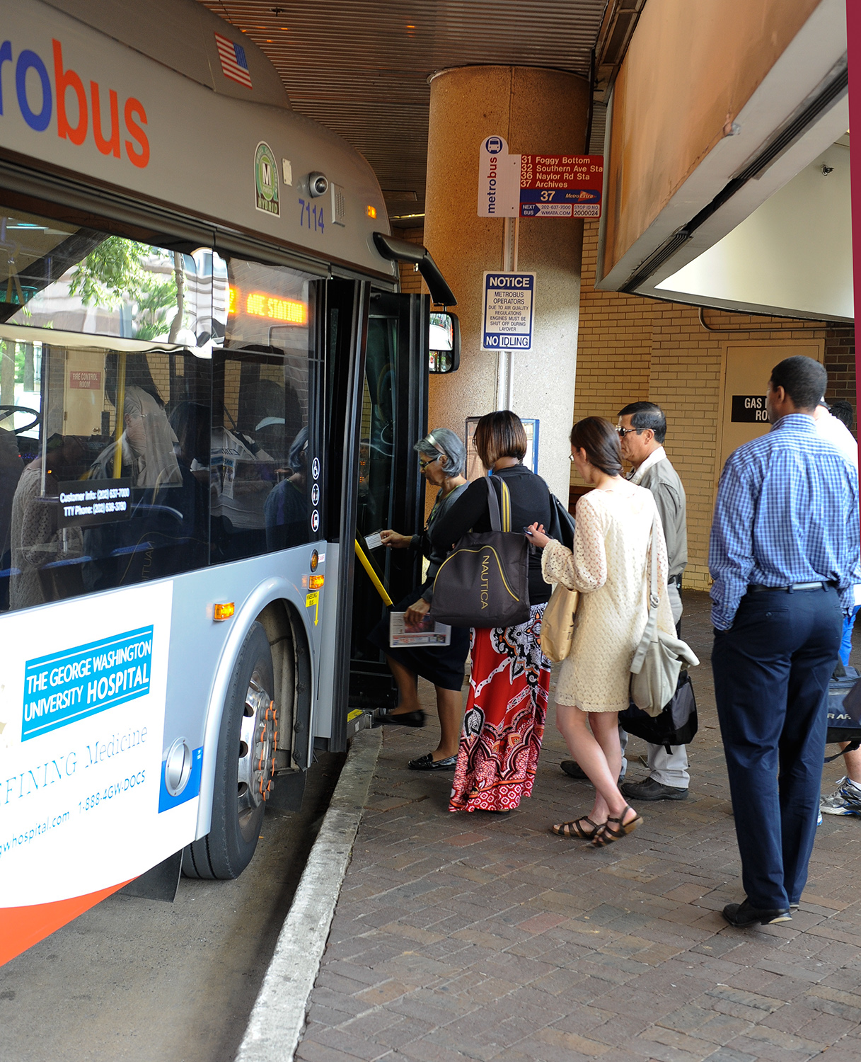
Boarding the 30s Line at Friendship Heights
The distance between stops is of key concern to Metro and its customers. More closely spaced stops provide customers with more convenient access, as they are likely to experience a shorter walk to the nearest bus stop. However, closely-spaced stops are also likely to result in a longer ride for customers because of the number of times the bus stops — to decelerate, come to a complete stop and then accelerate and re-merge into traffic — is increased. This can lead to degraded service quality for bus passengers and increased maintenance, and operating costs for Metro.
Having fewer stops along a bus route can benefit passengers not only by reducing the time it takes for them to make their trip, but also by making the service more reliable and predictable. When stops are analyzed, several factors will cause them to be taken out of consideration for removal. These reasons include stops in front of a school, house of worship, community center, senior housing, park, transfer point, or other popular amenities. These bus stops will not be removed irrespective of usage.
Read more…


Recent Comments