
Why isn’t Metro looking at a line to [insert address here]?
[Editor’s note: this will be our last post of 2013. We look forward to seeing you again in early January.]
You name it and we tested it as part of our analysis and development of the Regional Transit System Plan (RTSP). Here’s the comprehensive list of what was analyzed.
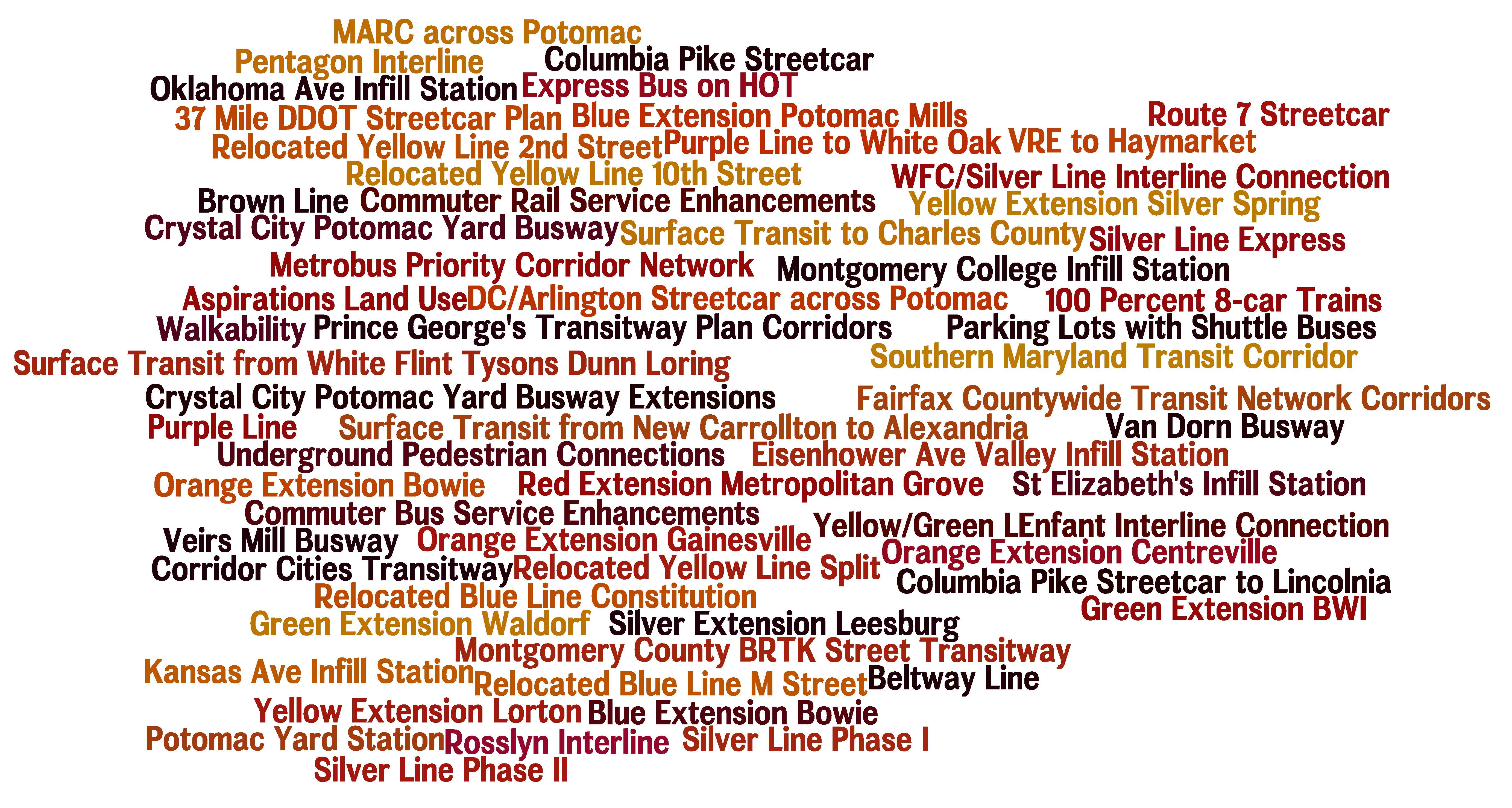
List of Transit Corridors, Projects, and Plans Analyzed as Part of RTSP
We have received tons of great comments on the proposed 2040 network of Metrorail and high capacity surface transit corridors. Many of you have said that we missed <insert corridor here> or have asked why we don’t have a line to <insert address here>. As part of this plan, we have analyzed almost every corridor or mode that you have identified. However, we recognize that most of it was behind the scenes and is buried deep in our posted presentations to the Technical Advisory Group (TAG).
Above is a list of what was analyzed before we unveiled the proposed 2040 Metrorail Network and regionally significant high capacity corridors. Better yet, here is a document that shows the Metrorail lines and other surface transit plans, projects, and strategies that were tested over the course of the project. Everything is listed and where possible, maps and graphics are provided to illustrate what was tested. All tested items were measured against a comprehensive set of measures of effectiveness (MOE). The MOEs assessed ridership, impact on core capacity, transfers, reduction in vehicle miles traveled (VMT), mode share, etc.
To wet your whistle, below, check out the Beltway Line that was tested. Only the segments that crossed the American Legion Bridge (between White Flint and Dunn Loring) and the Woodrow Wilson Bridge (between Branch Avenue and Eisenhower Avenue) had some promise and therefore, they continued on in the analysis, though as surface transit not Metrorail. The other segments did not provide good ridership, primarily due to the low densities within a walkable distance from the Beltway, and had little impact on Metrorail core capacity.
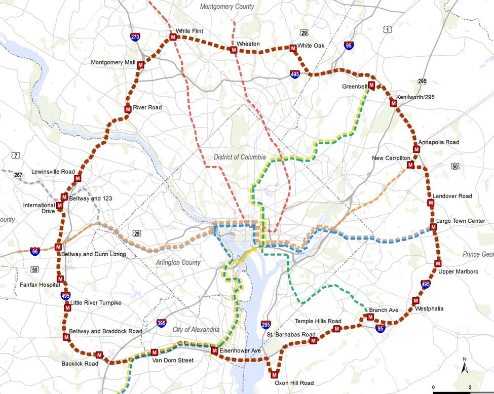
Alignment of a Beltway Line that was tested in the RTSP
Let us know what you think!


")

Recent Comments