
A Half-Mile Walk to the Nearest Metrorail Station, Mapped
August 4th, 2014
21 comments
Here’s a map showing the walkable area around the nearest Metrorail station.
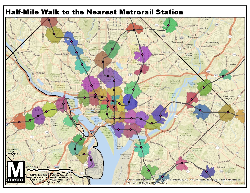
Did you ever wonder which Metrorail station is closest? Where’s the breakeven point between two stations? This map shows the areas you can actually reach within a half-mile walk along the roadway network, as we described previously. The twist this time is that I disallowed “overlap” within the GIS network analysis, so land is allotted to the closest station only, calculated by network walk distance.
What do you see in this map? Here’s a regional view with all stations, as well.
Update 9/2/2014: the GIS source file for this map is now available for download, in geodatabase (.gdb) format.

Recent Comments