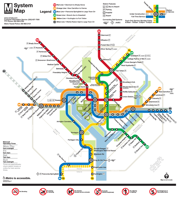
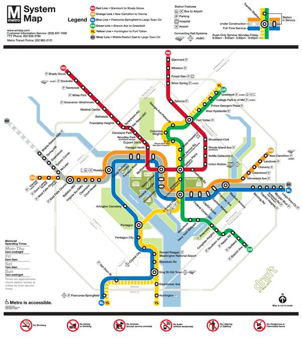
Final Draft Silver Line Metrorail Map for Review
We are down to the final two! Based on extensive customer feedback from the latest map revisions, we made some additional improvements to the map:
- Added the Metro Transit Police phone number;
- Made the rail lines 24% thinner;
- Added the Anacostia National Park;
- Included a note that the map is not to scale;
- Placed a darkened Silver Line between the Blue and Orange lines; and
- Lightened the Beltway and jurisdiction borders.
We are now down to selecting the icon to represent a three-line station. When we asked for feedback in the last round, some of you said that you didn’t like the idea of a completely new, third type of icon on the map (i.e., the capsule). Others said you liked the capsule, but it was too thin. It was recommended that we try to make the capsule the same width as the current station dot, but stretch it into an oval.
After reviewing your comments, Lance Wyman went back to his drawing board and came up with these two options:
- Map #1: Retains the current station dot with thin, white extenders
- Map #2: Stretches the current station dot into an oval
Take a look at these final versions and let us know which one you prefer. All comments welcome! Please provide feedback in the comments section below or on our MindMixer site. Thank you for your input.


Recent Comments