
Metro Studying Opportunities for Coordination of Regional LRT and Streetcar Systems
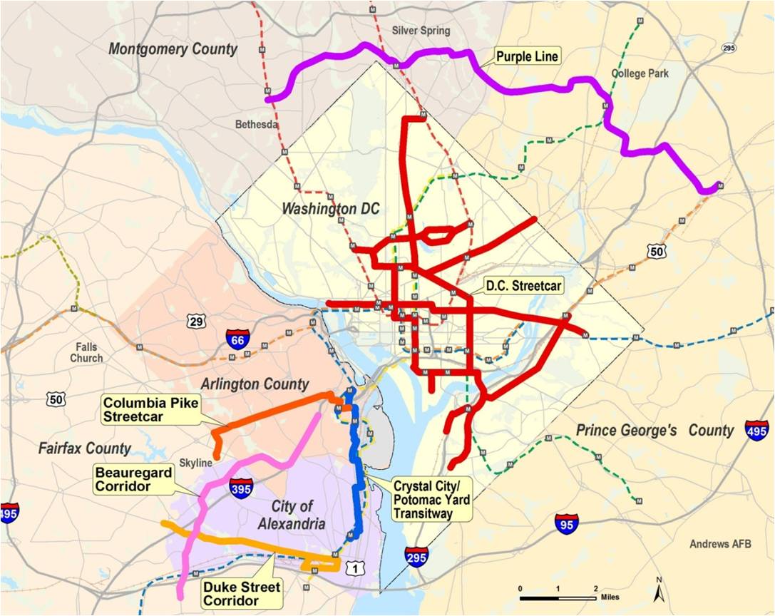
This map shows the corridors being studied by the region for potential light rail, streetcar, or bus rapid transit lines. Click the image for a larger version.
The Washington, DC metropolitan region may be the home of a light rail line and several streetcar lines in the near future according to regional plans. The state of Maryland is in the preliminary engineering phase of the Purple Line, a 16-mile light rail line that is proposed to run between Bethesda in Montgomery County to New Carrollton in Prince George’s County. The District of Columbia has almost completed construction of the H Street-Benning Road streetcar line, with scheduled revenue operation expected to begin later this year, and has also planned an expanded streetcar network. Meanwhile, Arlington and Fairfax Counties have submitted an application for federal Small Starts funding to begin project development for the Columbia Pike Streetcar line, running almost five miles from Pentagon City in Arlington to Bailey’s Crossroads in Fairfax County. Arlington County is also advancing planning for its Crystal City Streetcar project, which would run from Pentagon City, through Crystal City, to the southern Arlington County line in Potomac Yard. (The Crystal City Streetcar project can be considered a follow-up to the Crystal City Transitway project currently under construction.)
Recognizing that Metro isn’t the sponsor or funding agent for these LRT and streetcar systems, and that key decisions made early in the process on the Columbia Pike and H Street streetcar lines have the potential to affect other systems for years to come, Metro has been coordinating with the sponsors since 2010 through the LRT and Streetcar Interoperability Study. A briefing on this study was presented to the Metro Board in early 2011. Read more…

Recent Comments