Archive for September, 2013

How Do Metrorail Riders Get to Their Station in the Morning?
September 30th, 2013 3 comments

Peds_CrystalCityTwo-thirds of Metrorail riders take transit, walk, or bike to Metrorail for their morning commute.

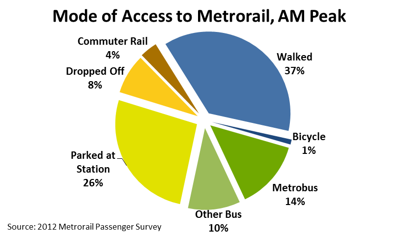
Every morning, thousands of people walk through the faregates and into Metrorail. Did you ever wonder how they get to their station? Our 2012 Metrorail Passenger Survey tells us the answer to this question, for the morning rush:

  • More than a third (38%) of Metrorail riders get to the station in the morning by walking or biking.
  • Another quarter arrive by bus – Metrobus, as well as other bus operators in the region.
  • Another third arrive by car – most by parking at or near the station, but some by getting dropped off.
  • Finally, about 4% of riders arrive via commuter rail – mostly at Union Station.

Of the 25,000 or so daily riders who access rail by “Other Bus,” the top three contributors are Fairfax Connector (6,700), Montgomery County’s RideOn (5,700), and private shuttles (4,900). Of those who parked at their station, one-third were driving from less three miles away. Carpooling to Metrorail is very low – we estimate average vehicle occupancy at 1.03 passengers per parked car.

Systemwide_Metrorail_AccessMode_May2012

The map below shows how the answer to “How Did They Get to the Station?” varies dramatically station to station. (For the sake of legibility on this map, I’ve simplified the access modes into 4 groups). Read more…

What Will the Travel Times Be on the Silver Line?

September 20th, 2013 26 comments

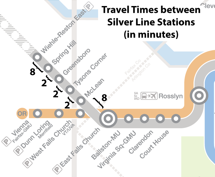
The stations on the new Silver Line are two minutes apart in the Tysons area, and the Tysons-area stations are eight minutes away from both East Falls Church and Wiehle-Reston East.

Silver-Line-Travel-Times

Draft travel times for the new Silver Line stations.

Earlier this year we published a series of posts about the region’s newest rail line, the Silver Line, due to begin service in early 2014. Those posts included answering the questions, “Where will it go?“, “What will happen to rail schedules?“, and “What will happen to bus schedules?“.

Now it’s time to talk about preliminary travel times between Silver Line stations. The map above illustrates the estimated travel times between the five new stations. These times are preliminary and may be refined after operational testing has been completed.

Below is a widget that can be used to look up the travel times between any two stations, including the five new Silver Line stations.*

Read more…

New routing proposed for Route 7Y in downtown DC

September 17th, 2013 7 comments

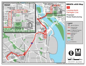
Metro is proposing to reroute the 7Y within the District of Columbia to serve the Foggy Bottom area as well as Farragut Square, McPherson Square, and Franklin Square.  This routing would provide a new, direct bus connection between Virginia and Washington’s downtown employment center as well as provide an additional travel option for current Blue Line riders between the Pentagon and downtown Washington, DC.  Under this proposal, the 7Y would follow its current route between Southern Towers and the US State Department (via the Pentagon) then to Franklin Square via 18th/19th Streets, and I/K Streets.

The map below illustrates the changes proposed. Please review and let us know what you think.  We will also be presenting these options at our upcoming public hearings.

Rt_7Y

Map illustrating change proposed for route 7Y. Click image for larger version.

Categories: Engage Tags:

Metro Unveils Final Silver Line Map

September 12th, 2013 24 comments

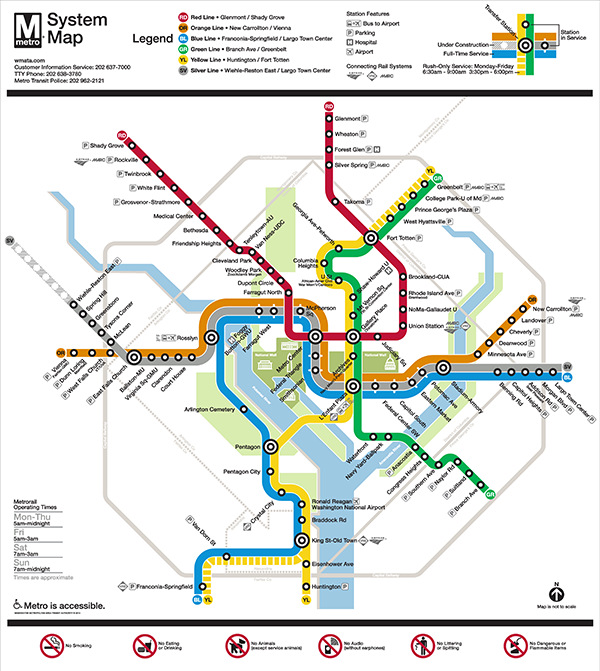
Metro is pleased to release the update to the Metrorail system map that shows phase one of the Silver Line in service and phase 2 under construction.

Final Map without addresses 07 13 600x671

Final Silver Line Phase 1 system map. Click for high resolution version.

Metro’s original system map designer, Lance Wyman, began working with Metro again a few years ago when we needed to update the system map to accommodate the “Rush-Plus” service plan.  Since then, the team has been working to incorporate the Silver Line onto the system map.  After several months and extensive customer feedback, Metro is pleased to release the updated map, above. Read more…

Categories: Engage Tags: , ,

Hunting Point bus routes – major service changes proposed (Routes 10A, 10B, 10E)

September 10th, 2013 11 comments

Routes 10A and 10E

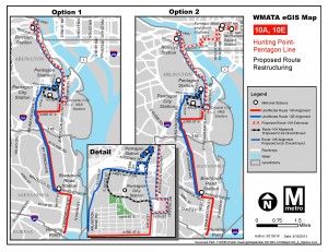
Metro is proposing to implement one of the following options in order to provide better connections for residents of Hunting Point and downtown Alexandria to Rosslyn and Downtown DC, reduce travel time to Rosslyn and improve service reliability, and relieve peak period crowding on the Blue Line (option 2 would also relieve peak period overcrowding on the Orange Line).

Option 1: Route 10E would terminate at the Pentagon and a re-routed 10A (renamed 10R.) would replace the peak period service to Rosslyn. The 10R would not serve the Pentagon and would continue to Rosslyn via 23rd Street, Eads Street, 18th Street, Crystal Drive to serve the Crystal City VRE Station, 15th Street, Jefferson Davis Highway, and Wilson Boulevard to Rosslyn station.

Option 2: Route 10E would terminate at the Pentagon.  An extension of the 10A peak period service (renamed 10Y) would provide service to Downtown DC via Rosslyn. The 10Y would not serve the Pentagon and would continue to Downtown DC via 23rd Street, Eads Street, 18th Street, Crystal Drive to serve the Crystal City VRE Station,  15th Street,  Jefferson Davis Highway, Wilson Boulevard, Rosslyn station, Lynn Street, Lee Highway/I-66, Roosevelt Bridge, E Street Expressway, 18th Northbound and 19th Street Southbound, and K Street to Farragut Square

Route 10B

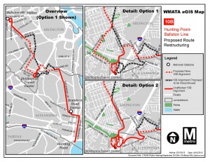
Currently, the 10B runs from Hunting Point to the Ballston-MU Metrorail station.  Metro is proposing to implement one of the following service change options:

Option 1: From South Glebe Road and Walter Reed Drive, rerouted Route 10B via Walter Reed Drive, Arlington Mill Drive, Randolph Street to Shirlington Transit Center, then continue via Quincy Street, Arlington Mill Drive, Shirlington Road, 24th Road South and South Glebe Road to the intersection of Mt. Vernon Avenue.

Option 2: Route 10B would be rerouted from Arna Valley (26th Road South, Adams Street, 26th Street South, 28th Street South, Meade Street) to operate via South Glebe Road between West Glebe Road and Mt. Vernon Avenue.

In both options the 10B will be rerouted from Walter Reed Drive and 2nd Street South to South Glebe Road between 2nd Street South and Walter Reed Drive.

The map below illustrates the changes proposed. Please review and let us know what you think.  We will also be presenting these options at our upcoming public hearings.

Rt_10A,E

Map of proposed changes to routes 10A and 10E. Click image for larger version.

Rt_10B

Map of proposed changes to Route 10B. Click image for larger version.


Categories: Engage Tags:

2013 Bicycle Parking Census at Metrorail Stations

September 9th, 2013 6 comments

Bicycles parked at racks at Metrorail stations inched up again this year, and Union Station is now Metro’s number-one station for bicycle access.

Union Station is now the busiest Metrorail station for bicycle access.

Union Station is now the busiest Metrorail station for bicycle access.

Using bike rack counts – one of two ways we gauge bike-to-rail access – bikes parked at Metrorail stations increased by 1% in the last year.  The number of bike racks increased 20% over the same time period. (The second measurement of bike access from theMetrorail Passenger Survey was published last week here).

Some highlights:

  • Overall bikes parked is up slightly above 2012.  However, we observed each station only once or twice, so it is difficult to discern long-term trends from short-term variation so far.
  • Union Station is now the single biggest station for bicycle access, not including bikes parked  inside the BikeStation there. We counted 130 bikes at that station, well beyond the capacity at racks.
  • Bike parking capacity is up 20% since 2012, including the College Park Bike & Ride. Metro now has space for over 5,000 bicycles at stations. We (and our partners) continue to add bike parking capacity to stay on track to reach our goal of 7,000 bicyclists by 2020.
  • Bike use increased at several major stations such as East Falls Church, Vienna, Greenbelt, and NoMa, but decreased at other stations such as King Street, Braddock Road, and Franconia-Springfield.
  • Bicycle numbers remained about even at several perennial heavy-hitters like Medical Center, Takoma, Grosvenor, and Columbia Heights.
2011 2012 2013 2011-12 Change 2012-13 Change
Parked Bicycles 2,196 2,271 2,285 3% 1%
Bike Rack Capacity 3,544 4,239 5,136 20% 21%

Read more…

Categories: Planning Studies Tags: ,

Major service change proposed for Route 4A

September 9th, 2013 2 comments

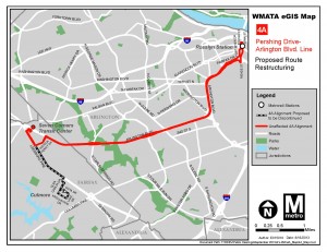
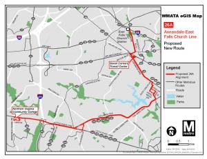
Earlier this year Metro completed a comprehensive service evaluation study of Routes 4A, 4B, 4E, 4H.  Metro is proposing to implement one of the changes recommended in this study.  Currently, Route 4A runs from Culmore to the Rosslyn Metrorail station. Under the proposed service change, the Culmore to Seven Corners segment of this route would be eliminated and replaced by a new Route 26A.  The proposed 26A would serve Northern Virginia Community College (Annandale campus), Annandale, Culmore, Seven Corners Transit Center, and East Falls Church Metrorail station.

The maps below illustrates the changes proposed. Please review and let us know what you think.  We will also be presenting these options at our upcoming public hearings.

Rt_4A

Map showing proposed change of 4A route. Click image for larger version.

Rt_26A

Map showing proposed 26A route. Click image for larger version.


Categories: Engage Tags:

Silver Spring Capacity Analysis Study Under Way

September 6th, 2013 Comments off

Metro is addresses crowding, integration of Purple Line in new Silver Spring Capacity Analysis.

Metro staff have recently kicked off a capacity analysis of the Silver Spring station. The purpose of this study is to evaluate how well the station is functioning currently in terms of access and egress, vertical circulation, and faregate crowding. The study is also looking at how to accommodate growth in demand due to the opening of the Purple Line as well as increasing job and household density in Silver Spring and the region between now and 2030.

queuing heat map

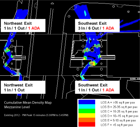
The current conditions assessment is nearly complete, and shows that the station is performing well under normal conditions.  The graphic above is a cumulative mean density map, illustrating the average amount of “elbow room” each passenger has during the peak 15 minutes.  It shows that the current configuration of faregates at the two mezzanines (north is to the upper left corner) is adequate to service PM peak period demand, with only a little crowding (orange) near some faregates.

This post focuses on the PM peak period because Silver Spring has more station exits in the PM peak than the AM peak:  exiting passengers all disembark the train at the same time, which can cause queues to form at escalators and faregates.  Passengers entering the station, however, tend to trickle in and don’t put as much of a strain on station facilities.   These passengers can crowd the platform waiting areas, which will also be evaluated under this study.

Read more…

Improving bus service on the 30s line (Routes 31, 32, 34, and 36)

September 5th, 2013 30 comments

The bus routes along Wisconsin and Pennsylvania Avenues are some of the busiest in the Metrobus system.  However these routes suffer from overcrowding and poor on-time performance.  In order to improve the frequency and reliability of service, Metro is exploring significant changes to routes 31, 32, 34, and 36.

These changes would include:

  • Adding service on Route 32 from Southern Avenue and Route 36 from Naylor Road and terminating both routes at Foggy Bottom.
  • Adding service on Route 31 from Friendship Heights and moving its terminus from Potomac Park to Archives.
  • Discontinuing service on Route 34 and moving its resources to Routes 32 and 36.
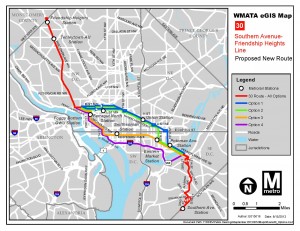
  • Creating a new Route 30 that would run between Southern Avenue and Friendship Heights.  Four different routes being considered this new line:
  • Option 1: Same as Route 32 between Southern Avenue and Potomac Avenue Station SE, then west to Georgetown via Lincoln Park, Union Station, and Thomas Circle, and then follow Route 31 between Georgetown and Friendship Heights.
  • Option 2: Same as Route 32 between Southern Avenue and Eastern Market, then west to Georgetown via 8th Street, Massachusetts Avenue, Union Station, and Thomas Circle, and then follow Route 31between Georgetown and Friendship Heights.
  • Option 3: Same as Route 32 between Southern Avenue and Independence Ave & 7th St SW, then west to Foggy Bottom via Independence Ave, 17th St SW, Virginia Ave, and Washington Circle, and then follow Route 31to Friendship Heights.
  • Option 4: Same as Route 32 between Southern Avenue and Anacostia Freeway (295) SE, then west to Foggy Bottom via Anacostia Freeway, Southeast/Southwest Freeway, Maine Avenue, 17th St SW, Virginia Ave, and Washington Circle, and then follow Route 31 to Friendship Heights.

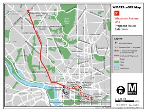
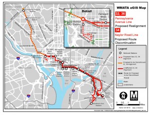
The maps below illustrates the changes proposed. Please review and let us know what you think.  We will also be presenting these options at our upcoming public hearings.

Rt_31

Map illustrating proposed changes to Route 31. Click image for larger version.

Rts_32,34,36

Map illustrating proposed changes for routes 32, 36 and 34. Click image for larger version.

Rt_30

Map illustrating options for proposed Route 30. Click image for larger version.


Categories: Engage Tags:

Metro’s Two Flavors of Parking

September 4th, 2013 4 comments

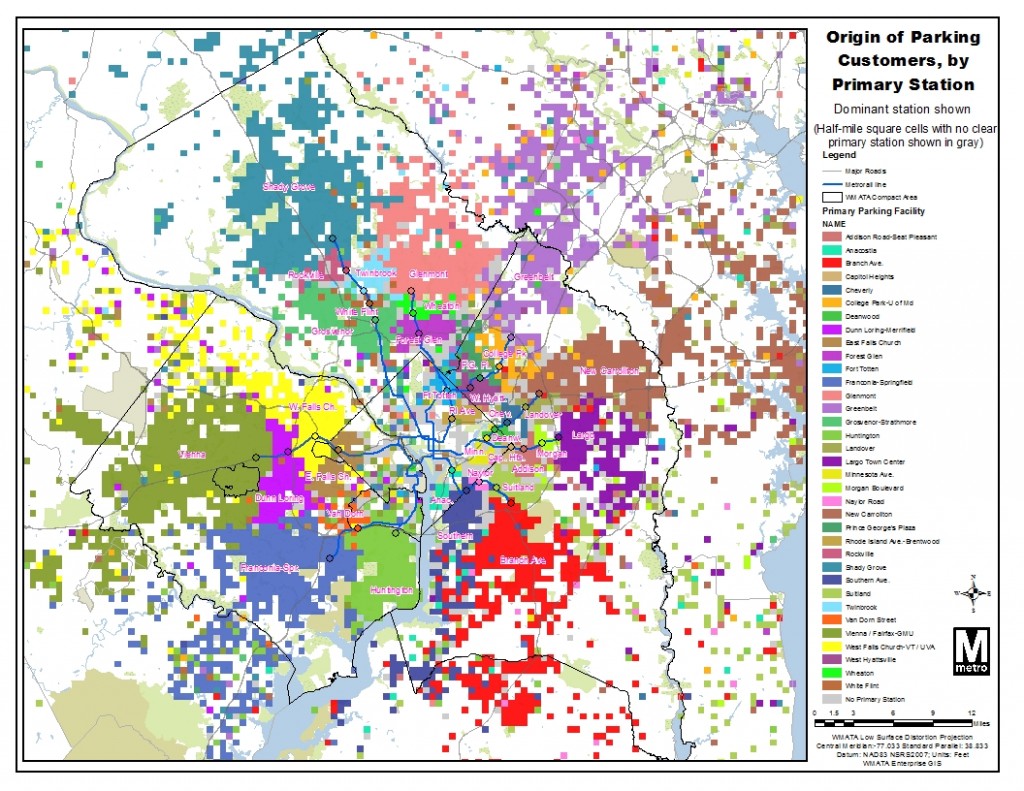
A handful of end-of-line stations’ parking facilities are doing the lion’s share of extending the reach of Metro across the region, while parking at most other stations primarily serves nearby residents.

Parking at rail stations is traditionally thought to extend the geographic reach of transit in the region, by giving longer-distance commuters a way to access a rail station. Based on an analysis of Metro parking customers’ origins, a handful of large end-of-line Metro parking facilities perform this function, but most Metrorail parking facilities do not. Nine Metrorail stations are capturing 70 percent of all customers who drive from more than three miles to park-and-ride, while the 26 other Metro parking facilities primarily serve the surrounding neighborhoods.

Our map of parking customers’ origins showed how far Metro’s reach extends across the region.  Now, this map shows the dominant station among Park & Ride customers, by half square-mile, for a typical weekday:

Map of dominant station of Park & Ride customers, highlighting each station's "catchment area"

Map of dominant station of Park & Ride customers, highlighting each station’s “catchment area.”

Areas where there is no clear primary station are shaded gray: for example, the dividing line between Southern Ave. and Branch Ave. stations. The dominant station is shown, regardless of how many Park & Ride customers there are for a square. There is some noise in this data, but two “flavors” of parking emerge: Read more…