Metro is addresses crowding, integration of Purple Line in new Silver Spring Capacity Analysis.
Metro staff have recently kicked off a capacity analysis of the Silver Spring station. The purpose of this study is to evaluate how well the station is functioning currently in terms of access and egress, vertical circulation, and faregate crowding. The study is also looking at how to accommodate growth in demand due to the opening of the Purple Line as well as increasing job and household density in Silver Spring and the region between now and 2030.
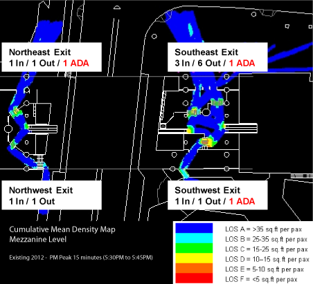
The current conditions assessment is nearly complete, and shows that the station is performing well under normal conditions. The graphic above is a cumulative mean density map, illustrating the average amount of “elbow room” each passenger has during the peak 15 minutes. It shows that the current configuration of faregates at the two mezzanines (north is to the upper left corner) is adequate to service PM peak period demand, with only a little crowding (orange) near some faregates.
This post focuses on the PM peak period because Silver Spring has more station exits in the PM peak than the AM peak: exiting passengers all disembark the train at the same time, which can cause queues to form at escalators and faregates. Passengers entering the station, however, tend to trickle in and don’t put as much of a strain on station facilities. These passengers can crowd the platform waiting areas, which will also be evaluated under this study.
Read more…
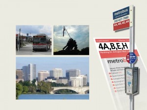 Metrobus in cooperation with Arlington County and Fairfax County recently completed a seven month long Service Evaluation Study (SES) for the Pershing Drive – Arlington Boulevard Line (Route 4A,B,E,H). The line serves Rosslyn, Arlington Boulevard and Pershing Drive, terminating at Seven Corners and Culmore.
The goals of the Service Evaluation Study are to:
1) Review the capacity, productivity, reliability, and quality of the service;
2) Identify the needs for facilities along the line and
3) Recommend changes to improve service delivery.
The study team reviewed existing operational and traffic conditions along the line, and then conducted a riders survey and a public outreach effort, using one focus group and two public meetings, to gain input from riders. After assessing all the available data and rider inputs, service recommendations were proposed for:
- Service Hours
- Frequency
- Reliability
- New Limited Stop Service
- Route Simplicity
- Bus Stop Distance and Amenities
- Traffic Operations
Read more…
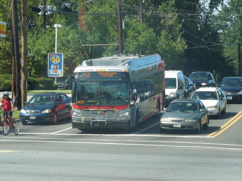 The Martin Luther King Jr. Highway Line (consisting of routes A11 and A12) is one of the busiest Metrobus lines in Prince George’s County. The line provides service from Capital Plaza to Addison Road Metro Rail Station via Landover Road and Martin Luther King Jr. Highway. On an average weekday, this route has nearly 3,000 riders. On-time performance (OTP) is generally good, averaging more than 80% for the past year.
Metro Bus Planning initiated a study of this line in June 2013, looking to improve service and efficiency. Some of the issues identified so far include:
- Route directness and convenience
- Low frequency of service during peak periods on weekdays and on weekends
- Peak period traffic congestion problems along sections of Landover Road and Martin Luther King Jr Highway
- Survey indicated that riders require more late night and weekend services, more frequency and better reliability
- Too many bus stops too close together
- Missing bus stop amenities
Metro will also host a public meeting to discuss the findings as well as the preliminary service improvement proposals.
The meeting will be open house style so you can drop by anytime. Metro Planners and project staff will be on hand to speak one-on-one with participants and get feedback about potential options for service improvement. Please also give us your comments below and/or complete the survey available online. For further information, check metrobus-studies.com. Read more…
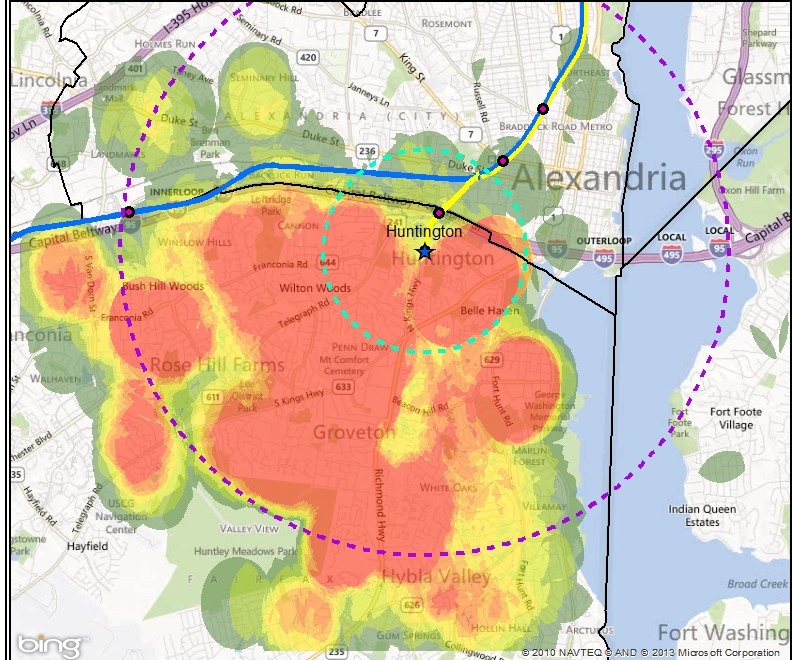
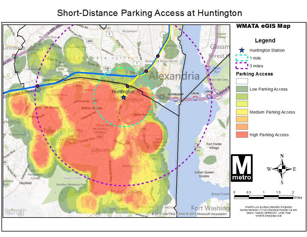
Heat map showing parking access within 1 mile and 3 miles at Huntington station, which may indicate good opportunities for pedestrian and bicycle improvements (click for full map)
We continue to explore barriers to pedestrian and bicycle access to Metrorail stations with a look at Huntington station. Previous posts in this series explored Forest Glen and Southern Avenue stations. All stations profiled share similar characteristics in that they have a high percentage of short-distance (less than three miles) parking access, and low bicycle use. By looking at street layout, customer distribution and gathering your comments we are working to better understand barriers facing pedestrians and bicyclists and improve safety.
The map on the right (full version) shows auto access “hotspots” for Huntington station. Huntington is located in Alexandria Virginia less than a mile south of interstate 495, the Capital Beltway.
The station serves as a park and ride option for commuters from south of the DC metropolitan area as it is the last station on the southern end of the Yellow Line and is easily accessible from the interstate. Still, roughly half of the 3,600 daily parking customers originate from the many residential areas within three miles of the station.
Short distance parking customers almost exclusively originate from south and west of the station. The Potomac River, Capital Beltway, and proximity to Eisenhower Ave, Kings Street, and Braddock Road stations also along the Yellow Line seem to influence this. Read more…
Metro Bus Planning is studying the Hunting Point Lines in Virginia. The lines under study include:
- 10 A,E – Hunting Point to Pentagon Line
- 10B – Hunting Point to Ballston Line
The Hunting Point Lines are one of the busiest services operating in Virginia and ridership has been growing steadily over the past five years. On an average weekday, over 5,000 people ride the Hunting Point Lines; the Saturday average is over 3,000 with 1,800 on Sunday. On-time performance (OTP) is generally good, averaging about 80% for June 2013. The lines meet Metro’s ridership and productivity thresholds.
Some of the issues identified in the existing conditions report include:
- Route directness and convenience
- On-time performance for the 10B on Saturday afternoons
- Traffic congestion problems at Mount Vernon Avenue on Saturdays
- Survey indicated that the main issues for riders are service frequency and reliability
- Too many bus stops too close together
- Missing bus stop amenities
Read more…
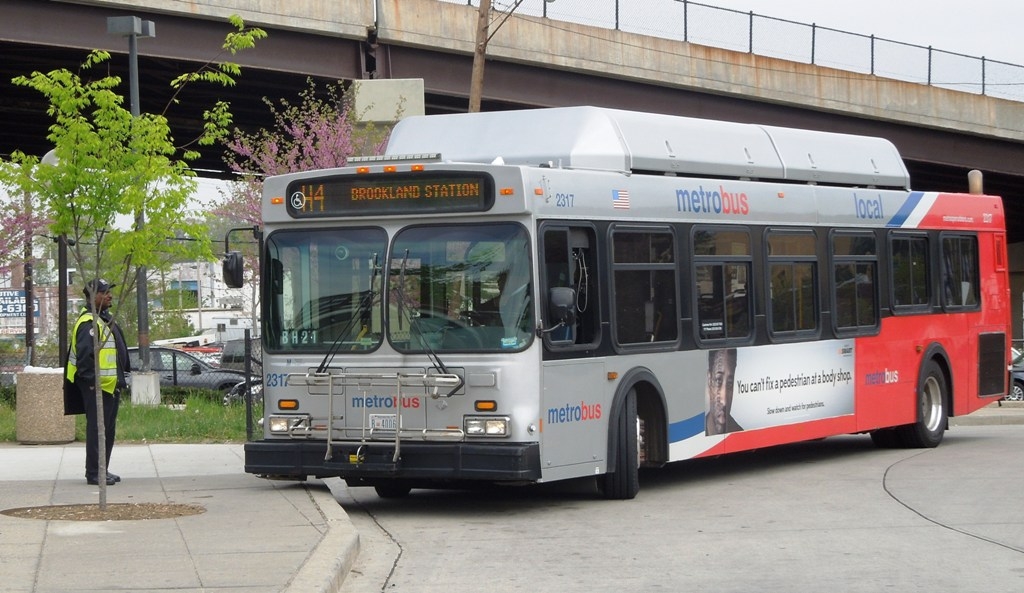
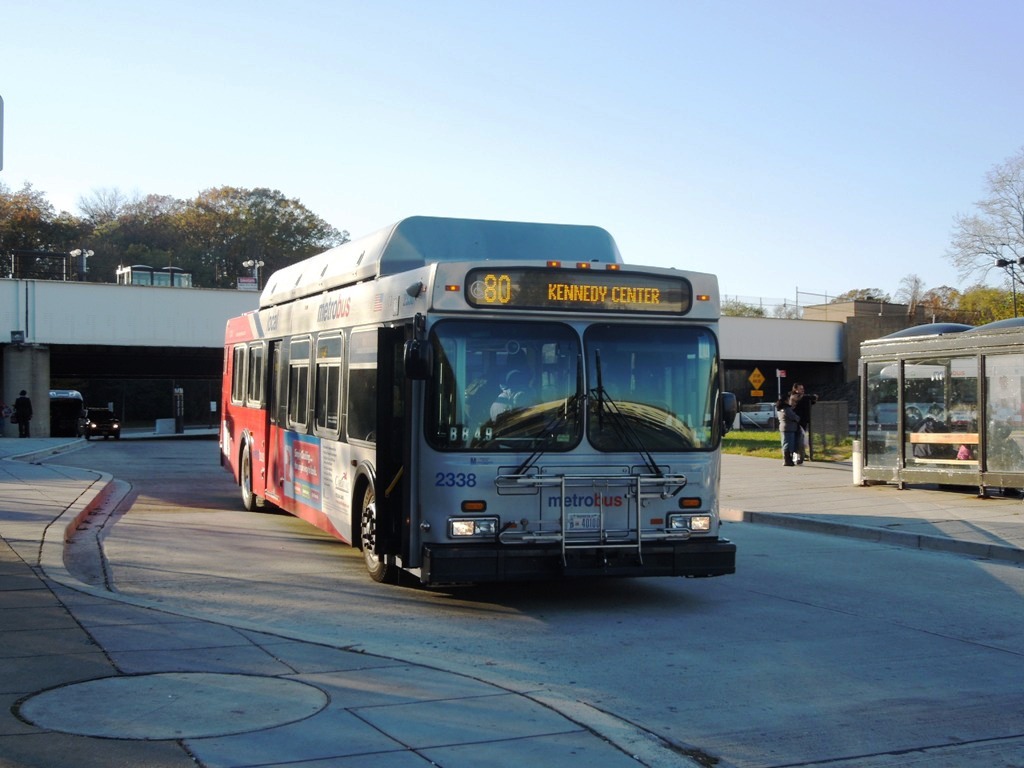
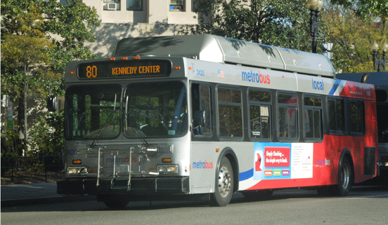 Metrobus planning staff recently hosted the final public meeting on Metrobus Route 80, the “North Capitol Street Line.” The purpose of this meeting was to share with the public a summary of the issues experienced by Route 80 riders and discuss possible recommendations for restructuring service, stops and route alignments to help alleviate crowding, reduce delay and increase service frequency.
The presentation boards are available for download. (PDF, 15MB) The key issues and a summary of preliminary recommendations are listed below. Read more…

Sample Bluetooth Sensor
Metro, in conjunction with Traffax, Inc., recently hosted a Bluetooth traffic monitoring test at Fort Totten station. Bluetooth technology has been used for years now, for monitoring vehicular traffic. Specifically, it has been used to provide travel time and origin-destination data, mostly in vehicular settings. Some pedestrian monitoring has been tested as well.
For Metro’s recent pilot, Bluetooth traffic monitoring was used to study pedestrian movements within a multi-level environment. The hope was that the Bluetooth data captured could tell stories about pedestrian flow within the station (including vertical movement), the train dwell times, train volumes, and the transfer rate between the Yellow/Green and Red lines. The latter is an area that WMATA is most interested in, since it is difficult to predict how people will ride Metro when given options. In this case, do people prefer transferring between Red and Yellow/Green at Fort Totten or at Gallery Place? This kind of data would make it easier for WMATA’s planning staff to better serve its customers by understanding true crowding levels on trains at peak load points.
It was estimated that 1 in 20 passengers’ movements would be captured in the pilot. The Bluetooth data sensors were placed in backpacks that Traffax employees were wearing. This initial data collection test will be used primarily to develop appropriate methods for analyzing such data, and to see what potential the data has for WMATA.
Please note that no personally identifiable information can be captured by detecting Bluetooth signals, which is the electronic equivalent of viewing license plates. Read more about privacy and Bluetooth on the Traffax website.
Stay tuned for more info!
Metro Bus Planning is studying the H lines in the District of Columbia including:
- Brookland-Potomac Park (H1),
- Crosstown Line (H2, H3, H4), and
- Park Road-Brookland Line (H8, H9).

This is an “emerging corridor”–a corridor which was not included in the original Priority Corridor Network studies–but one with heavy and growing ridership. On an average weekday, 10,000 people ride the H lines; the Sautrday average is 6,300 with 4,500 on Sunday. On-time performance overall for April, 2013 is close to 70%, well below Metro’s goal of 78%. All three lines do meet Metro’s ridership and productivity thresholds. Read more…
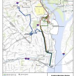
 The final public meeting for the study of Metrobus Route 80 (The North Capitol Street Line) will take place next week!
You’re invited to come see and comment on the draft recommendations for improvements. The study team hopes to submit the final recommendations to the Metro Board this summer for approval.
The meeting is open to the public and will take place on:
Wednesday, May 22, 2013
Anytime between 5:30 pm and 7:00 pm
St. Anthony’s School
12th & Lawrence Streets NE
Cafeteria entrance at 3400 12th Street NE, ground floor
Read more…


Recent Comments