Author Archive

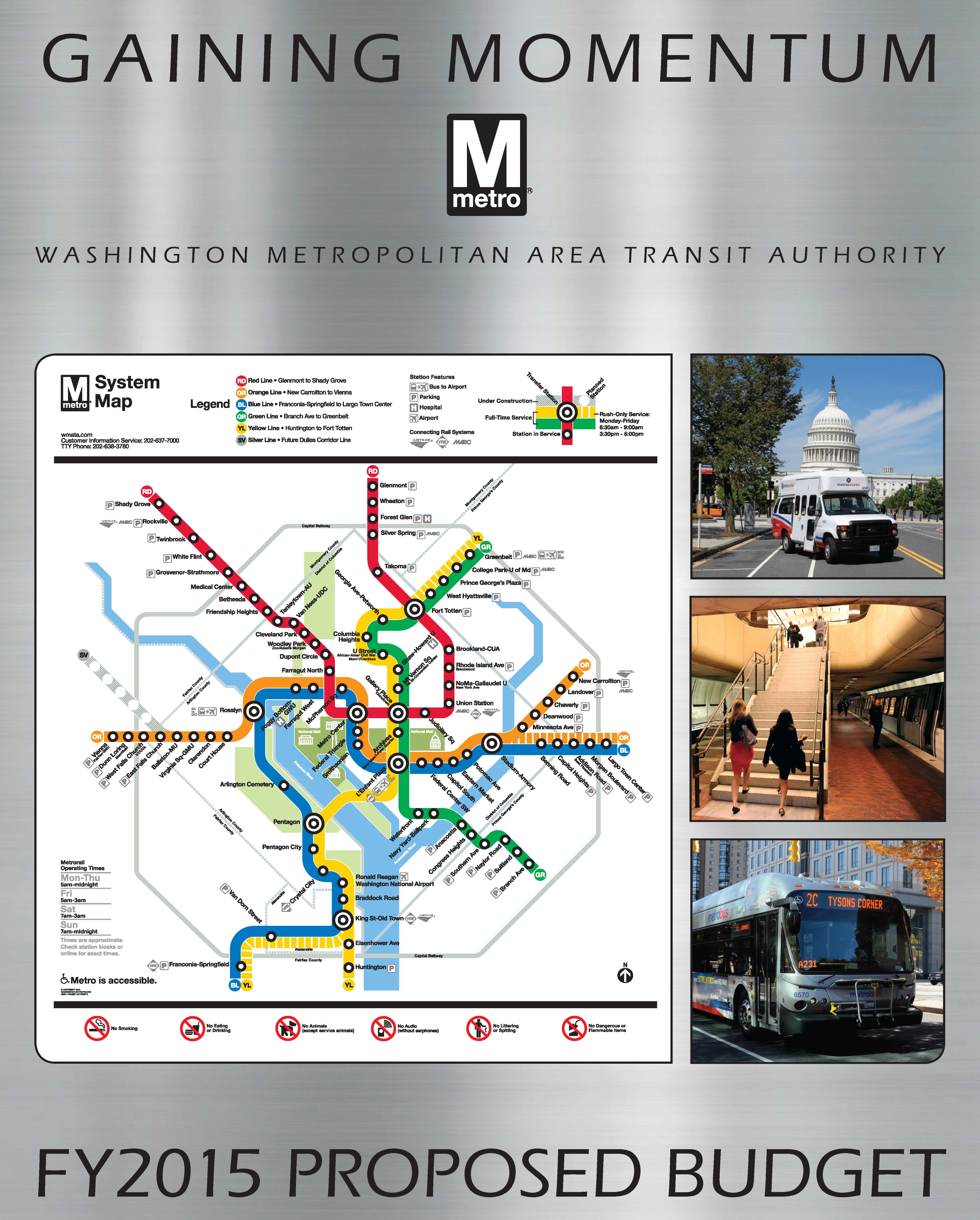
A Bus Named Desire – What We Heard at StreetsCamp 2015

July 9th, 2015 11 comments

In part 2 of the series, StreetsCamp participants had a number of ideas to make buses better – all buses, not just Metrobus.

A Bus Named Desire - Comments from Streetscamp
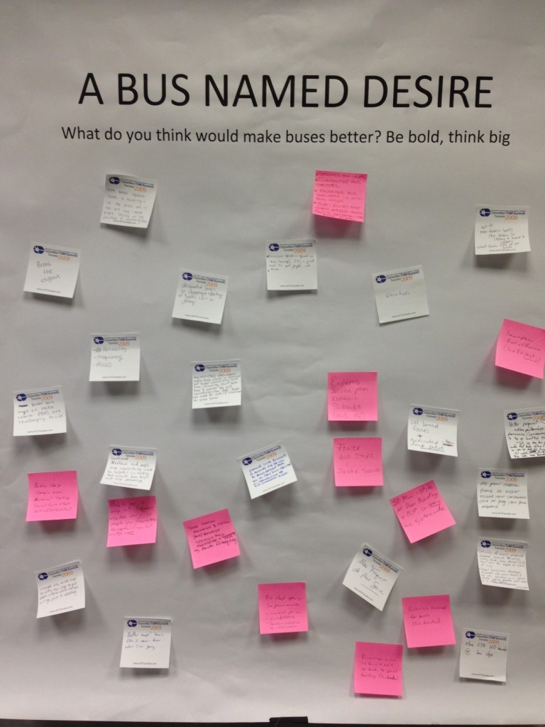
A Bus Named Desire was the question of the day at Metro Planning staff’s StreetsCamp session last Saturday. We asked what participants thought would make a better bus – from any perspective. What are the things that transit agencies and local jurisdictions could do speed up buses, increase the level of comfort for potential riders to ride the bus, change service, etc.

Here’s what we heard, grouped by topic:

Service

  • Bus lanes, bus lanes, bus lanes (WMATA note – there are some great corridors for these. Please also let your city/county know you think they are important. They own and operate the streets!)
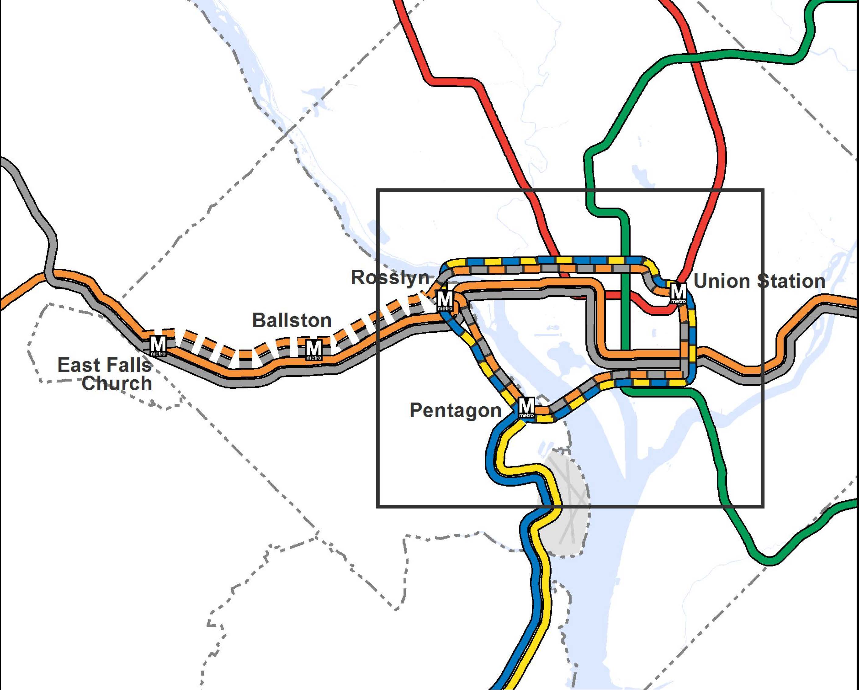
  • Bus routes that offer better connections to destinations far from Metro stations
  • Take station relocation and system redesign seriously. Build partnerships with community organizations. (WMATA note – both a regional approach, as well as line by line, are underway!)
  • Consolidate stops on every line to save time and money. Buses don’t need to stop every block.
  • More frequent off-peak service
  • Add express service from Maryland suburbs

Read more…

Transit Today, Tomorrow, and Beyond: There’s More to It Than Metrorail

July 6th, 2015 1 comment

In part one of this series, Metro Planners led a session at StreetsCamp  Saturday June 20, 2015 to talk with transit advocates about other possibilities beyond Metrorail to increase transit use, reach, and access.

I want Metro to...

Politicians and citizens always ask for more Metrorail, but why should transit continue to chase land use decisions? Metro Planners Allison Davis and Kristin Haldeman talked to transit advocates and urbanists at StreetsCamp last Saturday to provide approaches that can help the transit we have today reach more people and be more cost-effective without requiring more Metrorail (pdf). The major take-aways for advocates and urbanists were to advocate for:

(1)    Local decision makers to monetize full life‐cycle cost of land use options;

(2)    Access projects that create comfortable (i.e. desirable) paths for pedestrians and bicyclists; and

(3)    Local jurisdictions to add transit signal priority, queue jumps, and bus lanes

Why these three specifically? Read more…

Metrorail: A Long-Term Solution

April 20th, 2015 12 comments

Metrorail has had a huge impact on the region, but as we’ve seen with the Silver Line, it can take decades to get from concept to execution.

One of the questions I hear most often as a planner for Metro is When will a Metro station open in xyz neighborhood, “in Georgetown”, or “at BWI”? It was the first question at the March Citizens Association of Georgetown meeting. My response — “Decades” — often elicits audible groans.

Given last summer’s opening of the Silver Line, we have a case study that can provide insight on how long it takes to plan, fund, and construct large infrastructure projects. The Dulles Corridor Metrorail Project has done a phenomenal job of maintaining a project timeline. Since the region has many recent newcomers, it is helpful to revisit many of the key milestones, as shown below. It is also helpful to remind readers that the Metropolitan Washington Airports Authority (MWAA) was the ultimate developer of the Silver Line (both Phases I and II) and that the project “only” required cooperation among the Commonwealth of Virginia, MWAA, Metro, the federal government, and Fairfax and Loudoun Counties. While just one example, the Silver Line’s long story is not vastly different from other mega-projects happening in the region and across the country.

Timeline for Planning, Environmental Process, Legal and Financing, and Constructing the Silver Line

Read more…

How Do Different Modes Compare?

May 14th, 2014 6 comments

The region either already has or is planning for a variety of different modes. How do they compare? The Silver Line will soon open as a Metrorail line. Later this year, a streetcar will be operating on H Street, NE with others planned for Columbia Pike in Arlington and the District. Arlington and Alexandria are jointly building a bus rapid transit (BRT) line between Crystal City and Potomac Yard. Once funding is finalized, Maryland will build the Purple Line and light rail transit (LRT) will connect New Carrollton and Bethesda. This is all in addition to the region’s existing commuter rail, commuter bus, Metrorail, Metrobus, and MetroExtra services. The region is not only expanding transit services, but it also expanding the types of transit modes that will operate. At long last, instead of talking about Portland (streetcar), Jersey City (light rail), or Cleveland (bus rapid transit), we’ll be able to point directly to services and infrastructure in our backyard or take a trip and experience the pros and cons of these modes for ourselves.

So how do the different modes compare? What kind of purposes does each serve? There are many external factors and trade-offs that influence how agencies and jurisdictions select which mode to implement.  As we see from the ongoing debates in jurisdictions across the region between LRT and BRT or streetcar and enhanced bus, there is not always one perfect choice. However, an array of transit and land use measures can provide context to the conversation. As part of ConnectGreaterWashington: The 2040 Regional Transit System Plan, we developed the below table to compare commuter rail, commuter bus, heavy rail, light rail, streetcar, bus rapid transit, and enhanced bus across land use intensity (households and employment), vehicle capacity, stop spacing, trip length, and capital and operating costs.

What do you think? Does this information better inform the rail vs bus debate? What other information would provide more clarity on what modes work where?

Comparison of High-Capacity Transit Modes

Comparison of High-Capacity Transit Modes


FY2015 Budget and Beyond

January 7th, 2014 1 comment

We want to hear from you! Interested Image for MM - Proposed Fiscal Year 2015 Annual Budgetin the FY2015 budget? Answer our survey or participate in an upcoming public meeting. Want to talk more long-term strategy? Connect on MindMixer.

We are seeking feedback from riders and offering multiple ways to comment on the proposed FY2015 budget and fare changes, as well as Metro’s Capital Improvement Program. You can participate in any or all of the following:

  • Survey: The survey includes questions about the fare changes, costs, and the benefits you will see going forward. The survey is open until 5 p.m. on February 11, 2014.
  • Public Hearings: The six public hearings will provide an opportunity for riders to give formal testimony on the docket of proposed budget actions.

Looking to get into the weeds and talk about some long(er)-term opportunities? We have started a new discussion on MindMixer to gather your ideas and thoughts about priorities and potential future changes to the balance of funding between riders and local government, continuing to allow fares to be paid in cash on Metrobus, parking, new fare options, and priorities for a down payment on Metro2025 initiatives.

Read more…

Tokyo Metro Signage – You Can Find Your Way Without Reading Japanese

January 6th, 2014 2 comments

Ten years ago I moved to Tokyo for work. Unfortunately, my Japanese language skills were non-existent, so I spent much of those early months perpetually lost on Tokyo’s streets. But underground it was a different story. If you’ve ever been, you know that many of the central Tokyo stations are massive – multiple exits, mezzanines, pedestrian tunnels, and tons and tons of people. However, Tokyo Metro, the JR East Lines and the private rail lines that together create the city’s rail network have a good wayfinding system provided in Japanese and English that make it fairly easy to get around underground.

Which car should I stand in?

Which car should you use?

Read more…

Why isn’t Metro looking at a line to [insert address here]?

December 20th, 2013 10 comments

[Editor’s note: this will be our last post of 2013.  We look forward to seeing you again in early January.]

You name it and we tested it as part of our analysis and development of the Regional Transit System Plan (RTSP). Here’s the comprehensive list of what was analyzed.

List of Transit Corridors, Projects, and Plans Analyzed as Part of RTSP

List of Transit Corridors, Projects, and Plans Analyzed as Part of RTSP

We have received tons of great comments on the proposed 2040 network of Metrorail and high capacity surface transit corridors. Many of you have said that we missed <insert corridor here> or have asked why we don’t have a line to <insert address here>. As part of this plan, we have analyzed almost every corridor or mode that you have identified. However, we recognize that most of it was behind the scenes and is buried deep in our posted presentations to the Technical Advisory Group (TAG).

Above is a list of what was analyzed before we unveiled the proposed 2040 Metrorail Network and regionally significant high capacity corridors. Better yet, here is a document that shows the Metrorail lines and other surface transit plans, projects, and strategies that were tested over the course of the project. Everything is listed and where possible, maps and graphics are provided to illustrate what was tested. All tested items were measured against a comprehensive set of measures of effectiveness (MOE). The MOEs assessed ridership, impact on core capacity, transfers, reduction in vehicle miles traveled (VMT), mode share, etc.

To wet your whistle, below, check out the Beltway Line that was tested. Only the segments that crossed the American Legion Bridge (between White Flint and Dunn Loring) and the Woodrow Wilson Bridge (between Branch Avenue and Eisenhower Avenue) had some promise and therefore, they continued on in the analysis, though as surface transit not Metrorail. The other segments did not provide good ridership, primarily due to the low densities within a walkable distance from the Beltway, and had little impact on Metrorail core capacity.

Alignment of a Beltway Line that was tested in the RTSP

Alignment of a Beltway Line that was tested in the RTSP

Let us know what you think!

More than Metrorail: The Region’s Most Important High-Capacity Surface Transit Corridors

December 19th, 2013 14 comments

In parallel with the proposed 2040 Metrorail network, we have identified 25 regionally significant corridors that merit high-capacity surface transit by 2040. Depending on the corridor, high-capacity surface transit can be provided more efficiently and effectively by modes other than Metrorail.

The best transit systems in the world are comprised of large networks served by multiple modes. In the National Capital Region, due to the growth and dispersal of activity centers, the high demand placed on Metrorail, and the realities of transit funding, expanding the transit network needs to occur by expanding transit on the region’s roads and highways not just by Metrorail. Metrorail is not and cannot be the best mode for every corridor because the vast majority of corridors do not have the land use, density and ridership to support it.

But don’t despair! There are plenty of other high-capacity modes such as bus rapid transit (BRT), light rail (LRT), streetcar, and enhanced bus that can provide:

  • high-frequency;
  • all day service;
  • large, comfortable vehicles; and
  • lower capital and operating costs than Metrorail.

Regionally Significant High Capacity Surface Transit Corridors as part of 2040 Regional Transit System Plan

Regionally Significant High-Capacity Surface Transit Corridors as part of 2040 Regional Transit System Plan

Read more…

Proposed 2040 Metrorail Network

December 5th, 2013 91 comments

Step right up and check out the proposed 2040 core Metrorail configuration with new Blue and Yellow Lines and a third line in Virginia!

Proposed 2040 Metrorail Core Configuration

Proposed 2040 Metrorail Core Configuration

Proposed 2040 Metrorail Network

Proposed 2040 Metrorail Network

What does this network do? The proposed rail network shown above is expected to reduce future crowding on Metrorail, provide enough capacity for future development, and expand the reach of transit in the region, especially to regional activity centers.

Why are we proposing it? This rail network is part of the 2040 Regional Transit System Plan (RTSP). Its purpose is to develop the rail and surface transit network for 2040 that meets the needs of the growing Washington DC region.

What else have we considered? About a month ago, we posted about some of the possible long-range changes to the Metrorail core that we are considering as part of the RTSP. We analyzed four different core configurations, gathered your comments, and the final configuration for the core is shown above. As many of you commented, it is a combination of two of the scenarios (Scenarios B and C).

Next Steps: The next and final step for the RTSP is to use this configuration, along with the high capacity surface corridors, to conduct a final round of analysis. The output will provide us with information on ridership, mode share, levels of crowding, transfers, etc. and ultimately a final network for 2040.

Let us know what you think!

A few extra notes:

(1) The Metrorail network shown in this post will be layered with an extensive high capacity surface transit network to expand transit and meet the needs of employment and population growth in the region.

(2) For the plan to have validity and acceptability across the region and within the federal planning process, it is based on the region’s adopted cooperative land use forecast for 2040. We used the Aspirations Land Use scenario to stress test the core of the system, but ultimately the plan needs to start with the region’s adopted land use. As follow on work to this plan, we will be testing different land uses to see what else we can learn to improve long-range plans.

(3) All of the lines shown, as well as all of the high capacity surface transit corridors, will need corridor studies, alternatives analyses, and full engineering studies. This cannot be done at a regional level, but would need to happen on a project by project, line by line level. So, while we are showing a new Blue Line on M Street, it very well could be on N or P Streets.

NPR Story on Arlington County’s Successes and Importance of Metro

October 25th, 2013 2 comments

NPR’s Morning Edition yesterday highlighted Arlington County‘s success in tackling commuting challenges, particularly as a result of the decision to bring Metrorail and transit-oriented development to the Rosslyn-Ballston corridor.  

When the Metrorail system was initially designed in the early 1960s, the plan proposed running the Orange Line in the median of what would ultimately become Interstate 66. Arlington County officials lobbied hard and put forward county funds to bring the Orange Line to its existing home, under Wilson Boulevard. They foresaw the benefits of high capacity transit IN the neighborhoods, as opposed to adjacent to the neighborhoods. They also set forth zoning, planning, and other policies to ensure that the county would maximize the benefits from that decision. The NPR story talks about the results of those decisions, the shift from a post-World War II auto-dependent suburb to a vibrant, mixed-use community that has become the gold standard for many cities across the world.

Orange Line - Proposed and Actual Alignments

Orange Line – Proposed and Actual Alignments

For more background on the history, growth, and experience with transit-oriented development in the corridor, check out this powerpoint from the Arlington County Department of Community Planning, Housing and Development. Not only does it provide additional information, it has some terrific before and after photos of the different Arlington neighborhoods and how they have changed. Parkington, anyone?

If you’d like to contribute to the NPR series, you can share your commuting experience with Morning Edition – #NPRcommute.

Yesterday’s NPR story was the first in a multi-part series on how communities are tackling commuting challenges.