
RTSP Analyzing New Metrorail Lines in the Core and Virginia: Dispatch from TAG Meeting #10
This is the first post in a two-part series based ![]() on content from the tenth meeting with the Regional Transit System Plan (RTSP) Technical Advisory Group (TAG) that was held in July. This post will focus on our analysis of Metrorail capacity and crowding, while the second post will focus on identifying and prioritizing regionally significant surface transit corridors.
on content from the tenth meeting with the Regional Transit System Plan (RTSP) Technical Advisory Group (TAG) that was held in July. This post will focus on our analysis of Metrorail capacity and crowding, while the second post will focus on identifying and prioritizing regionally significant surface transit corridors.
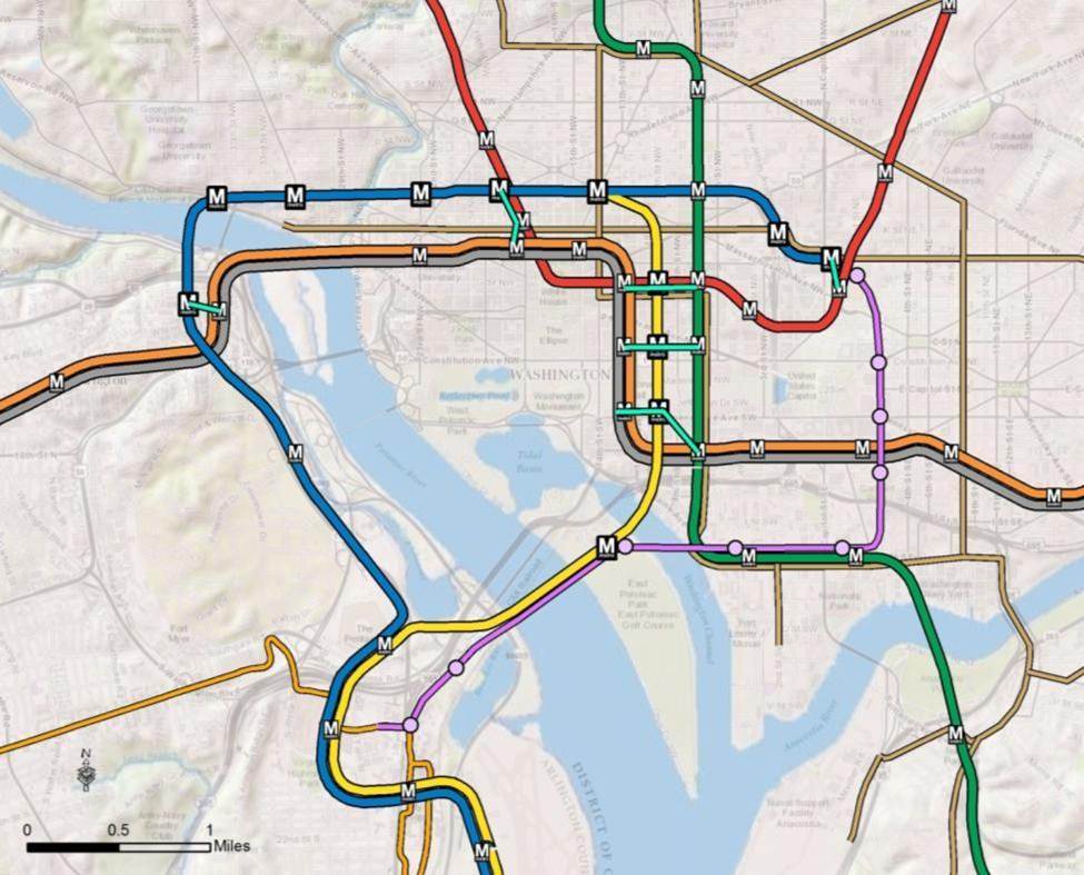
By 2040, ridership and crowding levels on Metrorail indicate the need for a new Blue Line and new Yellow line in the system’s core and a third line in Virginia.
At the time of our last post, we had run an initial round of four scenarios that sought to resolve regional mobility issues. We gathered a lot of information from the results, but realized that we needed to run a second round of scenarios focused almost entirely on Metrorail. Using MWCOG’s Cooperative Forecast Round 8.1 land use, which has been adopted by the region, and MWCOG’s Aspirations land use, which shifts more jobs and households into the regional activity centers, the maps below clearly demonstrate crowded conditions in 2040. The Base Network shown in these maps includes 100 percent eight-car trains and all the CLRP projects. Crowded conditions exist on the Orange Line west of Rosslyn, on the Yellow and Green Lines south of L’Enfant Plaza, and on the Silver Line west of Tysons. Because the results indicated that Metro would be severely crowded EVEN if we run the longest possible trains (eight-car trains), we wanted to explore other long-term solutions.

Crowding on Metrorail by 2040, even with the longest possible (eight-car) trains. Base Network AM Peak, Round 8.1 Cooperative Forecast
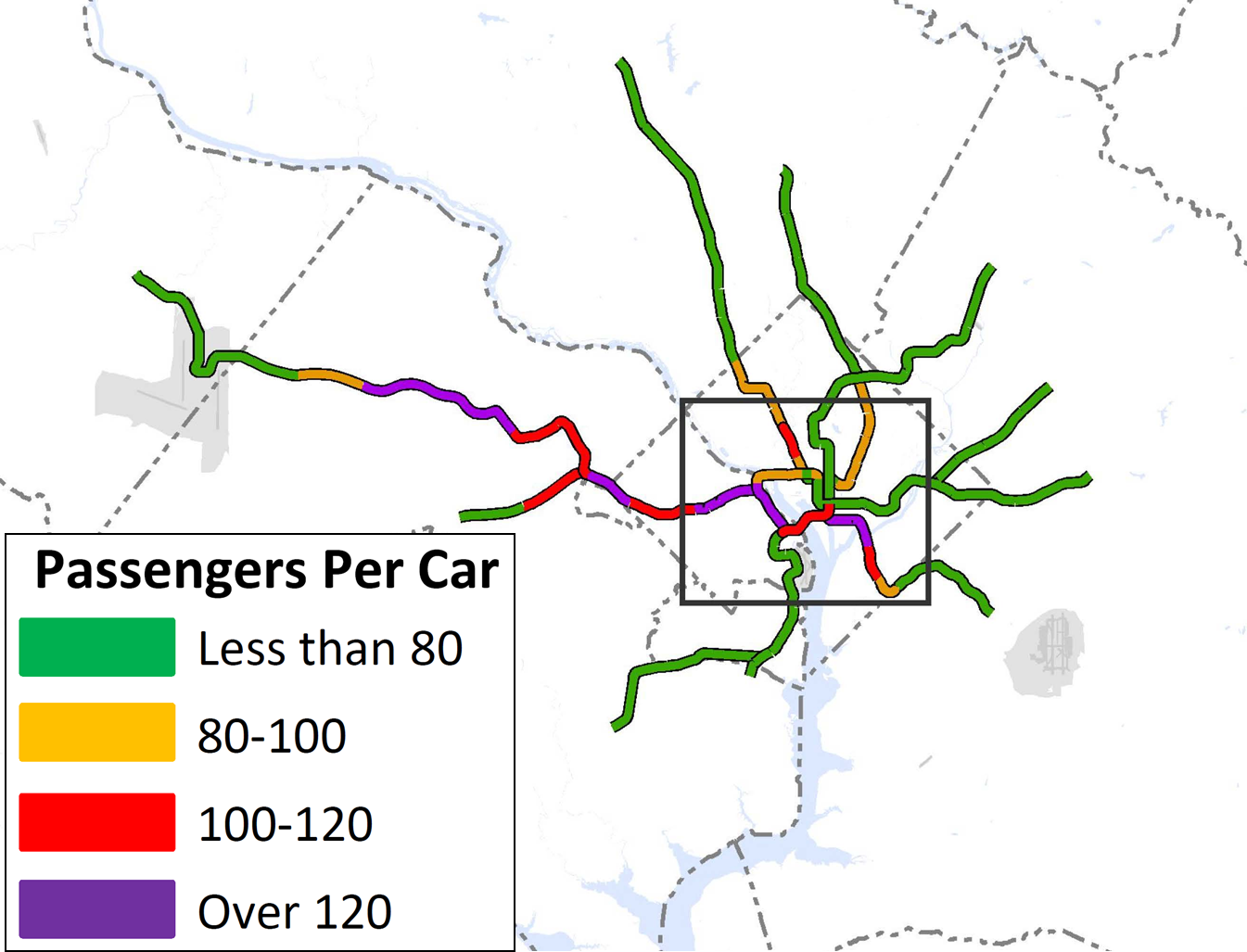
Crowding on Metrorail in 2040 even with the longest possible (eight-car) trains, Base Network AM Peak, Aspirations Land Use
Scenarios Tested
By keeping the surface transit network, such as light rail, streetcar, and bus rapid transit, essentially the same across the scenarios, we were able to vary the Metrorail network and fully understand the impacts of proposed improvements. The goals of the scenarios were to reduce crowding on Metrorail below adopted service standards, which is currently 100 passengers per car, as well as understand the impacts of adding Metrorail to currently underserved areas in the core and central jurisdictions of Washington, Arlington, and Alexandria. The four scenarios varied in degrees of geographic expansion and are shown below:
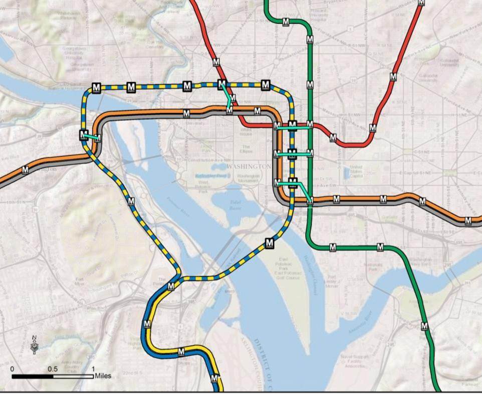
Scenario A:
New River crossing with separated Blue and Yellow lines remaining in existing core
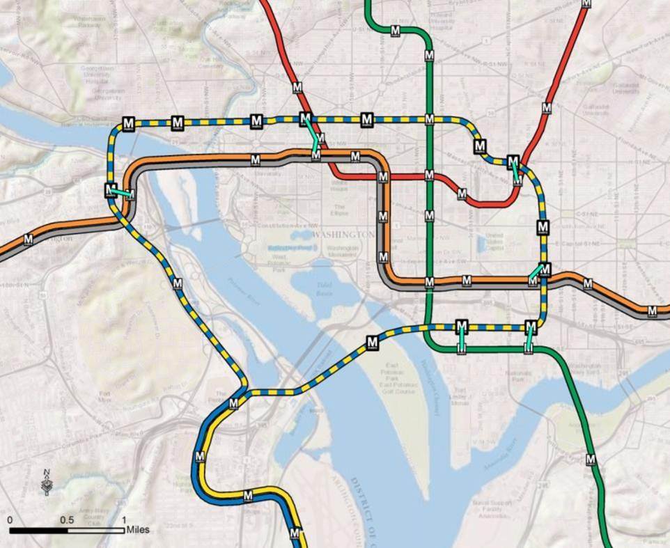
Scenario B:
New River crossing with separated Blue and Yellow lines connecting Southeast, Southwest, and Union Station
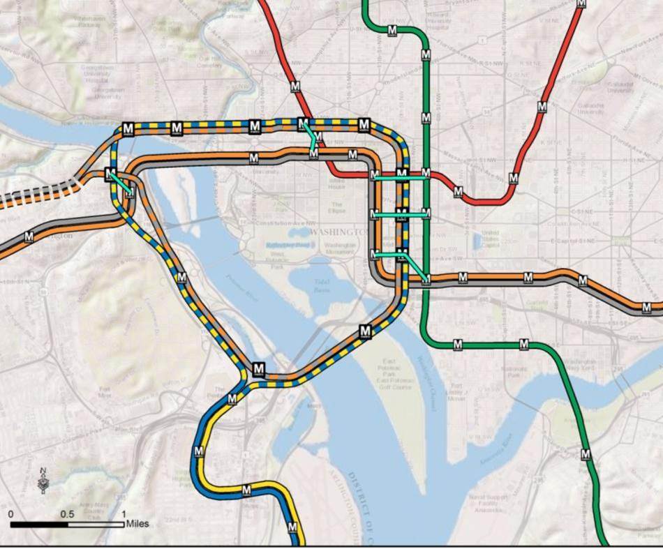
Scenario C:
New River crossing with Orange/Silver Express and separated Blue and Yellow lines remaining in existing core
Scenario D:
New River crossing with separated Blue Line to Union Station, separated Yellow Line in the existing core, and a Light Rail connection between Northern Virginia and Union Station through Southeast and Southwest
What Did We Learn?
The four scenarios modeled focused on addressing how best to increase transit capacity to the system core to meet projected future demand. The performance of each scenario was evaluated against a set of measures to determine the relative effectiveness of each compared to the base network.
- Only Scenario C provided enough new capacity to bring crowding below 100 passengers per car on all links of the network. While this is the lower end of our adopted service standards, it does enable future development beyond 2040, which is a long-term planning goal.
- Scenario B provided better connectivity to underserved areas such as the waterfront, Navy Yard, and Union Station.
- All scenarios showed that transfers at Metro Center, Gallery Place, and L’Enfant Plaza would be below projected 2040 numbers. Rosslyn, however, showed an increase in transfers due to the second Rosslyn station proposed in every scenario.
For more information on scenario descriptions, measured results, and key findings download meeting materials: TAG 10 Presentation.
What do you think? Do you have a preferred scenario? What would you like to see for a Metrorail network in 2040 that is both realistic and visionary?
Post 2 outlines our approach to developing an integrated network of high capacity transit on the region’s significant corridors.

While I can see that scenario C was the best that you presented, I still wonder if a more aggressive plan, such as extending the N-S ‘yellow’ portion of the expansion to NH Ave/White Oak (either 14th St. or 7th/GA Ave) or via U.S. 29 to White Oak or farther or possibly extending the E-W ‘blue’ portion along H street (merging with the existing Orange/Blue line after RFK or moving southeast to serve currently unserved corridors like PA Ave across the river) would enhance the additional infrastructure being proposed.
What is with all these bizarre loop configurations? They all represent a wasted opportunity. The best option looks like D – any new line that *doesn’t* connect to Union Station would be a travesty – but even then, why stop there? Why not open up H Street, Trinidad, other parts of NE DC to the Blue Line? Why not keep that separated Yellow Line running north to Brightwood, 16th St. Heights, etc.?
Glad to see that the M Street Subway is virtually a lock, but outside of that, you need to be thinking much bigger, even if you have to phase the plans.
Plan D is probably the most interesting and the most multimodal, though a lot of the extra lines on that map should be shown on the other options as well. What I like about it is that it doesn’t limit even more future additions from happening to both the blue and yellow lines. I like the Light rail/ streetcar addition from Crystal City to Union Station. Very cool connection.
One stop in Georgetown is plenty. I recommend the larger loop with express Silver line service (combo of options B & C). New connection to Union Station is a must. Why not try a broader loop, Georgetown > Dupont > U St > NoMa > H St.
All of these seem like the worst, or at least the least imaginative, possibilities WMATA could study to resolve long-term crowding/expansion issues in the core.
I completely agree that core crowding during peak hours is an issue. But it’s just not clear to me that the right way to model solutions to that problem is to look at a handful of scenarios that involve extremely high-costs (e.g., new tunnels) that serve nearly no new areas or activity centers.
In fact, my personal position is that a new M Street and/or 10th Street tunnel in downtown DC is probably the most money you could spend for the least actual transit benefit in the entire region. I’m not pursued that building new core tunnels should just be done to be a “relief value” of peak period capacity issues of the current system. New lines should serve new areas, add new transfer capabilities, or solve longstanding regional connection issues – not re-serve the already most transit-rich areas of the entire region.
Instead, I’d suggest that if our Metrorail system faces a peak period crowding problem in the medium- to long-term future, we could consider several ways to address the issue before digging new tunnels. For example:
1. Charge higher peak fares until, at peak, ridership stays below capacity.
2. Prioritize and build higher-quality street-running transit alternatives. I realize some of this is being considered and assumed here, but we should be bolder about new LRT or BRT lines before spending billions of dollars on metrorail tunnels.
3. Work with employers to encourage flexible work schedules to minimize peaks.
4. Buy future rolling stock with fewer seats and more standing capacity.
5. Automatic train operation + platform side doors for more reliable station dwell times and thus higher train frequencies.
6. Do the smaller, cheaper things first (new platforms at Rosslyn, new track connection near Pentagon, etc.) rather than whole new tunnels throughout the core.
Now, if after those 6 things we still have unreasonable peak period crowding issues – congratulations to us! That’s a tremendous transit market that needs more capacity. But even then I find it hard to imagine that the right capacity to add is billions of dollars for a new line + 12 or so new stations where all but 2 or 3 of those stations would be within 400 feet or so of existing Metro stations.
That just seems like the most inefficient way to add capacity in a region begging for better North/South connections in Virginia, non-core East/West connections across DC and Maryland, more transit East of the River in DC, and major under-served areas in NE DC, to name a few weaknesses of the current network.
@Bryan
Well, you can combine some of that, if you think bigger. Opening up even existing areas to more transit can’t be a bad thing, and if you tie that to say, running the blue line further east after Union Station, then you get the best of both worlds. It’s not a zero-sum game. And as the new tunnels are DECADES away, it would be easy to implement some of these in the meantime.
For LRT/BRT to actually work, it will take each jurisdiction setting aside actual dedicated transit lanes (among other things). Virginia prohibits this by law because it’s a crazy state. DDOT has talked about it but so far nothing. No idea with Maryland.
If you DON’T do that, you’re just building a really expensive bus.
I always though P St would be the ideal place to put a separated blue. Run it through Georgetown, connect in Dupont, new stop in Logan area, slightly stretched transfer in Shaw, possibly a new stop running on NJ Ave towards Mass Ave, connect to Union, continue on Mass all the way down and terminate at Stadium Armory where you could transfer to Orange and Silver I guess. Also at least in the long term let’s have an ambitious plan for yellow. Maybe an upper looper that will hit L’Enfant, express to Union under the Mall, straight up North Capital with a station every 3000′ or so transfer to Green Line with a new station somewhere near Rock Creek Cemetary and then bank a left and head straight to Van Ness or Friendship Heights.
As a DC resident, I find this sad. Metro’s long-term vision, as shown in this post, is about getting suburbanites into and out of the city at rush hour. Metro has no interest in providing additional service to DC residents. There’s no vision for additional service to H Street NE, a short subway ride from Union Station, and one of the fastest-growing areas of the district. There’s no vision for additional service to Ward 5, or any other affordable part of the city. These new rail lines will improve rush-hour service for Virginia commuters, and that’s about it. What do DC residents get, besides more cuts to buses?
Scenario B looks to me as the best base to build upon going forward. By itself, the blue/yellow “loop” on the edges of downtown is a stopgap, but it does spread the core of downtown in a way that should relieve pressure on the most congested links of the system (if not to the degree of Scenario C). What Scenario B does, though, is preserve the ability for the Blue and Yellow lines to be decoupled at Union Station in the future, extending the Blue Line east from there along H Street toward River Terrace and the Yellow Line up North Capitol Street toward the Hospital Center (and from there, up Georgia Avenue to Silver Spring and new points beyond). None of the other plans both relieve pressure downtown and open up new areas that are currently lacking in rail service. For those reasons, I find Scenario B to be far and away the best option.
Thanks for all the comments. Keep them coming!
There are a couple of things to keep in mind about this plan:
(1) The Metrorail network shown in this post will be layered with an extensive high capacity surface transit network shown in the second post that will expand transit and meet the needs of employment and population growth in the region.
(2) For the plan to have validity and acceptability across the region and within the federal planning process, it is based on the region’s adopted cooperative land use forecast for 2040. We used the Aspirations Land Use scenario to stress test the core of the system, but ultimately the plan needs to be based on the region’s adopted land use. As follow on work to this plan, we will be testing different land uses to see what else we can learn to improve long-range plans.
(3) All of the lines shown, as well as all of the surface transit corridors in the second post, will need corridor studies, alternatives analyses, and full engineering studies. This cannot be done at a regional level, but would need to happen on a project by project, line by line level. So, while we are showing a new Blue Line on M Street, it very well could be on N or P as commented on above.
Why not have a separate Blue line that goes to areas of DC that are not near a current Metrorail station instead of making stops that are at most 5 blocks from a current one.
Maybe a line that circles DC with stops at Pentagon, Navy Yard, Potomac Ave, Stadium Armory, New Station near Benning Road, New Station near Trinidad, New Station near Ft Lincoln, Rhode Island Ave or Brookland, New Station at Washington Hosp Center, New Station near Brightwood, New Station near Chevy Chase, Tenleytown, New Station near American University or Cathedral Heights, New Station near Glover Park, New Station in Georgetown, Rosslyn, Arlington Centenary, Pentagon
Or if a separate Blue Line if the desire then send the line north from Rosslyn with a stop in Georgetown, but after that skip Downtown DC and go to areas in DC not served by Metrorail and service them which means the western portion of NW, Upper Northwest on both sides of Rock Creek Park, and NE east of the Red line and Northeast /Souteast DC that is north of the current Blue and Orange lines.
In short how about stations in the following areas which are not served by Metrorail at all and have long bus rides to a station instead of placing new stations in areas that already have one
Georgetown
Cathedral Heights,
Barnaby Woods or Forest Hills
Brightwood
Brightwood Park
16th Street Heights
Manor Park
Washington Hospital Center
Langdon
Woodridge
Ft Lincoln
Ivy City
Trinidad
H Street
Langston
Kingman Park
Most of the other comments have very helpful comments about the core. I’d like to address projected crowded conditions on the Silver Line west of Tysons. The big limitation that all these scenarios in different ways is that since various lines share track, one can’t merely add more trains since those the finite number slots for trains are already used up by other lines on the communal track.
Say there are five blue line trains per hour. While the shared Rosslyn-Stadium Armory capacity is filled up, on the non-shared Orange line from Courthouse to Vienna, and Minnesota Avenue to New Carrollton there are five empty spaces for trains if pocket tracks/infrastructure allowed it. (Ditto on the Blue Line for Orange Slots). Normally, this doesn’t matter because who would take a train from New Carrollton to just Minnesota Avenue, or from Vienna to just Courthouse, or Springfield to just Arlington Cemetery? The core is the destination.
However, as the projections show there are crowded conditions not only in the core and the dreaded orange crush, but also on the Silver Line west of Tysons, but not as much on the Silver Line east of tyson’s till the merge with the Orange Line. This is obviously because Tyson’s is a destination in and of itself and a job center. Thus, there will be need for more trains that go east to Tyson’s, but for the moment, not the same need for as many addition trains to go all the way to Largo.
Scenario C does a great job at this by creating a new River crossing with Orange/Silver Express and separated Blue and Yellow lines, which frees up all the Blue line slots, and I suspect (but can’t tell from the map) adding even more slots via the Express Track, thus adding by far more core capacity. The number of trains WMATA is able to procure and staff would be the limitation at that point. This is clearly the best option.
Scenarios, A, B, and D all solve this problem by separating the Blue Line. Thus, the blue line slots can be reassigned to the Orange or Silver line (For those wondering what happens to Largo in these, most likely the Blue Line trains here would just become Silver ones, increasing capacity to Tyson’s and keeping Largo-Rosslyn service as is).
But we all know that America isn’t the best at funding public transit. Look at the crappy funding WMATA has gotten until recently or how the Silver Line was stripped now to just what absolutely essential: Metro tracks at the lowest price possible, thus the ugly concrete aerial track/stations. What could WMATA in the meantime to increase capacity without a capital M major public works project? I think the key is to build pocket tracks and buy rolling stock to use those extra slots on lines that double up.
For Tyson’s, build a pocket track somewhere between the McLean Station and the Orange/Silver Merge, or worst case scenario use the WFC rail yard lead as one. This trackage is ground level in a highway median. Shouldn’t be too hard or expensive. That would allow WMATA to add a few extra Loudoun-Tyson’s trains and add flexibility when trains break. (Metro already does this with Yellow Line trains at Mt. Vernon Square. They have an operator hop on the last car. The old operator drives into the pocket from the front then gives control to the new operator who then drives the train back the other way to Huntington.)
For Orange Crush, while many passengers are going to Foggy Bottom and Beyond, many are merely going to Rosslyn-Ballston (esp Rosslyn), a big job center. Metro is already looking at building a Wye to connect Courthouse to Arlington Cemetery. That section of the Blue line is the least used track in the system. Why not add a platform to the Rosslyn Station at that wye, then install a pocket track between that Wye and Arlington Cemetery? WMATA could run some extra trains to Rosslyn. For that matter, add another platform and pocket track to Pentagon and boom one seat Silver, Orange (in addition to Blue and Yellow) ride to the Pentagon.
I also think a Fort Totten pocket track would be a good idea. (Notice that metro had to short trains to Mt. Vernon this weekend and only has them only go that far during rush? No pocket track at Fort Totten is the major reason why).
From looking at the presentation, it’s clear that building express tracks for the Orange/Silver segment is the driver for Scenario C’s improvements. I believe that a combination of Scenario B and C would be best, preferably without looping. I would run the Silver Line on express tracks to Rosslyn, the Pentagon and then across the bridge with the separated Yellow Line. I’d create a separate Blue Line to Union Station. Of course, interconnections will be needed for robustness and the possibility of reorganizing lines. A great disadvantage of loops is that they foreclose the possibility of future extensions.
I agree completely, Sandy, but if you look at the history of Metro Rail and Allison’s comments below you’ll notice that WMATA has never been interested in moving people around DC but rather moving people (more specifically, those in Virginia and Maryland) to downtown DC — the employment center. Understanding that, as a DC resident I would much rather the District government give up on WMATA and spend the money it would otherwise spend there on other modes of transportation (streetcar with exclusive lanes, bikes, buses, cars) that increase DC residents’ mobility all across the District.
@Sandy
@Sandy: keep in mind that DC is also investing in a streetcar network to improve transit options and connection points to Metro.
A separated Blue Line in DC is a given. The M St. to Mass to Union Station route would be optimal, especially if it continued under H St., but there may be redundancy with the H St. streetcar. I am not a fan of a streetcar to Georgetown, simply because there is already too much surface traffic and trust me, unless streetcars have a separated ROW they become less useful than buses that can at least weave among the obstacles. I live in San Francisco and the surface lines crawl.
Having lived on Columbia Pike I also feel a Metro line under it, rather than a streetcar line, would be a much wiser use of funds given the redevelopment potential along the entire route. It would also be faster than the streetcars and handle more passengers at a time. Don’t get me wrong, I’m not anti-streetcar, but as I mentioned above unless there is a dedicated ROW you’re basically replacing a bus with a less flexible rail system.
@Jared: there is a pocket track at Ft. Totten on the Red Line just south of the station. In the late 90s before the inner-city segment of the Green Line was finished Metro would run rush hour trains from Greenbelt to Ft. Totten and down the Red Line using this pocket track.
@Mark
Ah yes, there is. I should have been more clear. I specifically was referring to a pocket track on the Green/Yellow lines north of the Fort Totten Station to enable shorting yellow trains there during rush and to let the yellow line terminate there even when there’s unrelated track work south of Mount Vernon.
This is part of a way for DC and metro to address the issue raised by others about increasing DC residents’ mobility all across the District. I’ve always thought that it would be good for the DC government to pay for some pocket tracks at south of Southern Ave, north of Fort Totten (Yellow/Green Line), and west of Rosslyn so DC could pay for extra service along the Fort Totten-Southern Green Line, Fort Totten-Nat Airport, and Rosslyn-Stadium Armory corridors for the benefit of DC residents. (This assumes that WMATA, as planned, restores the National Airport Pocket Track and also fixes up the Stadium Armory one).
If the track ever gets repaired to this point, this would be a way for there to be 24 hour core-only service. The idea is to build small to add flexibility for big moves later.
Btw, as far as these scenarios, I like C the most. But I would rather do C with the loop route of B. That would connect Union Station with a one seat ride to 1) Tyson’s, 2) National Airport, 3) Dulles and 4) National’s Park. More importantly, this would not only “move people (more specifically, those in Virginia and Maryland) to downtown DC” but also “move people around DC” by “spreading the core of downtown.” The idea here should be to increase capacity by adding more destinations to the system, for both commuters and 24/7 residents.
If you’re going to build an express silver/orange line in Virginia, why have it run parallel to the existing orange? Instead, separate the silver and orange at west falls so that one of them travels under Route 7 to Skyline, then turns back to run to the Pentagon under Columbia Pike. A new line could be four track, new stations along an express track. New infill stations along Route 7 and Columbia Pike could provide for new urban, walkable development opportunities close to the central core. Connect this to the yellow line bridge via a new platform at Pentagon (after the current blue/yellow split, this avoiding creating a bottleneck).
Many of you have mentioned extending the Blue Line on H Street, NE and/or extending the Yellow Line north of downtown, perhaps on North Capitol Street. In earlier rounds of modeling, both of these options were tested. However, using the adopted land use, the resulting ridership wasn’t great. Additionally, a lot of the riders came from other transit modes, as opposed to creating new riders.
That said, with significant changes in land use that aren’t already proposed along either of those corridors would definitely provide a reason to revisit these extensions. Additionally, the new Blue and Yellow lines as proposed should not preclude these extensions beyond 2040.
@Paul: I like your proposal. Route 7 and CP have a lot of infill potential. Also, it would be nice to have a downtown Falls Church station too. One of the problems with suburban transit planning is that it requires many of its riders to drive to a station. In the Bay Area the BART system is doing just that. Instead of focusing on expansion in its core areas it keeps building farther out inducing more sprawl. However, in its credit, it would like to run the Livermore extension through the city itself with an underground station in downtown. Many businesses and residents are protesting this citing 1950s and 60s mentality of “trains bring crime” and would rather have the alignment in the median of the freeway, miles from downtown, thereby creating another suburban commuter sprawl station.
@Allison Davis
Thanks for the clarification. Was a combination of Scenarios B and C tested, with the express routes from C and the Blue/Yellow alignment of B?
I’m in agreement with those who say connections to Union Station, which is becoming more and more of the entry point and multi-modal hub of the city, are vital. The farther east blue/yellow alignment, in particular, would also allow (in a way that a 10th Street alignment considered in Scenarios A and C would not) for extending one or both of the Blue and Yellow lines if more significant land use changes are proposed in the future.
The scenario you describe, Adam, has not yet been tested. What is explained in the post above is the set of four scenarios that we tested and what we learned from the outputs. What we learned is that the combination of the third line in Virginia (from scenario C) and the large loop to Union Station and SW/SE (from scenario B) provides the best combination to meet 2040 growth projections on Metrorail. This, combined with the high capacity corridors (see the second post), will be modeled this fall.
@Allison Davis Fantastic. Thanks again.
@Allison Davis
What kind of new development do the long-range plans foresee? For instance, if DC gets its way and height limits are lifted outside of the L’Enfant City, then anything that goes up 16th and/or North Capitol is likely to be serving much denser developments than exist today.
Is there no thought given to the fact that Metro access drives development? Columbia Heights would never have built the huge multi-unit buildings it has without the Metro stop there. I hate that these plans require the development before they’re built; it misses the point that rail access is a HUGE driver of density.
@Jared Christian Why stop at Fort Totten? Buy more rolling stock and expand the turnaround capabilities at Greenbelt, and then just run a single line with a Branch Avenue branch and a Huntington branch (although a pocket track should be built at Fort Totten too, as well as many more locations throughout the system).
@MetroDerp You make an excellent point. It is a challenge that the proposed transit network is based on a static land use model. But for better or worse, that is the way the federal process works and where we are in the process right now. To be accepted by our partners in the region and federally, we must initially base the future transit network on the region’s adopted land use. The land use model is developed by Metropolitan Washington Council of Governments with inputs from all of the local Offices of Planning.
That said, once we finalize that network, we are planning to undertake sensitivity tests on land use. These will ask questions such as what if the height limit is limited to only the federal city, what if transit were a zero subsidy system, what if we wanted a 50% transit mode share all the time, etc. This will be where we look at land use changes. Any ideas for great questions to ask are appreciated. We’ll only be able to test a few ideas, but we’re hoping to really think big and ensure a better understanding of the connection between transportation and land use in the region.
As for what is included in the region’s adopted land use forecast, you can find that information in the links below. They are all owned, maintained, and updated by MWCOG’s Department of Community Planning and Services. These aren’t the prettiest items to read unfortunately. Note that Round 8.2 was adopted this summer, but that occurred after we started our models, so we used Round 8.1 as it was most current at the time.
Round 8.1 Employment Forecasts: http://www.mwcog.org/store/item.asp?PUBLICATION_ID=441
Round 8.1 Population and Household Forecasts: http://www.mwcog.org/store/item.asp?PUBLICATION_ID=444
Traffic Analysis Zone Maps: http://www.mwcog.org/store/item.asp?PUBLICATION_ID=400
Regional Activity Centers: http://www.mwcog.org/uploads/pub-documents/oV5cXVc20130813171550.pdf
Just wanted to reiterate some of my thoughts, which I expressed earlier elsewhere:
1) scenario A and B and the creation of “loops” through the core. From a purely station-location perspective, A seems to be doubling down on established areas (which have overcrowding admittedly) and neglecting up and coming areas and non-served areas. This, in my mind, would be a huge loss of potential because if A/B were built as a new downtown line, it would then be decades before another line is built. Thus under served/non-served areas would continue in that status.
Further, I think the loss of direct Yellow service at L’Enfant (though they’re providing a walkway) would hurt the VA-MD connection by adding further steps between the two and, moreover, the loss of the Yellow line northwards to at least Mt. Vernon seems unwise.
Lastly, what would prompt a station at East Potomac Golf Course? If that entire “island” were redeveloped into housing and commercial space, then I can see a need for a station. But otherwise I would have to think it would be completely underused.
2) scenarios A and B. Before this post, I had been thinking about the merits of a new underground line in DC that would be completely located within the core, totally separate from the other lines but connected at key terminals with walkways, and designed as a loop. This would be a true “subway” line, with smaller headways, maybe 24 hour service, and less grandiose stations. It would look like scenario B, but pushed further east and not crossing into VA. This type of line would “throw a bone” to the concept that DC is a city, and needs a city-style subway rather than commuter-style transit. It would also, I imagine, increase the connectivity of the core and lessen the demands on the system (i.e. the commuter transit part) for intra-core trips.
3) scenario C. Boy where do I start with this one. Per the post, this option provided the best means of getting people into/out of the core. I see this logic, since it separates Blue/Yellow and thus creates more room on Silver/Orange and Green, and also creates a whole new Orange/Silver express line.
It’s the express line that raises a whole host of questions and I did not see any answers in the post or pdf. For instance, from where to where is the line express? Does it run express from Rosslyn to Tysons? McLean? Wiehle? A big problem I see is that it then joins up with the new B/Y lines, so we would again have 4 lines sharing a track downtown and any emergency singletracking would back up not just the regular B/Y lines, but also the express lines into the core, absent a third track or very good pocket track locations.
In the end, it seems silly to think too much about scenario C, since I cannot imagine it ever being built due to the cost of an express line from Rosslyn to the Tysons area, all of which would need to be underground I imagine.
4) scenario D. I like the new M street Blue line (but admit it may be wiser to place it under P Street), but it seems odd to have it end at Union station without going further east/north east into under served areas. I like the Yellow line to Thomas Circle for purely personal reasons, but wonder whether it makes sense to end the line at that point and leave areas to the north under served. The best thing about D are the streetcar/light rail options, but none of that is really Metro.
Lastly, is the Red line really in need of no further work? And by that I mean, is there no large capital project that would make sense for the Red line by 2040? The crowding data provided in the post shows that 8-car trains take care of the Red line for decades to come. I suppose there just is not as much growth on the Red line as is projected in VA…..
@MetroDerp
Oh, I agree. I would much like WMATA to buy the rolling stock to and infrastructure to run eight car trains everywhere, including a yellow line, all the time, to Greenbelt.
I just think WMATA needs more pocket tracks for more not only more reliable service but also more flexible service options. The Fort Totten Green Line pocket track would help my idea of core only 24-hour service down the line for example, or shorting more trains to up and coming places like Columbia Heights/GA Ave.
Small moves now for big moves later. (On this line of thinking I’d hope that, if these loops were built, that there would be provisions for further expansions (I.e. stub tunnels that could serve as a pocket track in the meantime, see Huntington)
@Allison Davis
In Scenario C, is the loop 2 tracks or 4 tracks? I’m hoping it is 4 tracks, with 2 for Orange/Silver and 2 for Blue/Yellow, but wanted to make sure.
I look forward to seeing the results of the combination of Arlington express tracks from C with the larger loop from B. I think that would be the most promising combination of these ideas.
Hopefully any of these loops would be designed to be easy to split apart and extend to the north/east at some point in the future.
I agree with the comments on selecting scenarios such as D or B that directly serve Union Station. This connection is needed to provide alternative service for the many riders who currently transfer to the Red Line at this station. It would provide congestion relief for thel existing transfer points at Metro Center and Gallery Place. Also it would provide redundant service across the northern perimeter of downtown giving riders an alternative service to the massive developments occurring in the areas adjacent to Massachusetts Avenue, Mount Vernon Square and M Street when operating problems occur on the Red, Orange and Silver lines.
In the scenarios with loops serving Union Station, a wye connection to the east of Union Station should be included to provide future service to the H Street NE corridor and beyond. This would provide a connection to the existing Orange/Blue Line at Okahoma Avenue or serve the Bladenburg Road corridor to Fort Lincoln.
@JDC Re: the East Potomac Park station: it’s shown sort of inaccurately on these maps. It’s not an East Potomac Golf Course station, it’s a Jefferson Memorial station. Unless I missed someone saying that there’d be a new Yellow bridge built as well in these models?
I actually think this would be great, since if appropriately labelled (Memorials? Jefferson/Roosevelt? Tidal Basin? Anything other than East Potomac Park really…) it might divide the tourist mass that always makes its collective way to the Smithsonian station. Wouldn’t win any awards for total ridership but could be a pretty useful addition to the system.
@jack – that makes much more sense. But it’s placement is indeed pretty far off from where one would imagine such a second mall-centric station would be placed.
Why not just develop a new subway line additionally?
To serve west DC / Maryland and run into Rosslyn and thru VA?
Wouldn’t this decrease traffic at Rosslyn by creating a connection through DC and solving the lack of a Georgetown Station?
I like B the best, it seems to provide new services in areas that are not currently served. In B, could crossovers be built to allow trains to run either tunnel, so basically you’d have an Orange Line Via New Passage and Orange Line via existing passage.
I will say that raising fairs is not a solution, that just puts more cars on the road.
Why is there still only one line running east-west? Why not add a cross-connector through NE/NW/McLean?
Also, what were the times-between-trains assumed? I’d like to see Metro running on a 3-minute schedule like Barcelona.
Another major item missing from these alternatives is a subway line under Columbia Pike, through South Arlington and on to Fairfax. The misconceived street car on Columbia Pike is doomed, thank goodness. Nevertheless, there is still both a large under-served population along the Columbia Pike corridor, and a largely untapped opportunity for development in this area. It was a mistake when the Columbia Pike line was omitted from the initial Metro design. Correction of this mistake is long overdue!
Is there any thought to returning the WO&D route to train service? I love the trail, but I wonder if it could be dual-use. It certainly goes through congested areas. As someone who grew up outside of NYC, I’ve been surprised at how this area let its rail network wither.
How about running the Green line north of the beltway and building a station near the Metro maintenance yard in Beltsville? USDA is located there and folks won’t need to use the already overcrowded beltway for the “short” jaunt to the Greenbelt station? Access from the new MD 200 ICC could also be factored in. Hey, why not dream? My suggestion would cost a lot less than any of the scenarios listed above.
The best of the new East West blue line ideas put forward by WMATA was the one running from Georgetown through West End, Conn Ave, Logan Circle, Shaw, NoMa, Union Station, H Street, Atlas, Trinidad. The overland Streetcar simply won’t sort out the congestion issues – it will cause greater congestion because streetcars won’t have their own lanes. Moreover, streetcar is not a replacement for subway – especially in light of WMATA’s “multi-nodal” aspirations. Subway is faster and more efficient. If you put subway into NE DC, then congestion at Union Station will be automatically relieved and fewer people would ride the red line. NE DC is one of the fastest growing areas in the District and the new proposals from WMATA simply aim at helping VA and MD residents to get in and out of the District -the new proposed East-West blue line is not visionary for the future – it is unbelievable that the whole of NE DC is cut out of the map.