
Improving bus service on the 30s line (Routes 31, 32, 34, and 36)
The bus routes along Wisconsin and Pennsylvania Avenues are some of the busiest in the Metrobus system. However these routes suffer from overcrowding and poor on-time performance. In order to improve the frequency and reliability of service, Metro is exploring significant changes to routes 31, 32, 34, and 36.
These changes would include:
- Adding service on Route 32 from Southern Avenue and Route 36 from Naylor Road and terminating both routes at Foggy Bottom.
- Adding service on Route 31 from Friendship Heights and moving its terminus from Potomac Park to Archives.
- Discontinuing service on Route 34 and moving its resources to Routes 32 and 36.
- Creating a new Route 30 that would run between Southern Avenue and Friendship Heights. Four different routes being considered this new line:
- Option 1: Same as Route 32 between Southern Avenue and Potomac Avenue Station SE, then west to Georgetown via Lincoln Park, Union Station, and Thomas Circle, and then follow Route 31 between Georgetown and Friendship Heights.
- Option 2: Same as Route 32 between Southern Avenue and Eastern Market, then west to Georgetown via 8th Street, Massachusetts Avenue, Union Station, and Thomas Circle, and then follow Route 31between Georgetown and Friendship Heights.
- Option 3: Same as Route 32 between Southern Avenue and Independence Ave & 7th St SW, then west to Foggy Bottom via Independence Ave, 17th St SW, Virginia Ave, and Washington Circle, and then follow Route 31to Friendship Heights.
- Option 4: Same as Route 32 between Southern Avenue and Anacostia Freeway (295) SE, then west to Foggy Bottom via Anacostia Freeway, Southeast/Southwest Freeway, Maine Avenue, 17th St SW, Virginia Ave, and Washington Circle, and then follow Route 31 to Friendship Heights.
The maps below illustrates the changes proposed. Please review and let us know what you think. We will also be presenting these options at our upcoming public hearings.
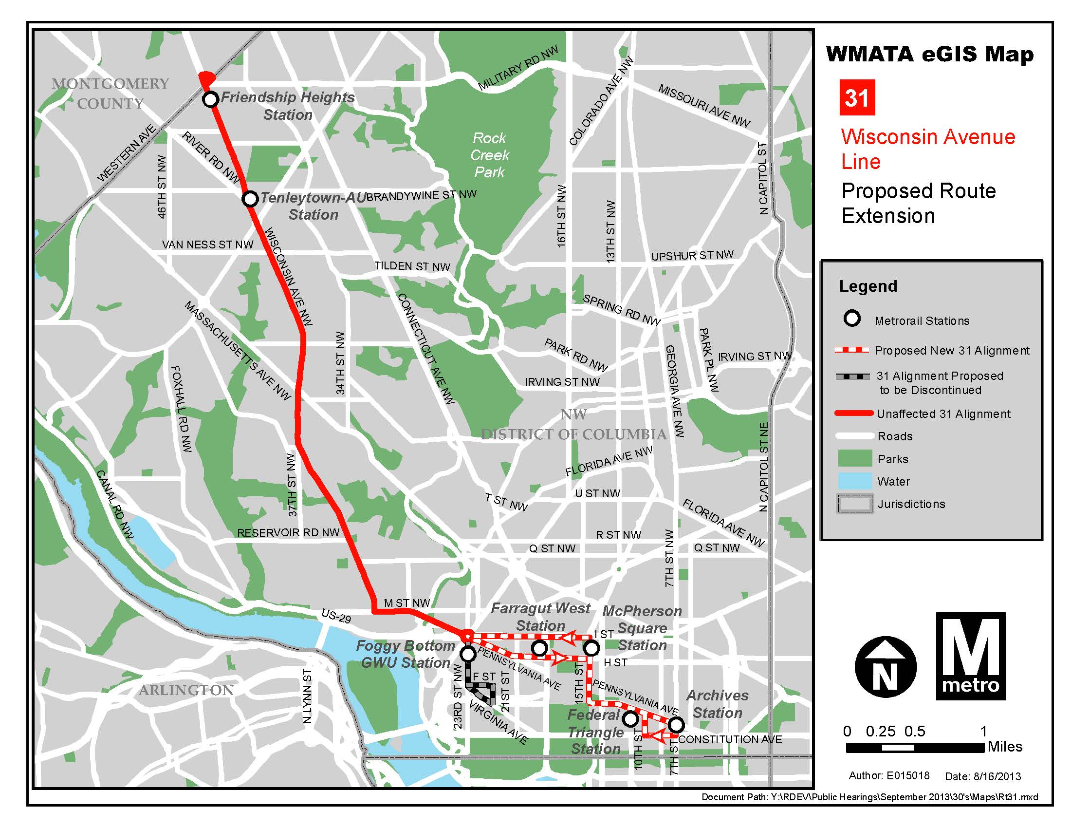
Map illustrating proposed changes to Route 31. Click image for larger version.

Map illustrating proposed changes for routes 32, 36 and 34. Click image for larger version.
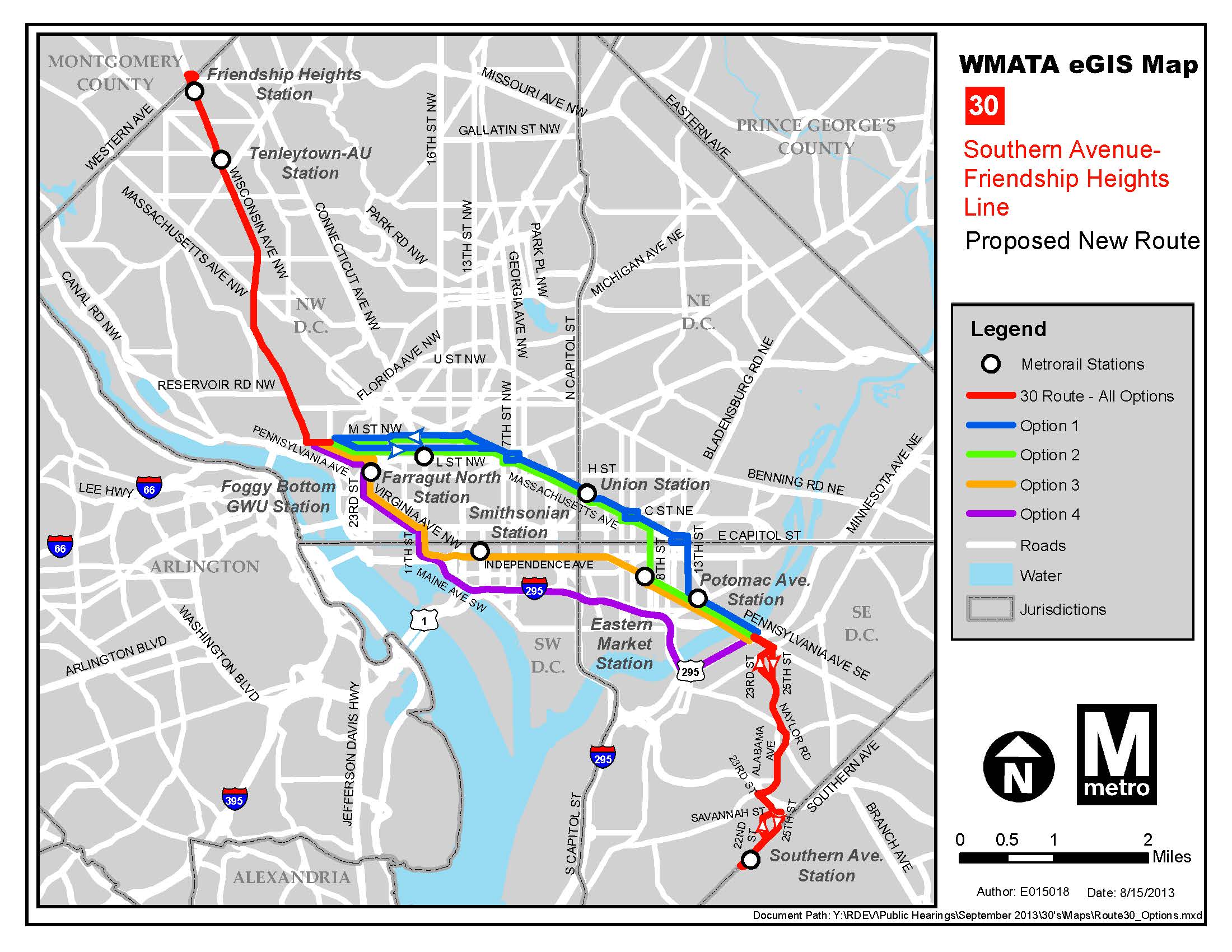
Map illustrating options for proposed Route 30. Click image for larger version.

Recent Comments