Archive for December, 2011

Identifying & Funding Pedestrian and Bicycle Project Needs

December 22nd, 2011 7 comments

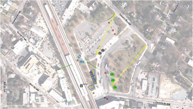
Back in August, we posted information about our latest endeavors to improve bike and walk access to Metrorail.  We have since completed our field work and now have a laundry list of more than 3,000 individual projects throughout the Metrorail system that we identified through that effort.  The projects range from the small and simple (e.g., Vienna racks) to the larger and more complex (e.g. additional Bike & Rides).  Metro’s Pedestrian and Bicycle Element of 2012-2017 Capital Improvement Program (1.1 MB, PDF) summarizes the findings by category, and provides an overview of the methodologies we employed to prioritize projects, as we identified a larger need than is currently funded.

And, although the  primary goal of this project is to provide a list of needed bike and pedestrian access projects to be funded through Metro’s Capital Improvement Program (CIP),  the list of needs developed in the inventory also will help better inform our partnerships on transit oriented development (TOD) and other projects near our stations.  Many of the projects improve the links from our station property to that of other property owners and will be instructive as stations undergo development transformations.

Project Highlights

Field teams were out evaluating conditions all over the system.  They highlighted desire lines to stations, bike parking needs, sidewalk & pathway improvements, intersection improvements and other pedestrian and bike needs.  Below are some high level summaries to give you a flavor of what we found out there:

Sidewalks and paths: Our field work identified hundreds of small sidewalk and pathway projects typically on Metro property that will improve access to our stations.  Each project tends to be small, say 200 to 500 feet long, but added together from end to end, they would stretch 10 miles.  Most of these projects are at suburban stations, where our entrances tend not to be directly located on the street network.

Intersection improvements: We looked at the intersections that serve our stations for places where new crosswalks, curb ramps, crossing islands or other improvements were needed and found 700 locations for such improvements.  Many of these are located off of our property on adjoining streets, so we plan to work with the local jurisdictions to address these.

Bike parking: More than 400 potential locations for future bike parking were identified, including the type and expected capacity of parking.  The field survey explored potential locations for additional Bike & Ride parking facilities and covers for bike racks.  Our plan is to build or reserve space for bike parking in the amounts needed to help us reach our mode share goals of 2.1% by 2020 and 3.5% by 2030.  To make these numbers work, we’ll continue to work with our local bike/ped planning partners to improve the on- and off-street connections to our stations so we can fill this bike parking.

Prioritizing Projects
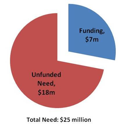
So, 3000+ is a lot of projects.  We’d love to be able to do them all.  However, our funding is currently constrained.  So, what do we do? – we prioritize.  And, how do we do that?  We look to our Agency goals.  At the top of the list is safety & security, delivering quality service and using resources wisely.   We took a look at how our projects stacked up against these goals and created an action plan to complete the projects that best achieved them.  There are more details about the process in the attached document, but let it suffice to say we think we’ll make some real headway in meeting these goals and their accompanying objectives as we improve access to our stations.  In the meantime, if other funding opportunities crop up – say TIGER IV, or V, or XXXII – we’ll be ready to go.

Follow Along with Us

We have already begun work on the projects identified, and planning for more projects is underway.  As we complete projects we’ll continue to post them here.  Please let us know what you think.  Have they helped?  Are there other projects you see out there?

Update January 18, 2012: Maps of all project needs at by individual Metrorail station are available below. Due to the size of the files, we’ve posted them as 8 separate documents in alphabetical order by station name. They should be readable with Adobe Acrobat 6.0 or later:

  1. Addison Road-Seat Pleasant to Capitol South (PDF, 2.2 MB)
  2. Cheverly to Dunn Loring-Merrifield (PDF, 2.2 MB)
  3. Dupont Circle to Gallery Pl-Chinatown (PDF, 2.5 MB)
  4. Georgia Ave-Petworth to King Street (PDF, 6.0 MB)
  5. Landover to Metro Center (PDF, 1.2 MB)
  6. Minnesota Ave to New York Ave-Florida Ave-Gallaudet U (PDF, 7.0 MB)
  7. Pentagon City to Twinbrook (PDF, 3.2 MB)
  8. U St/African-Amer Civil War Memorial/Cardozo to Woodley Park-Zoo/Adams Morgan (PDF, 2.4 MB)


What Does Transit Do For Regional Mobility?

December 16th, 2011 1 comment

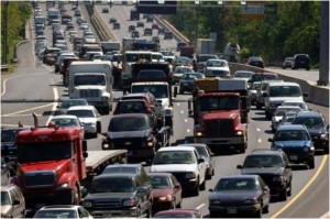
This study measured transit's impact on congestion, roads, and parking in the Washington region.

One of the best ways to understand the value of something is to take it away, and measure the difference. So, as part of our “Business Case” for transit study, we tried taking away transit to see what happened to the Washington DC region, using MWCOG’s Regional Travel Demand Model. This model represents people’s origins and destinations, and all the different options for getting around, including detailed transit and highway capacity information. What does that model predict would happen without transit?


Read more…

What Value Does Metrorail Bring to Land Markets?

December 13th, 2011 4 comments

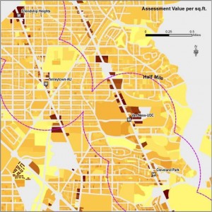
To measure Metro's impact on land markets, we analyzed property value assessment records across the region. Shown above is a sample from the District of Columbia.

A Metrorail station can make the land surrounding the station much easier to get to and from. Especially if traffic is bad and parking is costly, as often happens in our region, a Metrorail station can offer a good alternative means of getting to and from an area, which gives the area near rail an advantage over areas farther from rail. Businesses can locate near a Metrorail station and reach workers around the region, more people can live in the neighborhood and get around by transit, and customers can shop or run errands there.  Economic theory tells us that the value of land around rail stations should reflect the value transit brings, as often does the density of development.  Economists would say that the accessibility value of transit is capitalized into the land value.

But what is this effect around Metrorail stations, and how much is it worth?  How much land value is associated with Metrorail, and how much property tax revenue does this generate for Metro’s jurisdictions?

To answer, we analyzed parcel-level property assessment values across the WMATA Compact jurisdiction as part of our “Business Case” for transit study.  We analyzed all properties, including residential, commercial, and federal office buildings.  The data show that:

  • Metro enables value-creating activity: $235 billion of property value sits within a half-mile of Metrorail station
  • About 80% of this value is from commercial properties (multi-family residential, office, retail, and other)
  • 28% of the Compact Area‘s property tax base sits on 4% of its land within a half-mile of Metrorail
  • The land within a half-mile of Metrorail stations generate $3.1 billion in property taxes per year for our funding partners

New York Avenue station has helped enable valuable development. Photo courtesy of NCPPP, click for context.

This does not mean that Metro caused all of this development, but it does show that Metro serves the value-creating parts of our region. Some of this development existed before Metrorail, and influenced the decision of where to build stations.  So, we ran a number of hedonic analyses (a statistical regression technique) to isolate the effect on property values uniquely from Metrorail proximity alone, or the “rail premium.”  After all, property values can be influenced by a variety of factors, including proximity to other infrastructure, desirability of the neighborhood, etc.  Controlling for all other factors, we found that within the Compact area:

  • Metrorail boosts property values, adding 6.8% more value to residential, 9.4% to multi-family, and 8.9% to commercial office properties within a half-mile of a Metrorail station – all other things being equal
  • Property becomes even more valuable as a property gets closer to Metro stations

Others have shown too that new Metrorail stations can attract and spur economic development, by tracing the history of development around stations, such as New York Avenue and the Rosslyn-Ballston corridor.

These findings show that Metro plays a significant role in our region’s land markets: not only is valuable development and economic activity clustered around Metrorail, but the benefits of Metrorail can be seen in actual property assessments.  Our regions’ land markets recognize and have responded to the value that Metro brings.  This helps make the case that Metro is vital to the region’s economy, and is a good investment of public funds.

Read the study’s Final Report (pdf).

Cross-posted at Region Forward.

Metro’s “Business Case” for Transit

December 6th, 2011 Comments off

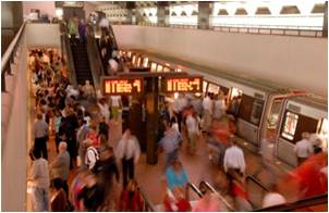
Busy Metrorail station

Metro is wrapping up a study on the “business case” for transit that tries to answer the question, “how does the region benefit from Metro?”

The Purpose of the Study:  The goal of the project is to tell the story of Metro’s critical role in the development of the greater Washington region.  We undertook the study to identify all the ways that Metro impacts the broader regional economy, and measure those impacts in terms of real estate value, economic competitiveness, avoided roadway infrastructure, and others.

Why this Study? At WMATA’s 35th anniversary, and as we plan for the future, it’s important to understand what has happened since we decided to grow and sustain our transit system. Metro often measures our performance in short-term transportation terms – ridership, service frequency and reliability, and costs. And we will continue to do so. But transportation is not an end to itself, it is a means to an end. Metro impacts the region in much broader ways – changing the real estate market, altering people’s choices about where to live and work, and impacting our economic livelihood.  This study tries to shed light on those longer-term impacts as well.

In addition, Metro is frequently in the public sphere with regards to our costs: our operating budget, fares, or capital program.  As we talk about costs, it’s important to talk about the benefits we provide, too.


This study began with a long list of ways to measure transit benefits, and then narrowed to a subset of quantifiable results.

What the Study Is: We try to evaluate transit by imagining a region without transit, and measuring the differences from today. One of the best ways to understand the value of something is to take it away. A Washington without transit is, of course, a hypothetical situation. Without transit, the region would look very different  – but that difference is exactly the effect that this report tries to measure. By imagining the region without transit, it is possible to understand its role and value in the economy of the Washington area.

What the Study Is Not:  This study is not a formal cost-benefit analysis of Metro. It does not add up all the benefits and compare benefits to costs, because some of the measures of benefits overlap other measures. For example, we quantify the road infrastructure not needed because of transit, and also the amount of congestion avoided, but these are in large part mutually exclusive. Instead, we try to describe the benefits of Metro in as many ways possible, to give people an idea of the magnitude of Metro’s impact.

What Can We Take Credit For? The study quantifies benefits, but doesn’t claim that the result is entirely due to Metro alone.  For example, Arlington County highlights its economic success in the Rosslyn-Ballston corridor along the Orange Line, but transit is only one part of this success, along with zoning, development decisions, long-term policies, and other factors.  So, in this study we measure the benefits where transit is either a precondition for, or an integral part of, an impact.

Results: We’ll be publishing a few posts in this space shortly to explain the major findings of the study.  Stay tuned!  In the meantime, read the Final Report (pdf).

Cross-posted at Region Forward.