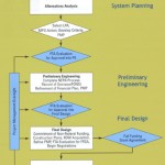
Metro’s early experience with promoting TOD took place at below-ground rail stations in established urban settings that did not require the provision of transit access facilities beyond connections from sidewalks to the stations below. More recently, WMATA’s opportunities to develop its land to support TOD have been predominantly in suburban rail stations that include extensive parking lots, bus bays, and facilities for taxis, bicycles, customer pick-up and drop-off, and ADA patrons.
The default agency policy in recent years has been to replace existing facilities with a like amount and kind of facilities on a reduced footprint, and to emphasize transit operational functionality over urban design issues. For example, this approach has tended to favor placing parking structures and bus bays adjacent to the station in lieu of pedestrian facilities, public spaces and mixed-use development. However, public feedback has prompted WMATA to reassess the appropriateness of this default approach, and there is a need for new thinking about how future patrons should arrive at suburban stations; how transit operations should function in TOD contexts; and how to better meet local development policy objectives.

Development plan for Twinbrook Metrorail station. Click the image for more information.
Over the past five years, WMATA has made a number of significant policy and program changes to recognize the changing development environment at suburban rail stations. For example, in 2008 WMATA adopted a new set of real estate development guidelines (1.91 MB PDF), and the first real estate projects implementing those guidelines were initiated in the summer and fall of 2010. While the evolution of WMATA’s planning and land development practice is underway, it is far from complete. WMATA’s most recently-launched TOD projects confront the agency with the immediate challenge of replacing first-generation, auto-oriented transit access facilities with a new generation of facilities that supports transit access, transit operations, and TOD.
Read more…
With increasing fuel prices and a rebounding economy soon to increase transit demand and with the progress of the Metro’s Regional Transit System Plan, it is opportune to reflect on the time and effort necessary to develop and implement a new rail line, be it Metrorail, light rail or streetcar. An important time factor is the Federal procedures and evaluations for Federal funding, upon which most ‘major capital investments’ in rail transit are reliant. The Federal share can range from 30 to 50 percent of the total project cost. The two most recent Metrorail extensions – Blue Line to Largo Town Center and the Dulles Corridor Line to Wiehle Avenue Station – follow or exceed the experience across the nation of 10 to 12 years from start of alternatives analysis (AA) to start of revenue operations. The Maryland Transit Administration conducted the AA of the Blue Line extension in the early 1990s; the 3-mile extension opened in late 2004. The Virginia Department of Rail and Public Transportation conducted the AA (then, a Major Investment Study, MIS) of the Dulles Corridor extension in the mid-1990’s; the 11-mile extension to the Wiehle Avenue Station will open in late 2013, nearly twenty years later.
For both these heavy rail extensions and for the light rail and streetcar projects now under development, the original project delivery schedules were more compressed. For example, the Dulles Corridor Task Force recommended in 1999 that the Dulles Corridor extension be open through Tysons Corner by 2006. An explanation for the differences in original and actual schedules includes, but is not limited to, extended timeframes for the following:
Read more…
The Regional Transit System Plan (RTSP) is intended to update the currently adopted Transit System Expansion Plan (TSEP) that was completed in 1999. In its implementation, the RTSP looks beyond the planning horizon of the TSEP by an additional fifteen years and incorporates updated travel demand, population and employment forecasts for the region. The following discussion will look at how much ridership growth has occurred over the ten-year period between 1999 and 2009, and will look at changes in the regional growth projections out to 2040 that will shape future demand for transit services.
Changes in Ridership

Figure 1. Change in ridership. Source: NTD
As envisioned in the adopted plan, transit ridership has grown since 1999, and is on the way toward the TSEP goal of doubling ridership by 2025. Annual transit passenger trips throughout the region have increased by about 30% in the first 10 years of the 25 year planning horizon. However, this growth in ridership has not been consistent across the region: close inspection of these data shows that ridership growth is happening at a faster rate on local feeder bus, express bus, and commuter rail services than for regional Metrorail and Metrobus services, although Metro accounts for the majority of the growth in absolute terms. The growth in ridership on local and commuter transit services highlights the need to create a transit plan that looks beyond the services provided only by Metro and to focus on the region at large.
Read more…
Metro is trying to triple the number of bicyclists accessing our transit services by 2020. Our Bicycle & Pedestrian Access Improvements Study showed that although bicycling represents a small portion of station access now, this mode has very strong potential for growth. For example, many of our parking customers live less than 3 miles from their rail station, and many parking facilities fill up between 7:45 and 8:30 am.

As part of this campaign, we are trying to learn more about the travel patterns of bicyclists so that we can better plan facilities and services for them. For example, how strong is the “seasonal” effect in biking? What time of day do cyclists ride? How does bicycling demand patterns compare to our rail and bus networks?
One source of data for these questions is the automatic bicycle counters that Arlington County has installed on the Custis Trail, a major trail for bicyclists between downtown, Arlington, and points west. This counter can sense the difference between a bicyclist and a pedestrian, and has been silently counting both since October 2009. The counter is located at the top of the hill between Rosslyn and Courthouse (map). Previous analyses of this data are available online.
While Custis Trail users certainly don’t necessarily represent current or potential bike-to-rail customers, they do provide some data-driven insight into the travel demand of bicyclists, whom we hope will be a key part to Metro’s long-term strategies for rail access. So, the rest of this post analyzes bicycle counts by 15-minute intervals between October 2009 and February 2011.
Read more…


Recent Comments